TopoQuest Logo
Do you find TopoQuest useful?
Help keep TopoQuest running and adding new maps/features by donating!
Bitcoin:  19c7KJd3qBynnjoSw5npx9KScwjBe4ifkT
Litecoin:  LXs6TkuXGGXo1vDsWCkWVdjQX94eUKd6ui
Home View Maps Find Maps Find Places Resources & Links


Powell Lake, Michigan Topographic Map

USGS Map Title: Powell Lake, MI
USGS Map MRC: 46086C6
DRG (GeoTIFF) Download: o46086c6.tif


Neighboring USGS Topographic Map Quads:


  Au Train, MI  
46086D7
 

  Munising, MI  
46086D6
 

  Indian Town, MI  
46086D5
 

  Forest Lake, MI  
46086C7
 

  Powell Lake, MI  
46086C6
 

  Juniper, MI  
46086C5
 

  Lake Stella, MI  
46086B7
 

  Tie Lake, MI  
46086B6
 

  Corner Lake, MI  
46086B5


Map MRC Location:

N47°
W87°
N47°
W86°
H8 H7 H6 H5 H4 H3 H2 H1
G8 G7 G6 G5 G4 G3 G2 G1
F8 F7 F6 F5 F4 F3 F2 F1
E8 E7 E6 E5 E4 E3 E2 E1
D8 D7 D6 D5 D4 D3 D2 D1
C8 C7 C6 C5 C4 C3 C2 C1
B8 B7 B6 B5 B4 B3 B2 B1
A8 A7 A6 A5 A4 A3 A2 A1
N46°
W87°
N46°
W86°

Powell Lake, MI USGS 1:24K Topographic Map Preview:
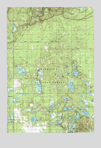
Powell Lake, MI USGS Topographic Map
Click on map above to begin viewing in our Map Viewer.

This topographic map contains these locations and features:
Feature Name Type Latitude Longitude GNIS ID View Map
Als LakeLakeN46.2758°W86.6360°1619015View Map
Big Twin LakeLakeN46.2690°W86.6374°1619206View Map
Buckhorn/Otter Lake CampgroundLocaleN46.3153°W86.7250°2351955View Map
CCC CampLocaleN46.2663°W86.6307°1622765View Map
CCC CampLocaleN46.3422°W86.7013°1622766View Map
Cherry LakeLakeN46.2605°W86.6551°1619485View Map
CoalwoodPopulated PlaceN46.3405°W86.7318°1619541View Map
Coalwood Post Office (historical)Post OfficeN46.3406°W86.7319°2352387View Map
Coalwood Recreational TrailTrailN46.3306°W86.6361°2098029View Map
Coalwood Station (historical)LocaleN46.3406°W86.7306°2352386View Map
Doe LakeLakeN46.2601°W86.6766°1619728View Map
Grimes LakeLakeN46.2739°W86.6631°1620084View Map
Halfmoon LakeLakeN46.2555°W86.6550°1620111View Map
Hartney LakeLakeN46.2658°W86.6732°1620142View Map
Hovey LakeLakeN46.2956°W86.7046°1620258View Map
Hovey Lake CampgroundLocaleN46.2905°W86.7010°1622601View Map
Island LakeLakeN46.2655°W86.6488°1620339View Map
Island Lake CampgroundLocaleN46.2708°W86.6335°1622764View Map
KentuckyPopulated PlaceN46.2652°W86.6310°1620415View Map
Kitten LakeLakeN46.3066°W86.7025°1620445View Map
Lake Twenty FiveLakeN46.2662°W86.7436°1621976View Map
Lost LakeLakeN46.2966°W86.6580°1620633View Map
McNeil LakeLakeN46.2893°W86.6304°1620779View Map
Mirror LakeLakeN46.2756°W86.6856°632483View Map
Misty LakeLakeN46.3041°W86.6714°1620865View Map
Moth LakeLakeN46.3076°W86.6779°1620912View Map
Mouse LakeLakeN46.3121°W86.7067°1620920View Map
Muddy LakeLakeN46.2823°W86.6648°1620945View Map
Otter LakeLakeN46.3116°W86.7291°1621126View Map
Peck LakeLakeN46.2809°W86.6451°1621184View Map
Phillip PondLakeN46.3191°W86.6565°1621225View Map
Powell LakeLakeN46.3093°W86.6512°1621307View Map
Ready LakeLakeN46.2630°W86.7116°1623028View Map
Shady LakeLakeN46.2585°W86.6851°1621570View Map
Shallow LakeLakeN46.2807°W86.7382°1621572View Map
Sister LakeLakeN46.3149°W86.6535°1621626View Map
Sphagnum LakeLakeN46.2949°W86.6313°1621720View Map
Swede LakeLakeN46.3727°W86.6423°1621840View Map
Three LakesLakeN46.3132°W86.6632°1621904View Map
Trueman LakeLakeN46.3087°W86.6644°1621968View Map
Upper Twin LakeLakeN46.2729°W86.6423°1622006View Map
Valley Spur Ski TrailTrailN46.3630°W86.6996°1622767View Map

Note: Coordinates in the location and feature list above are referenced to NAD83 datum.


Copyright (C) 2008-2025 Ryan Niemi / Sunset Dynamics ... All Rights Reserved