TopoQuest Logo
Do you find TopoQuest useful?
Help keep TopoQuest running and adding new maps/features by donating!
Bitcoin:  19c7KJd3qBynnjoSw5npx9KScwjBe4ifkT
Litecoin:  LXs6TkuXGGXo1vDsWCkWVdjQX94eUKd6ui
Home View Maps Find Maps Find Places Resources & Links


Forest Lake, Michigan Topographic Map

USGS Map Title: Forest Lake, MI
USGS Map MRC: 46086C7
DRG (GeoTIFF) Download: o46086c7.tif


Neighboring USGS Topographic Map Quads:


  Rock River, MI  
46086D8
 

  Au Train, MI  
46086D7
 

  Munising, MI  
46086D6
 

  Chatham, MI  
46086C8
 

  Forest Lake, MI  
46086C7
 

  Powell Lake, MI  
46086C6
 

  Trenary, MI  
46086B8
 

  Lake Stella, MI  
46086B7
 

  Tie Lake, MI  
46086B6


Map MRC Location:

N47°
W87°
N47°
W86°
H8 H7 H6 H5 H4 H3 H2 H1
G8 G7 G6 G5 G4 G3 G2 G1
F8 F7 F6 F5 F4 F3 F2 F1
E8 E7 E6 E5 E4 E3 E2 E1
D8 D7 D6 D5 D4 D3 D2 D1
C8 C7 C6 C5 C4 C3 C2 C1
B8 B7 B6 B5 B4 B3 B2 B1
A8 A7 A6 A5 A4 A3 A2 A1
N46°
W87°
N46°
W86°

Forest Lake, MI USGS 1:24K Topographic Map Preview:
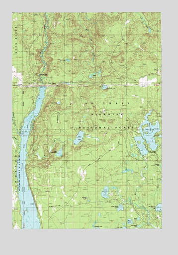
Forest Lake, MI USGS Topographic Map
Click on map above to begin viewing in our Map Viewer.

This topographic map contains these locations and features:
Feature Name Type Latitude Longitude GNIS ID View Map
Ackerman LakeLakeN46.3315°W86.7974°619800View Map
Addis LakesLakeN46.3391°W86.8070°1618991View Map
Addis Lakes Ski TrailTrailN46.3444°W86.8082°1622282View Map
Aleck LakeLakeN46.2540°W86.7768°619931View Map
Au Train FallsFallsN46.3386°W86.8513°1619056View Map
AuTrain Township Fire DepartmentBuildingN46.2949°W86.7546°1622249View Map
Bunting LakeLakeN46.2709°W86.7974°1619367View Map
CCC CampLocaleN46.3691°W86.7785°1622251View Map
DixonPopulated PlaceN46.3324°W86.8532°1619725View Map
Forest LakePopulated PlaceN46.3327°W86.8377°1619955View Map
Forest Lake Campground and Picnic AreaParkN46.3063°W86.8685°1622250View Map
Forest Lake Lookout TowerTowerN46.3219°W86.8432°1623354View Map
Forest Lake Post Office (historical)Post OfficeN46.3333°W86.8378°2352385View Map
Forest Lake Station (historical)LocaleN46.3333°W86.8389°2352384View Map
Grassy PondLakeN46.2676°W86.8130°1620068View Map
Hemlock LakeLakeN46.2853°W86.7500°1620168View Map
Jenny LakeLakeN46.2556°W86.7696°1620361View Map
Joe CreekStreamN46.2911°W86.8632°629290View Map
Joe LakeLakeN46.3023°W86.8192°1620369View Map
Lake SeventeenLakeN46.2937°W86.8354°1621567View Map
Line LakeLakeN46.3472°W86.8285°630511View Map
Little Aleck LakeLakeN46.2513°W86.7692°1620527View Map
Little Round LakeLakeN46.2619°W86.7846°630754View Map
Odell PondLakeN46.3225°W86.8359°1621092View Map
Sixteenmile LakeLakeN46.3032°W86.7618°638042View Map
Slapneck CreekStreamN46.3041°W86.8671°1621640View Map
StillmanPopulated PlaceN46.3424°W86.7513°1617869View Map
Township of Au TrainCivilN46.3419°W86.7646°1625869View Map
VailPopulated PlaceN46.3366°W86.7729°1617908View Map
Wheelbarrow LakeLakeN46.2621°W86.7518°1622123View Map

Note: Coordinates in the location and feature list above are referenced to NAD83 datum.


Copyright (C) 2008-2025 Ryan Niemi / Sunset Dynamics ... All Rights Reserved