TopoQuest Logo
Do you find TopoQuest useful?
Help keep TopoQuest running and adding new maps/features by donating!
Bitcoin:  19c7KJd3qBynnjoSw5npx9KScwjBe4ifkT
Litecoin:  LXs6TkuXGGXo1vDsWCkWVdjQX94eUKd6ui
Home View Maps Find Maps Find Places Resources & Links


Poyen, Arkansas Topographic Map

USGS Map Title: Poyen, AR
USGS Map MRC: 34092C6
DRG (GeoTIFF) Download: o34092c6.tif


Neighboring USGS Topographic Map Quads:


  Malvern North, AR  
34092D7
 

  Traskwood, AR  
34092D6
 

  Tull, AR  
34092D5
 

  Malvern South, AR  
34092C7
 

  Poyen, AR  
34092C6
 

  Prattsville, AR  
34092C5
 

  Round Hill, AR  
34092B7
 

  Willow, AR  
34092B6
 

  Leola, AR  
34092B5


Map MRC Location:

N35°
W93°
N35°
W92°
H8 H7 H6 H5 H4 H3 H2 H1
G8 G7 G6 G5 G4 G3 G2 G1
F8 F7 F6 F5 F4 F3 F2 F1
E8 E7 E6 E5 E4 E3 E2 E1
D8 D7 D6 D5 D4 D3 D2 D1
C8 C7 C6 C5 C4 C3 C2 C1
B8 B7 B6 B5 B4 B3 B2 B1
A8 A7 A6 A5 A4 A3 A2 A1
N34°
W93°
N34°
W92°

Poyen, AR USGS 1:24K Topographic Map Preview:
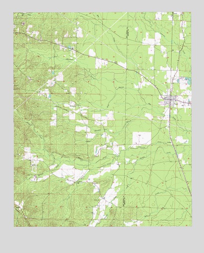
Poyen, AR USGS Topographic Map
Click on map above to begin viewing in our Map Viewer.

This topographic map contains these locations and features:
Feature Name Type Latitude Longitude GNIS ID View Map
Arkansas Noname 27 DamDamN34.3551°W92.7102°80168View Map
Big Creek ChurchChurchN34.3209°W92.7066°46544View Map
Buck BranchStreamN34.3295°W92.6624°47115View Map
Clear CreekStreamN34.3057°W92.6279°47829View Map
Clear Creek ChurchChurchN34.2757°W92.7043°47835View Map
Cunningham CemeteryCemeteryN34.2804°W92.7404°48263View Map
Huskey ChurchChurchN34.2654°W92.6907°50467View Map
Keisler CreekStreamN34.2912°W92.6774°50788View Map
LenhamPopulated PlaceN34.3004°W92.6391°58055View Map
Lono - Rolla Volunteer Fire Department Substation 2BuildingN34.2668°W92.6882°2116739View Map
Malvern Country ClubLocaleN34.2859°W92.7374°82512View Map
McLean (historical)Populated PlaceN34.3481°W92.6391°60634View Map
PoyenPopulated PlaceN34.3243°W92.6399°58419View Map
Poyen CemeteryCemeteryN34.3218°W92.6271°53753View Map
Poyen Elementary SchoolSchoolN34.3250°W92.6441°60636View Map
Poyen High SchoolSchoolN34.3256°W92.6434°60637View Map
Poyen Volunteer Fire StationBuildingN34.3245°W92.6408°2117000View Map
Rhinehart BranchStreamN34.3326°W92.6627°54000View Map
Thomas CreekStreamN34.2901°W92.7171°55528View Map
Thunder BranchStreamN34.3154°W92.6460°55564View Map
Town of PoyenCivilN34.3244°W92.6420°2407157View Map
Township of Big CreekCivilN34.3184°W92.7088°66652View Map
Township of FenterCivilN34.3393°W92.6324°66607View Map

Note: Coordinates in the location and feature list above are referenced to NAD83 datum.


Copyright (C) 2008-2025 Ryan Niemi / Sunset Dynamics ... All Rights Reserved