TopoQuest Logo
Do you find TopoQuest useful?
Help keep TopoQuest running and adding new maps/features by donating!
Bitcoin:  19c7KJd3qBynnjoSw5npx9KScwjBe4ifkT
Litecoin:  LXs6TkuXGGXo1vDsWCkWVdjQX94eUKd6ui
Home View Maps Find Maps Find Places Resources & Links


Prairie Center, Illinois Topographic Map

USGS Map Title: Prairie Center, IL
USGS Map MRC: 41088D8
DRG (GeoTIFF) Download: o41088d8.tif


Neighboring USGS Topographic Map Quads:


  Mendota East, IL  
41089E1
 

  Earlville, IL  
41088E8
 

  Leland, IL  
41088E7
 

  Troy Grove, IL  
41089D1
 

  Prairie Center, IL  
41088D8
 

  Wedron, IL  
41088D7
 

  La Salle, IL  
41089C1
 

  Starved Rock, IL  
41088C8
 

  Ottawa, IL  
41088C7


Map MRC Location:

N42°
W89°
N42°
W88°
H8 H7 H6 H5 H4 H3 H2 H1
G8 G7 G6 G5 G4 G3 G2 G1
F8 F7 F6 F5 F4 F3 F2 F1
E8 E7 E6 E5 E4 E3 E2 E1
D8 D7 D6 D5 D4 D3 D2 D1
C8 C7 C6 C5 C4 C3 C2 C1
B8 B7 B6 B5 B4 B3 B2 B1
A8 A7 A6 A5 A4 A3 A2 A1
N41°
W89°
N41°
W88°

Prairie Center, IL USGS 1:24K Topographic Map Preview:
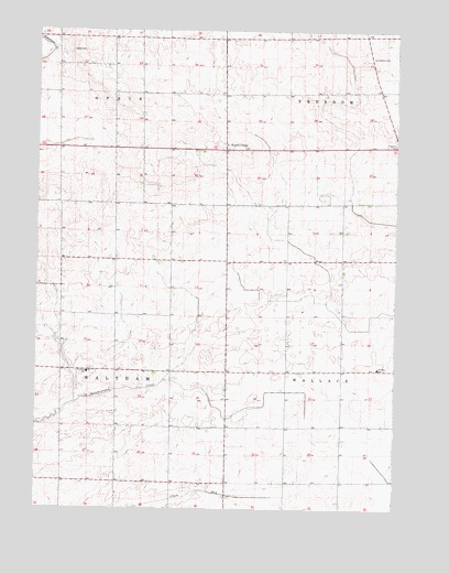
Prairie Center, IL USGS Topographic Map
Click on map above to begin viewing in our Map Viewer.

This topographic map contains these locations and features:
Feature Name Type Latitude Longitude GNIS ID View Map
Davis CemeteryCemeteryN41.4944°W88.9882°406974View Map
Edgecombe School (historical)SchoolN41.4406°W88.9915°1748219View Map
Freedom Centre (historical)Populated PlaceN41.4845°W88.8806°1816056View Map
Fullertown School (historical)SchoolN41.4403°W88.9123°1748221View Map
Garland School (historical)SchoolN41.4978°W88.9545°1748225View Map
Gouldtown CemeteryCemeteryN41.4932°W88.8839°409218View Map
Gouldtown School (historical)SchoolN41.4998°W88.8867°1748227View Map
Moniot School (historical)SchoolN41.3814°W88.9520°1748249View Map
Ophir Center School (historical)SchoolN41.4984°W88.9879°1748253View Map
Prairie CenterPopulated PlaceN41.4689°W88.9345°416097View Map
Sargent School (historical)SchoolN41.3823°W88.9901°1748262View Map
School Number 186 (historical)SchoolN41.4106°W88.9540°1748264View Map
School Number 200 (historical)SchoolN41.3817°W88.9131°1748265View Map
School Number 237 (historical)SchoolN41.4698°W88.9684°1748266View Map
School Number 248 (historical)SchoolN41.4842°W88.8834°1748267View Map
Totel School (historical)SchoolN41.4114°W88.9123°1748270View Map
Township of FreedomCivilN41.4992°W88.8757°429029View Map
Township of OphirCivilN41.4986°W88.9925°429495View Map
Township of WallaceCivilN41.4116°W88.8895°429886View Map
Township of WalthamCivilN41.4126°W88.9911°429891View Map
Wallace Elementary SchoolSchoolN41.4120°W88.8809°1719160View Map
Waltham Center School (historical)SchoolN41.4117°W88.9915°1748272View Map
Waltham Elementary SchoolSchoolN41.4106°W88.9820°420493View Map
Wilson School (historical)SchoolN41.4403°W88.9534°1748275View Map

Note: Coordinates in the location and feature list above are referenced to NAD83 datum.


Copyright (C) 2008-2025 Ryan Niemi / Sunset Dynamics ... All Rights Reserved