TopoQuest Logo
Do you find TopoQuest useful?
Help keep TopoQuest running and adding new maps/features by donating!
Bitcoin:  19c7KJd3qBynnjoSw5npx9KScwjBe4ifkT
Litecoin:  LXs6TkuXGGXo1vDsWCkWVdjQX94eUKd6ui
Home View Maps Find Maps Find Places Resources & Links


Big Beaver Reservoir, Colorado Topographic Map

USGS Map Title: Big Beaver Reservoir, CO
USGS Map MRC: 39107H6
DRG (GeoTIFF) Download: o39107h6.tif


Neighboring USGS Topographic Map Quads:


  Rattlesnake Mesa, CO  
40107A7
 

  Sawmill Mountain, CO  
40107A6
 

  Fawn Creek, CO  
40107A5
 

  Veatch Gulch, CO  
39107H7
 

  Big Beaver Reservoir, CO  
39107H6
 

  Buford, CO  
39107H5
 

  Red Elephant Point, CO  
39107G7
 

  Triangle Park, CO  
39107G6
 

  Meadow Creek Lake, CO  
39107G5


Map MRC Location:

N40°
W108°
N40°
W107°
H8 H7 H6 H5 H4 H3 H2 H1
G8 G7 G6 G5 G4 G3 G2 G1
F8 F7 F6 F5 F4 F3 F2 F1
E8 E7 E6 E5 E4 E3 E2 E1
D8 D7 D6 D5 D4 D3 D2 D1
C8 C7 C6 C5 C4 C3 C2 C1
B8 B7 B6 B5 B4 B3 B2 B1
A8 A7 A6 A5 A4 A3 A2 A1
N39°
W108°
N39°
W107°

Big Beaver Reservoir, CO USGS 1:24K Topographic Map Preview:
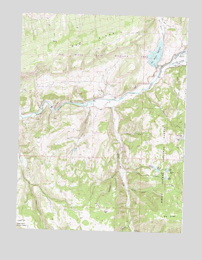
Big Beaver Reservoir, CO USGS Topographic Map
Click on map above to begin viewing in our Map Viewer.

This topographic map contains these locations and features:
Feature Name Type Latitude Longitude GNIS ID View Map
Beaver LakeReservoirN39.9115°W107.6449°173584View Map
Beaver Lake DamDamN39.9116°W107.6456°199924View Map
Bel-aire Rearing StationLocaleN39.9791°W107.6298°173591View Map
Big Beaver CreekStreamN39.9680°W107.6456°173440View Map
Big Beaver DamDamN39.9716°W107.6473°199926View Map
Big Beaver ReservoirReservoirN39.9771°W107.6486°173590View Map
Big RidgeRidgeN39.8847°W107.6345°202165View Map
Burro Mountain LakeLakeN39.9304°W107.6256°202166View Map
Cabin LakeReservoirN39.9113°W107.6373°173583View Map
Daum DrawValleyN39.9315°W107.6758°173588View Map
Deadman GulchValleyN39.9104°W107.6731°173578View Map
Dobbs ReservoirReservoirN39.9293°W107.6282°173586View Map
Gilley LakeReservoirN39.9067°W107.6381°173580View Map
Greenstreet CreekStreamN39.9572°W107.6556°173595View Map
Gregor DamDamN39.9066°W107.6390°201122View Map
Lake AveryReservoirN39.9716°W107.6473°199927View Map
Marcott DitchCanalN39.9722°W107.6284°202167View Map
North Elk Cow CampLocaleN39.8753°W107.6606°173577View Map
North Elk CreekStreamN39.9508°W107.6828°173592View Map
North Fork White RiverStreamN39.9730°W107.6384°173461View Map
Russell CampLocaleN39.9247°W107.6584°173587View Map
Sawmill CreekStreamN39.9722°W107.6303°173596View Map
Seventh LakeReservoirN39.9126°W107.6477°173585View Map
Shadow LakeReservoirN39.9101°W107.6360°173582View Map
South Fork White RiverStreamN39.9730°W107.6384°173597View Map
Stump LakeReservoirN39.9090°W107.6391°173581View Map
Vaughn CreekStreamN39.9091°W107.6717°173594View Map
Warner PointCliffN39.9472°W107.7217°173589View Map
Whiskey GulchValleyN39.8785°W107.6643°173593View Map

Note: Coordinates in the location and feature list above are referenced to NAD83 datum.


Copyright (C) 2008-2024 Ryan Niemi / Sunset Dynamics ... All Rights Reserved