TopoQuest Logo
Do you find TopoQuest useful?
Help keep TopoQuest running and adding new maps/features by donating!
Bitcoin:  19c7KJd3qBynnjoSw5npx9KScwjBe4ifkT
Litecoin:  LXs6TkuXGGXo1vDsWCkWVdjQX94eUKd6ui
Home View Maps Find Maps Find Places Resources & Links


Triangle Park, Colorado Topographic Map

USGS Map Title: Triangle Park, CO
USGS Map MRC: 39107G6
DRG (GeoTIFF) Download: o39107g6.tif


Neighboring USGS Topographic Map Quads:


  Veatch Gulch, CO  
39107H7
 

  Big Beaver Reservoir, CO  
39107H6
 

  Buford, CO  
39107H5
 

  Red Elephant Point, CO  
39107G7
 

  Triangle Park, CO  
39107G6
 

  Meadow Creek Lake, CO  
39107G5
 

  Horse Mountain, CO  
39107F7
 

  Rifle Falls, CO  
39107F6
 

  Deep Creek Point, CO  
39107F5


Map MRC Location:

N40°
W108°
N40°
W107°
H8 H7 H6 H5 H4 H3 H2 H1
G8 G7 G6 G5 G4 G3 G2 G1
F8 F7 F6 F5 F4 F3 F2 F1
E8 E7 E6 E5 E4 E3 E2 E1
D8 D7 D6 D5 D4 D3 D2 D1
C8 C7 C6 C5 C4 C3 C2 C1
B8 B7 B6 B5 B4 B3 B2 B1
A8 A7 A6 A5 A4 A3 A2 A1
N39°
W108°
N39°
W107°

Triangle Park, CO USGS 1:24K Topographic Map Preview:
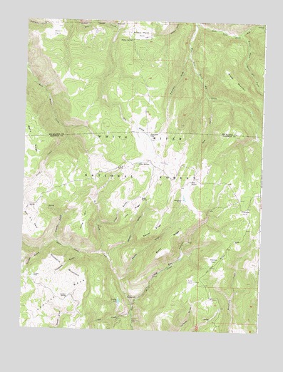
Triangle Park, CO USGS Topographic Map
Click on map above to begin viewing in our Map Viewer.

This topographic map contains these locations and features:
Feature Name Type Latitude Longitude GNIS ID View Map
Banner RidgeRidgeN39.7928°W107.6840°173783View Map
Bear GulchValleyN39.8444°W107.6538°173758View Map
Burnt RidgeRidgeN39.7819°W107.6753°173785View Map
Corbett LakeLakeN39.7716°W107.7438°173777View Map
Coulter DamDamN39.7605°W107.6990°201256View Map
Coulter LakeReservoirN39.7617°W107.6988°173787View Map
Dutch CreekStreamN39.8300°W107.7278°173747View Map
Dynamite LakeLakeN39.8291°W107.6846°173767View Map
East Fork North Elk CreekStreamN39.8747°W107.6612°173612View Map
G V CreekStreamN39.7814°W107.7084°173773View Map
G V SpringSpringN39.8157°W107.6979°173768View Map
Garden GulchValleyN39.7800°W107.7048°173782View Map
Hamilton CampLocaleN39.8747°W107.6598°173754View Map
Hoover GulchValleyN39.7860°W107.7325°173775View Map
Irish GulchValleyN39.7937°W107.7101°173774View Map
Irish RidgeRidgeN39.7939°W107.6959°173772View Map
Irish SpringSpringN39.8033°W107.6881°173770View Map
Lake ParkFlatN39.7708°W107.6617°173792View Map
Little Box CampgroundLocaleN39.7625°W107.6892°173789View Map
Little Box CanyonValleyN39.7604°W107.6918°173786View Map
Little Box Canyon CampgroundLocaleN39.7619°W107.6892°197200View Map
Little GV SpringSpringN39.8086°W107.7070°197198View Map
Little HillSummitN39.7975°W107.7198°173781View Map
Middle Fork North Elk CreekStreamN39.8694°W107.6401°173756View Map
Middle MountainSummitN39.8483°W107.6373°173757View Map
Mud SpringSpringN39.8101°W107.6621°173759View Map
Mud Spring RanchLocaleN39.8030°W107.6670°173771View Map
Orphan SpringSpringN39.7634°W107.7260°173780View Map
Prospect DrawValleyN39.8609°W107.6650°173766View Map
Saddle Horse ParkFlatN39.8708°W107.6909°173751View Map
Salt CreekStreamN39.7555°W107.6948°173764View Map
Seaman ParkFlatN39.7791°W107.6506°173791View Map
Snowdrift MountainSummitN39.7786°W107.7353°173778View Map
Spruce Picnic AreaLocaleN39.7541°W107.6917°173790View Map
Stump GulchValleyN39.7707°W107.6985°173784View Map
Tangle GulchValleyN39.7823°W107.7403°173776View Map
Three Forks CampgroundLocaleN39.7636°W107.6942°173788View Map
Three Forks CreekStreamN39.7603°W107.6917°173749View Map
Trappers GulchValleyN39.7813°W107.7196°173779View Map
Triangle ParkFlatN39.7986°W107.6340°173760View Map
Twin SpringsSpringN39.8175°W107.6898°173769View Map
Wear ParkFlatN39.8694°W107.7353°173753View Map
West Fork North Elk CreekStreamN39.8747°W107.6612°173755View Map
Widow SpringSpringN39.8669°W107.6953°173752View Map

Note: Coordinates in the location and feature list above are referenced to NAD83 datum.


Copyright (C) 2008-2025 Ryan Niemi / Sunset Dynamics ... All Rights Reserved