TopoQuest Logo
Do you find TopoQuest useful?
Help keep TopoQuest running and adding new maps/features by donating!
Bitcoin:  19c7KJd3qBynnjoSw5npx9KScwjBe4ifkT
Litecoin:  LXs6TkuXGGXo1vDsWCkWVdjQX94eUKd6ui
Home View Maps Find Maps Find Places Resources & Links


Presidio East, Texas Topographic Map

USGS Map Title: Presidio East, TX
USGS Map MRC: 29104E3
DRG (GeoTIFF) Download: o29104e3.tif


Neighboring USGS Topographic Map Quads:


  Arroyo Melado, TX  
29104F4
 

  La Boquilla, TX  
29104F3
 

  Alamo Spring, TX  
29104F2
 

  Presidio West, TX  
29104E4
 

  Presidio East, TX  
29104E3
 

  Cerro Redondo, TX  
29104E2


  Redford, TX  
29104D2


Map MRC Location:

N30°
W105°
N30°
W104°
H8 H7 H6 H5 H4 H3 H2 H1
G8 G7 G6 G5 G4 G3 G2 G1
F8 F7 F6 F5 F4 F3 F2 F1
E8 E7 E6 E5 E4 E3 E2 E1
D8 D7 D6 D5 D4 D3 D2 D1
C8 C7 C6 C5 C4 C3 C2 C1
B8 B7 B6 B5 B4 B3 B2 B1
A8 A7 A6 A5 A4 A3 A2 A1
N29°
W105°
N29°
W104°

Presidio East, TX USGS 1:24K Topographic Map Preview:
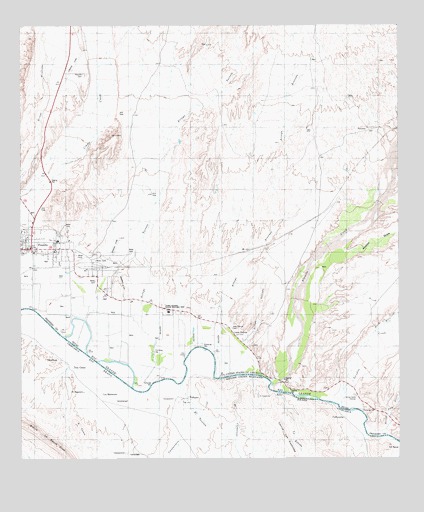
Presidio East, TX USGS Topographic Map
Click on map above to begin viewing in our Map Viewer.

This topographic map contains these locations and features:
Feature Name Type Latitude Longitude GNIS ID View Map
Alamito CreekStreamN29.5210°W104.2919°1372254View Map
Arroyo ArenosoValleyN29.5395°W104.3093°1329710View Map
Arroyo GalindoValleyN29.5331°W104.3015°1329729View Map
Arroyo Palo BlancoValleyN29.5068°W104.2544°1329745View Map
Arroyo TortolaValleyN29.5330°W104.3316°1329765View Map
Black Hills CreekStreamN29.5360°W104.2591°1330754View Map
Campo Santo EstradaLocaleN29.5180°W104.2644°1332047View Map
Casa Blanca CemeteryCemeteryN29.5378°W104.3055°1332264View Map
City of PresidioCivilN29.5603°W104.3653°2411489View Map
Estrada CreekLocaleN29.5238°W104.2677°1376911View Map
Fort LeatonLocaleN29.5419°W104.3271°2032126View Map
Fort Leaton (historical)Populated PlaceN29.5427°W104.3221°2034879View Map
Fort Leaton State Historic SiteParkN29.5441°W104.3280°1336056View Map
Fort Leaton State Historic Site Nature TrailTrailN29.5441°W104.3280°2032730View Map
Loma PelonaPopulated PlaceN29.5355°W104.3041°1378597View Map
PresidioPopulated PlaceN29.5607°W104.3721°1344545View Map
Presidio CemeteryCemeteryN29.6110°W104.3535°1344546View Map
Presidio County Volunteer Fire DepartmentBuildingN29.5595°W104.3523°2552062View Map
Presidio Emergency Medical ServicesBuildingN29.5594°W104.3570°2656117View Map
Presidio Post OfficePost OfficeN29.5602°W104.3704°2731838View Map
Terneros CreekStreamN29.5146°W104.2688°1372210View Map
United States Border Patrol StationBuildingN29.5703°W104.3708°2750837View Map

Note: Coordinates in the location and feature list above are referenced to NAD83 datum.


Copyright (C) 2008-2024 Ryan Niemi / Sunset Dynamics ... All Rights Reserved