TopoQuest Logo
Do you find TopoQuest useful?
Help keep TopoQuest running and adding new maps/features by donating!
Bitcoin:  19c7KJd3qBynnjoSw5npx9KScwjBe4ifkT
Litecoin:  LXs6TkuXGGXo1vDsWCkWVdjQX94eUKd6ui
Home View Maps Find Maps Find Places Resources & Links


Redford, Texas Topographic Map

USGS Map Title: Redford, TX
USGS Map MRC: 29104D2
DRG (GeoTIFF) Download: o29104d2.tif


Neighboring USGS Topographic Map Quads:


  Presidio East, TX  
29104E3
 

  Cerro Redondo, TX  
29104E2
 

  Manzanillo Canyon, TX  
29104E1


  Redford, TX  
29104D2
 

  Agua Adentro Mountain, TX  
29104D1


  Redford SE, TX  
29104C1


Map MRC Location:

N30°
W105°
N30°
W104°
H8 H7 H6 H5 H4 H3 H2 H1
G8 G7 G6 G5 G4 G3 G2 G1
F8 F7 F6 F5 F4 F3 F2 F1
E8 E7 E6 E5 E4 E3 E2 E1
D8 D7 D6 D5 D4 D3 D2 D1
C8 C7 C6 C5 C4 C3 C2 C1
B8 B7 B6 B5 B4 B3 B2 B1
A8 A7 A6 A5 A4 A3 A2 A1
N29°
W105°
N29°
W104°

Redford, TX USGS 1:24K Topographic Map Preview:
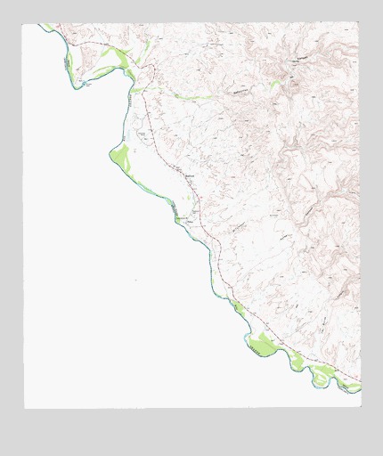
Redford, TX USGS Topographic Map
Click on map above to begin viewing in our Map Viewer.

This topographic map contains these locations and features:
Feature Name Type Latitude Longitude GNIS ID View Map
Auras CanyonValleyN29.4195°W104.1806°1329841View Map
Bofecillos CanyonValleyN29.4789°W104.2032°1330983View Map
El Calabazar CanyonValleyN29.4258°W104.1808°1335167View Map
PolvoPopulated PlaceN29.4352°W104.1938°1376921View Map
Polvo CrossingLocaleN29.4366°W104.1938°1376920View Map
RedfordPopulated PlaceN29.4499°W104.1894°1344981View Map
Redford CemeteryCemeteryN29.4377°W104.1863°1344982View Map
Redford Census Designated PlaceCensusN29.4342°W104.1824°2409152View Map

Note: Coordinates in the location and feature list above are referenced to NAD83 datum.


Copyright (C) 2008-2024 Ryan Niemi / Sunset Dynamics ... All Rights Reserved