TopoQuest Logo
Do you find TopoQuest useful?
Help keep TopoQuest running and adding new maps/features by donating!
Bitcoin:  19c7KJd3qBynnjoSw5npx9KScwjBe4ifkT
Litecoin:  LXs6TkuXGGXo1vDsWCkWVdjQX94eUKd6ui
Home View Maps Find Maps Find Places Resources & Links


Preston, Iowa Topographic Map

USGS Map Title: Preston, IA
USGS Map MRC: 42090A4
DRG (GeoTIFF) Download: o42090a4.tif


Neighboring USGS Topographic Map Quads:


  Andrew, IA  
42090B5
 

  Springbrook, IA  
42090B4
 

  Green Island, IA  
42090B3
 

  Delmar North, IA  
42090A5
 

  Preston, IA  
42090A4
 

  Miles, IA  
42090A3
 

  Delmar South, IA  
41090H5
 

  Goose Lake, IA  
41090H4
 

  Andover, IA  
41090H3


Map MRC Location:

N43°
W91°
N43°
W90°
H8 H7 H6 H5 H4 H3 H2 H1
G8 G7 G6 G5 G4 G3 G2 G1
F8 F7 F6 F5 F4 F3 F2 F1
E8 E7 E6 E5 E4 E3 E2 E1
D8 D7 D6 D5 D4 D3 D2 D1
C8 C7 C6 C5 C4 C3 C2 C1
B8 B7 B6 B5 B4 B3 B2 B1
A8 A7 A6 A5 A4 A3 A2 A1
N42°
W91°
N42°
W90°

Preston, IA USGS 1:24K Topographic Map Preview:
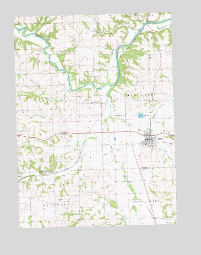
Preston, IA USGS Topographic Map
Click on map above to begin viewing in our Map Viewer.

This topographic map contains these locations and features:
Feature Name Type Latitude Longitude GNIS ID View Map
Bear CreekStreamN42.0103°W90.4132°454405View Map
Brown Post Office (historical)Post OfficeN42.0306°W90.4993°2000631View Map
BrownsPopulated PlaceN42.0306°W90.4993°464473View Map
Browns StationLocaleN42.0311°W90.4746°454871View Map
City of PrestonCivilN42.0490°W90.3974°2396273View Map
City of SpraguevilleCivilN42.0717°W90.4321°2395930View Map
Community Ambulance Service PrestonBuildingN42.0510°W90.3959°2599968View Map
Copper CreekStreamN42.0659°W90.4315°455621View Map
Deep CreekStreamN42.0828°W90.4315°455845View Map
Farley CemeteryCemeteryN42.0556°W90.3835°2001032View Map
HiggensportLocaleN42.1195°W90.4562°466153View Map
Higginsport Post Office (historical)Post OfficeN42.1167°W90.4590°2000875View Map
Jackson County Recreational TrailTrailN42.1031°W90.4121°2001080View Map
Methodist ChurchChurchN42.0503°W90.3946°2000986View Map
North Bend School CemeteryCemeteryN42.0910°W90.4612°2001047View Map
Plum River Golf CourseLocaleN42.0750°W90.4008°2000984View Map
PrestonPopulated PlaceN42.0503°W90.4140°460442View Map
Preston (historical)LocaleN42.0506°W90.3960°2000983View Map
Preston CemeteryCemeteryN42.0475°W90.3751°1825068View Map
Preston Elementary SchoolSchoolN42.0484°W90.3978°2000988View Map
Preston Fire DepartmentBuildingN42.0502°W90.3972°2000982View Map
Preston High SchoolSchoolN42.0475°W90.3983°2000989View Map
Preston Police DepartmentBuildingN42.0505°W90.3942°2000980View Map
Preston Post OfficePost OfficeN42.0500°W90.3971°2000981View Map
Preston Public LibraryBuildingN42.0500°W90.3974°2000979View Map
Reed CemeteryCemeteryN42.1000°W90.4418°1958188View Map
Rock CreekStreamN42.0811°W90.4565°460730View Map
Rockaway (historical)Populated PlaceN42.1031°W90.4124°464196View Map
Rockaway (historical)LocaleN42.1031°W90.4124°2000873View Map
Russell Farm CemeteryCemeteryN42.1000°W90.4029°2001033View Map
Ryan CreekStreamN42.0756°W90.4685°460871View Map
Saint Johns Lutheran ChurchChurchN42.0503°W90.3946°2000985View Map
Saint Joseph Catholic ChurchChurchN42.0464°W90.4049°2000987View Map
Saint Joseph CemeteryCemeteryN42.0417°W90.3835°2001044View Map
Saint Joseph ChurchChurchN42.0159°W90.4687°461101View Map
Saint Josephs CemeteryCemeteryN42.0161°W90.4685°2000844View Map
Salem ChurchChurchN42.0706°W90.4354°461366View Map
Salem Lutheran ChurchChurchN42.0703°W90.4329°2001027View Map
Salem's Lutheran CemeteryCemeteryN42.0729°W90.4418°461375View Map
Schickel CemeteryCemeteryN42.1001°W90.4445°2001046View Map
Schmidt Farm CemeteryCemeteryN42.1004°W90.4442°1958240View Map
Simmons CreekStreamN42.0164°W90.4129°461641View Map
South Copper CreekStreamN42.0570°W90.4160°461773View Map
SpraguevillePopulated PlaceN42.0725°W90.4351°461859View Map
Spragueville (historical)LocaleN42.0722°W90.4279°2001025View Map
Spragueville Post OfficePost OfficeN42.0725°W90.4351°2001026View Map
Sugar CreekStreamN42.0481°W90.4315°462056View Map
Summer Hill CemeteryCemeteryN42.0556°W90.4629°462076View Map
Township of FairfieldCivilN42.0768°W90.4909°467813View Map
Valley CemeteryCemeteryN42.0111°W90.3974°2000850View Map

Note: Coordinates in the location and feature list above are referenced to NAD83 datum.


Copyright (C) 2008-2025 Ryan Niemi / Sunset Dynamics ... All Rights Reserved