TopoQuest Logo
Do you find TopoQuest useful?
Help keep TopoQuest running and adding new maps/features by donating!
Bitcoin:  19c7KJd3qBynnjoSw5npx9KScwjBe4ifkT
Litecoin:  LXs6TkuXGGXo1vDsWCkWVdjQX94eUKd6ui
Home View Maps Find Maps Find Places Resources & Links


Priest Lake NW, Idaho Topographic Map

USGS Map Title: Priest Lake NW, ID
USGS Map MRC: 48116F8
DRG (GeoTIFF) Download: o48116f8.tif


Neighboring USGS Topographic Map Quads:


  Helmer Mountain, WA  
48117G1
 

  Upper Priest Lake, ID  
48116G8
 

  Caribou Creek, ID  
48116G7
 

  Orwig Hump, WA  
48117F1
 

  Priest Lake NW, ID  
48116F8
 

  Priest Lake NE, ID  
48116F7
 

  Gleason Mountain, WA  
48117E1
 

  Priest Lake SW, ID  
48116E8
 

  Priest Lake SE, ID  
48116E7


Map MRC Location:

N49°
W117°
N49°
W116°
H8 H7 H6 H5 H4 H3 H2 H1
G8 G7 G6 G5 G4 G3 G2 G1
F8 F7 F6 F5 F4 F3 F2 F1
E8 E7 E6 E5 E4 E3 E2 E1
D8 D7 D6 D5 D4 D3 D2 D1
C8 C7 C6 C5 C4 C3 C2 C1
B8 B7 B6 B5 B4 B3 B2 B1
A8 A7 A6 A5 A4 A3 A2 A1
N48°
W117°
N48°
W116°

Priest Lake NW, ID USGS 1:24K Topographic Map Preview:
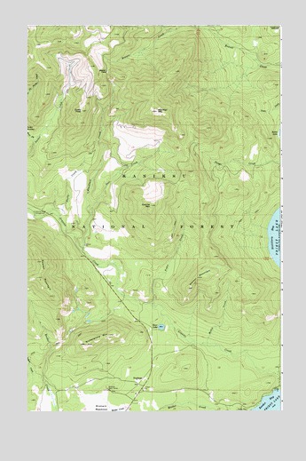
Priest Lake NW, ID USGS Topographic Map
Click on map above to begin viewing in our Map Viewer.

This topographic map contains these locations and features:
Feature Name Type Latitude Longitude GNIS ID View Map
Beaver PassGapN48.7355°W116.9622°377280View Map
Bismark Work CenterLocaleN48.6324°W116.9616°377702View Map
Blacktail CreekStreamN48.6771°W116.9741°377828View Map
Blacktail MountainSummitN48.7224°W116.9383°396148View Map
Bottle LakeLakeN48.7151°W116.8761°378058View Map
Bottle Lake Research Natural AreaParkN48.7160°W116.8769°394165View Map
Dusty CreekStreamN48.6885°W116.9847°380951View Map
Dusty PeakSummitN48.7224°W116.9738°396424View Map
Fedar CreekStreamN48.6588°W116.9380°396480View Map
Granite Creek CampgroundLocaleN48.6894°W116.9974°382534View Map
Granite MountainSummitN48.6919°W116.9405°396581View Map
Indian CreekStreamN48.6363°W116.9966°397808View Map
Jost CreekStreamN48.6885°W116.9697°384029View Map
Kerr LakeLakeN48.6524°W116.9345°384187View Map
Ledgewood Picnic AreaLocaleN48.6263°W116.8897°394311View Map
Media CreekStreamN48.6463°W116.9122°386728View Map
Nickelplate MountainSummitN48.6469°W116.9722°400013View Map
NordmanPopulated PlaceN48.6338°W116.9458°397948View Map
Nordman CampgroundLocaleN48.6691°W116.9597°394195View Map
Nordman Post OfficePost OfficeN48.6305°W116.9471°2766868View Map
Reeder Bay CampgroundLocaleN48.6252°W116.8919°389265View Map
Reeder LakeReservoirN48.6563°W116.9705°394190View Map
Reeder MountainSummitN48.6683°W116.9955°397095View Map
Watson MountainSummitN48.6683°W116.9169°397301View Map
West Fork Packer CreekStreamN48.7124°W116.9969°393162View Map
West Priest Lake Fire Department Station 2BuildingN48.6312°W116.9463°2619118View Map

Note: Coordinates in the location and feature list above are referenced to NAD83 datum.


Copyright (C) 2008-2024 Ryan Niemi / Sunset Dynamics ... All Rights Reserved