TopoQuest Logo
Do you find TopoQuest useful?
Help keep TopoQuest running and adding new maps/features by donating!
Bitcoin:  19c7KJd3qBynnjoSw5npx9KScwjBe4ifkT
Litecoin:  LXs6TkuXGGXo1vDsWCkWVdjQX94eUKd6ui
Home View Maps Find Maps Find Places Resources & Links


Priest Lake SE, Idaho Topographic Map

USGS Map Title: Priest Lake SE, ID
USGS Map MRC: 48116E7
DRG (GeoTIFF) Download: o48116e7.tif


Neighboring USGS Topographic Map Quads:


  Priest Lake NW, ID  
48116F8
 

  Priest Lake NE, ID  
48116F7
 

  The Wigwams, ID  
48116F6
 

  Priest Lake SW, ID  
48116E8
 

  Priest Lake SE, ID  
48116E7
 

  Mount Roothaan, ID  
48116E6
 

  Outlet Bay, ID  
48116D8
 

  Coolin, ID  
48116D7
 

  Mount Casey, ID  
48116D6


Map MRC Location:

N49°
W117°
N49°
W116°
H8 H7 H6 H5 H4 H3 H2 H1
G8 G7 G6 G5 G4 G3 G2 G1
F8 F7 F6 F5 F4 F3 F2 F1
E8 E7 E6 E5 E4 E3 E2 E1
D8 D7 D6 D5 D4 D3 D2 D1
C8 C7 C6 C5 C4 C3 C2 C1
B8 B7 B6 B5 B4 B3 B2 B1
A8 A7 A6 A5 A4 A3 A2 A1
N48°
W117°
N48°
W116°

Priest Lake SE, ID USGS 1:24K Topographic Map Preview:
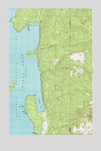
Priest Lake SE, ID USGS Topographic Map
Click on map above to begin viewing in our Map Viewer.

This topographic map contains these locations and features:
Feature Name Type Latitude Longitude GNIS ID View Map
Camels PrairieRidgeN48.5416°W116.7571°378746View Map
Camels Prairie Lookout TowerTowerN48.5399°W116.7519°394847View Map
Cape HornCapeN48.6141°W116.8705°397527View Map
Cavanaugh BayBayN48.5305°W116.8288°379055View Map
Cavanaugh Bay AirportAirportN48.5199°W116.8225°400797View Map
Cavanaugh Bay HeadquartersLocaleN48.5213°W116.8219°394203View Map
Cougar CreekStreamN48.5308°W116.8241°379887View Map
Eightmile IslandIslandN48.5802°W116.8430°397682View Map
Fenton CreekStreamN48.5238°W116.8233°381653View Map
Fourmile IslandIslandN48.5283°W116.8580°397719View Map
Hess PointCapeN48.5233°W116.8522°383126View Map
Horton CreekStreamN48.5816°W116.8374°383432View Map
Hunt CreekStreamN48.5635°W116.8305°383555View Map
Idaho Department of Lands Priest Lake Fire Protection District StationBuildingN48.5227°W116.8228°2619080View Map
Indian CreekStreamN48.6108°W116.8360°397807View Map
Indian Creek BayBayN48.6080°W116.8377°383665View Map
Indian Creek CampgroundLocaleN48.6113°W116.8313°383668View Map
Pinto PointCapeN48.6041°W116.8463°397995View Map
Priest LakeReservoirN48.5884°W116.8650°398012View Map
Priest Lake Incubation ChannelsChannelN48.5644°W116.8288°401077View Map
Priest Lake State ForestParkN48.5666°W116.7760°394316View Map
Priest Lake State Park Indian Creek UnitLocaleN48.6113°W116.8313°398483View Map
Rocky PointCapeN48.5394°W116.8385°398067View Map
Roothaan MountainSummitN48.6199°W116.8505°399187View Map
Selkirk MountainsRangeN48.5002°W116.7513°395889View Map
Soldier CreekStreamN48.5033°W116.8383°390817View Map
South Fork Hunt CreekStreamN48.5658°W116.8094°390952View Map
Steamboat BayBayN48.5213°W116.8483°391385View Map
Vinther-Nelson Historical CabinLocaleN48.5785°W116.8413°394202View Map

Note: Coordinates in the location and feature list above are referenced to NAD83 datum.


Copyright (C) 2008-2024 Ryan Niemi / Sunset Dynamics ... All Rights Reserved