TopoQuest Logo
Do you find TopoQuest useful?
Help keep TopoQuest running and adding new maps/features by donating!
Bitcoin:  19c7KJd3qBynnjoSw5npx9KScwjBe4ifkT
Litecoin:  LXs6TkuXGGXo1vDsWCkWVdjQX94eUKd6ui
Home View Maps Find Maps Find Places Resources & Links


Purdys Gardens, California Topographic Map

USGS Map Title: Purdys Gardens, CA
USGS Map MRC: 39123A1
DRG (GeoTIFF) Download: o39123a1.tif


Neighboring USGS Topographic Map Quads:


  Ukiah, CA  
39123B2
 

  Cow Mountain, CA  
39123B1
 

  Upper Lake, CA  
39122B8
 

  Elledge Peak, CA  
39123A2
 

  Purdys Gardens, CA  
39123A1
 

  Lakeport, CA  
39122A8
 

  Yorkville, CA  
38123H2
 

  Hopland, CA  
38123H1
 

  Highland Springs, CA  
38122H8


Map MRC Location:

N40°
W124°
N40°
W123°
H8 H7 H6 H5 H4 H3 H2 H1
G8 G7 G6 G5 G4 G3 G2 G1
F8 F7 F6 F5 F4 F3 F2 F1
E8 E7 E6 E5 E4 E3 E2 E1
D8 D7 D6 D5 D4 D3 D2 D1
C8 C7 C6 C5 C4 C3 C2 C1
B8 B7 B6 B5 B4 B3 B2 B1
A8 A7 A6 A5 A4 A3 A2 A1
N39°
W124°
N39°
W123°

Purdys Gardens, CA USGS 1:24K Topographic Map Preview:
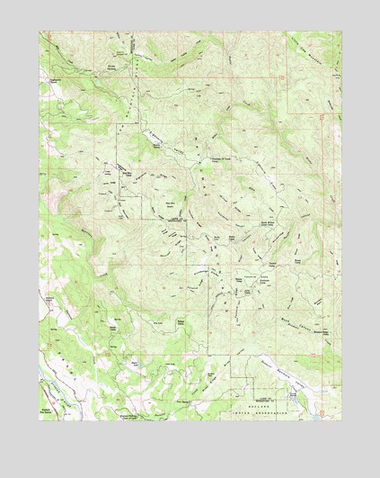
Purdys Gardens, CA USGS Topographic Map
Click on map above to begin viewing in our Map Viewer.

This topographic map contains these locations and features:
Feature Name Type Latitude Longitude GNIS ID View Map
Alder CanyonValleyN39.0621°W123.0350°218086View Map
Ashmore RidgeRidgeN39.0602°W123.0697°218437View Map
Basin RidgeRidgeN39.0655°W123.0772°218721View Map
Bedford RockPillarN39.0146°W123.0567°218955View Map
Benmore Ridge CampLocaleN39.0282°W123.0058°219037View Map
Benmore ValleyValleyN39.0124°W123.0206°254605View Map
Boundary BasinBasinN39.0380°W123.0108°219703View Map
Brushy RidgeRidgeN39.0571°W123.0564°219957View Map
Buck CanyonValleyN39.0255°W123.0061°219978View Map
Buck RidgeRidgeN39.0377°W123.0222°220007View Map
Bushy CampLocaleN39.0574°W123.0467°220265View Map
California Department of Forestry and Fire Protection HoplandBuildingN39.0037°W123.1202°2622300View Map
California Department of Forestry and Fire Protection Hopland Volunteer Fire DistrictBuildingN39.0037°W123.1198°2622195View Map
Coon LakeLakeN39.0176°W123.0740°221514View Map
Cow MountainSummitN39.1079°W123.0872°1658330View Map
Dorst RanchLocaleN39.0074°W123.0222°222530View Map
Eaglepoint RanchLocaleN39.1082°W123.1219°222840View Map
Eightmile GladeFlatN39.0777°W123.0325°223008View Map
Eightmile RidgeRidgeN39.0785°W123.0800°223009View Map
Eightmile ValleyStreamN39.0896°W123.0589°223010View Map
Fountain of Youth CampLocaleN39.0841°W123.0550°253214View Map
Fourmile GladeFlatN39.0460°W123.0358°223757View Map
Fourmile RidgeRidgeN39.0368°W123.0442°223760View Map
Fourpoint CanyonValleyN39.0749°W123.0611°223763View Map
Hagan LakeLakeN39.0181°W123.0844°224771View Map
Hog LakeLakeN39.0316°W123.0788°225403View Map
Hopland Field StationLocaleN39.0018°W123.0847°225575View Map
Hopland Fire StationLocaleN39.0030°W123.1206°225576View Map
James CabinLocaleN39.0296°W123.0939°226121View Map
Jerky CampLocaleN39.0402°W123.0408°226210View Map
Kelsey CabinLocaleN39.0305°W123.0683°226482View Map
Knobcone CampLocaleN39.0435°W123.0347°226660View Map
Lost ValleyBasinN39.0793°W123.0975°254944View Map
Lyons ValleyStreamN39.1149°W123.0783°227870View Map
Lyons Valley CreekStreamN39.1157°W123.0478°227871View Map
Miner RidgeRidgeN39.0757°W123.0967°228789View Map
Morrison RidgeRidgeN39.0549°W123.0711°229086View Map
Norris RanchLocaleN39.0888°W123.0767°229590View Map
Panther CreekStreamN39.0891°W123.0575°230298View Map
Panther RidgeRidgeN39.0641°W123.0617°230310View Map
Peters 393 DamDamN39.0016°W123.0128°1663856View Map
Poor RanchLocaleN39.0060°W123.0639°230935View Map
Pratt Ranch (historical)LocaleN39.0018°W123.0844°1653194View Map
Purdys GardensLocaleN39.1121°W123.0939°231098View Map
Pyramid RidgeRidgeN39.0427°W123.0603°231108View Map
Red MountainSummitN39.0652°W123.0911°231352View Map
Red Mountain BasinBasinN39.0691°W123.0717°231357View Map
Red Mountain CampLocaleN39.0788°W123.0875°231358View Map
Rickabaugh GladesFlatN39.0468°W123.0583°231557View Map
Riley RidgeRidgeN39.0113°W123.0558°231588View Map
Riley ValleyStreamN39.0243°W123.0389°231591View Map
Rocky LakeLakeN39.0585°W123.0538°231775View Map
Ruddick RanchLocaleN39.0391°W123.1236°232007View Map
Shin Skin RidgeRidgeN39.0577°W123.0278°233006View Map
Short RidgeRidgeN39.0610°W123.0733°233051View Map
Simms CampLocaleN39.0455°W123.0419°233160View Map
South Willow Creek CampLocaleN39.0630°W123.0347°235127View Map
Spruce CanyonValleyN39.0624°W123.0014°235292View Map
Spruce RidgeRidgeN39.0571°W123.0192°235294View Map
Traft RidgeRidgeN39.0518°W123.0042°236506View Map
Tucker CampLocaleN39.0499°W123.0317°236588View Map
Tucker RidgeRidgeN39.0532°W123.0364°236590View Map
Ukiah Television Translator StationLocaleN39.1171°W123.0942°1724269View Map
Vandenburg RidgeRidgeN39.0816°W123.0939°237025View Map
Willow CreekStreamN39.1024°W123.0431°237881View Map
Willow RidgeRidgeN39.0696°W123.0467°237930View Map
Woods CampLocaleN39.0507°W123.0211°238154View Map

Note: Coordinates in the location and feature list above are referenced to NAD83 datum.


Copyright (C) 2008-2024 Ryan Niemi / Sunset Dynamics ... All Rights Reserved