TopoQuest Logo
Do you find TopoQuest useful?
Help keep TopoQuest running and adding new maps/features by donating!
Bitcoin:  19c7KJd3qBynnjoSw5npx9KScwjBe4ifkT
Litecoin:  LXs6TkuXGGXo1vDsWCkWVdjQX94eUKd6ui
Home View Maps Find Maps Find Places Resources & Links


Purley, Texas Topographic Map

USGS Map Title: Purley, TX
USGS Map MRC: 33095A3
DRG (GeoTIFF) Download: o33095a3.tif


Neighboring USGS Topographic Map Quads:


  Dike, TX  
33095B4
 

  Saltillo, TX  
33095B3
 

  Mount Vernon, TX  
33095B2
 

  Como, TX  
33095A4
 

  Purley, TX  
33095A3
 

  New Hope, TX  
33095A2
 

  Pleasant Grove, TX  
32095H4
 

  Winnsboro, TX  
32095H3
 

  Newsome, TX  
32095H2


Map MRC Location:

N34°
W96°
N34°
W95°
H8 H7 H6 H5 H4 H3 H2 H1
G8 G7 G6 G5 G4 G3 G2 G1
F8 F7 F6 F5 F4 F3 F2 F1
E8 E7 E6 E5 E4 E3 E2 E1
D8 D7 D6 D5 D4 D3 D2 D1
C8 C7 C6 C5 C4 C3 C2 C1
B8 B7 B6 B5 B4 B3 B2 B1
A8 A7 A6 A5 A4 A3 A2 A1
N33°
W96°
N33°
W95°

Purley, TX USGS 1:24K Topographic Map Preview:
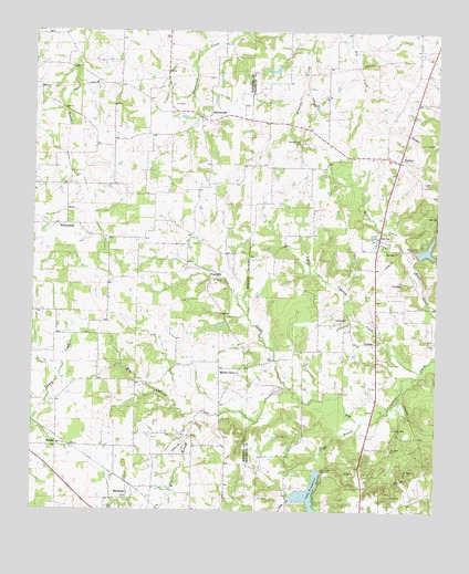
Purley, TX USGS Topographic Map
Click on map above to begin viewing in our Map Viewer.

This topographic map contains these locations and features:
Feature Name Type Latitude Longitude GNIS ID View Map
Blair CreekStreamN33.0532°W95.2502°1372618View Map
Coon CreekStreamN33.0323°W95.2958°1354924View Map
CypressPopulated PlaceN33.0440°W95.2691°1379627View Map
Cypress ChurchChurchN33.0501°W95.2780°1355514View Map
Glade BranchStreamN33.0229°W95.2733°1373841View Map
GreenwoodPopulated PlaceN33.1026°W95.3230°1379861View Map
HarmonyPopulated PlaceN33.0046°W95.3455°1379896View Map
HumblePopulated PlaceN33.0168°W95.3674°1379976View Map
Lake FranklinReservoirN33.0046°W95.2893°1373767View Map
Lake Franklin DamDamN33.0118°W95.2869°1860745View Map
Liberty CemeteryCemeteryN33.0857°W95.2522°1361146View Map
Little Cypress CreekStreamN33.0365°W95.2541°1361330View Map
Morris CreekStreamN33.0632°W95.2572°1363162View Map
Morris GrovePopulated PlaceN33.0371°W95.3144°1380213View Map
Mount Zion ChurchChurchN33.0001°W95.3194°1342156View Map
Pine HillPopulated PlaceN33.0610°W95.3202°1380359View Map
Pleasant Hill CemeteryCemeteryN33.0965°W95.2927°1365426View Map
PurleyPopulated PlaceN33.0912°W95.2622°1365865View Map
Purley Volunteer Fire DepartmentBuildingN33.0878°W95.2573°2655609View Map
Wilcox BranchStreamN33.0251°W95.3236°1376785View Map
WinterfieldPopulated PlaceN33.0746°W95.3649°1380941View Map
Zachry LakeReservoirN33.0681°W95.2535°1860744View Map
Zachry Lake DamDamN33.0668°W95.2569°1860743View Map

Note: Coordinates in the location and feature list above are referenced to NAD83 datum.


Copyright (C) 2008-2024 Ryan Niemi / Sunset Dynamics ... All Rights Reserved