TopoQuest Logo
Do you find TopoQuest useful?
Help keep TopoQuest running and adding new maps/features by donating!
Bitcoin:  19c7KJd3qBynnjoSw5npx9KScwjBe4ifkT
Litecoin:  LXs6TkuXGGXo1vDsWCkWVdjQX94eUKd6ui
Home View Maps Find Maps Find Places Resources & Links


New Hope, Texas Topographic Map

USGS Map Title: New Hope, TX
USGS Map MRC: 33095A2
DRG (GeoTIFF) Download: o33095a2.tif


Neighboring USGS Topographic Map Quads:


  Saltillo, TX  
33095B3
 

  Mount Vernon, TX  
33095B2
 

  Winfield, TX  
33095B1
 

  Purley, TX  
33095A3
 

  New Hope, TX  
33095A2
 

  Monticello, TX  
33095A1
 

  Winnsboro, TX  
32095H3
 

  Newsome, TX  
32095H2
 

  Leesburg, TX  
32095H1


Map MRC Location:

N34°
W96°
N34°
W95°
H8 H7 H6 H5 H4 H3 H2 H1
G8 G7 G6 G5 G4 G3 G2 G1
F8 F7 F6 F5 F4 F3 F2 F1
E8 E7 E6 E5 E4 E3 E2 E1
D8 D7 D6 D5 D4 D3 D2 D1
C8 C7 C6 C5 C4 C3 C2 C1
B8 B7 B6 B5 B4 B3 B2 B1
A8 A7 A6 A5 A4 A3 A2 A1
N33°
W96°
N33°
W95°

New Hope, TX USGS 1:24K Topographic Map Preview:
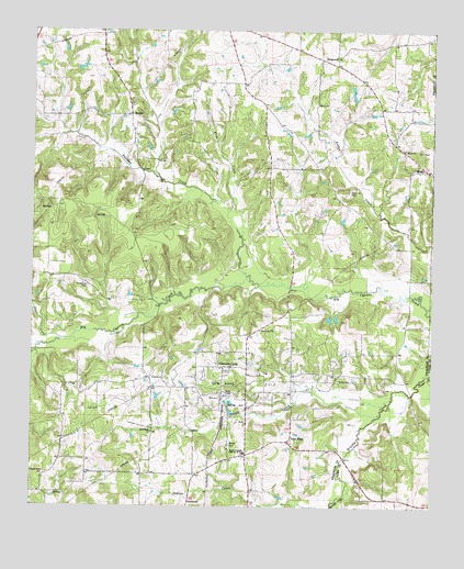
New Hope, TX USGS Topographic Map
Click on map above to begin viewing in our Map Viewer.

This topographic map contains these locations and features:
Feature Name Type Latitude Longitude GNIS ID View Map
Andys CreekStreamN33.0523°W95.1272°1329549View Map
Bethel CemeteryCemeteryN33.0165°W95.1880°1330485View Map
Clopton Road ChurchChurchN33.0085°W95.2463°1333001View Map
Cypress Creek ParkParkN33.0726°W95.1386°2028461View Map
Franklin County DamDamN33.0568°W95.1402°1860737View Map
Frog CreekStreamN33.0776°W95.1888°1336268View Map
Good Hope ChurchChurchN33.0196°W95.2124°1336693View Map
HopewellPopulated PlaceN33.1185°W95.1558°1378469View Map
KPXI-FM (Mount Pleasant)TowerN33.0768°W95.2408°1388041View Map
Lake Cypress SpringsReservoirN33.0594°W95.1878°1829123View Map
Mac Kay HeliportAirportN33.0601°W95.1577°1387225View Map
MaconPopulated PlaceN33.0887°W95.1277°1378632View Map
Macon ChurchChurchN33.0940°W95.1347°1340817View Map
MajorsPopulated PlaceN33.1029°W95.2197°1378636View Map
Mary King ParkParkN33.0532°W95.1711°2029825View Map
New HopePopulated PlaceN33.0182°W95.1691°1378745View Map
New Hope Oil FieldOilfieldN33.0326°W95.1841°1342484View Map
Over Look ParkParkN33.0668°W95.1683°2029645View Map
Panther CreekStreamN33.0607°W95.1833°1375352View Map
Prairie BranchStreamN33.0001°W95.1530°1344483View Map
Rock Hill CemeteryCemeteryN33.0829°W95.1516°1345380View Map
Rogers-Drummond HouseBuildingN33.1185°W95.1533°2032697View Map
Snodgrass CemeteryCemeteryN33.0584°W95.2334°1347334View Map
South Franklin County Volunteer Fire DepartmentBuildingN33.0411°W95.2148°2655326View Map
South Franklin CSD Number 20 SchoolSchoolN33.0140°W95.1836°1347463View Map
South Franklin Volunteer Fire Department Station 1BuildingN33.0142°W95.1835°2655224View Map
South Franklin Volunteer Fire Department Station 2BuildingN33.0417°W95.2149°2655611View Map
Stouts CreekStreamN33.0243°W95.1411°1347981View Map
Tidewater CampLocaleN33.0368°W95.1899°1348550View Map
Walleye ParkParkN33.0704°W95.1566°2029972View Map
Winnsboro DivisionCivilN33.0075°W95.2211°1939332View Map

Note: Coordinates in the location and feature list above are referenced to NAD83 datum.


Copyright (C) 2008-2025 Ryan Niemi / Sunset Dynamics ... All Rights Reserved