TopoQuest Logo
Do you find TopoQuest useful?
Help keep TopoQuest running and adding new maps/features by donating!
Bitcoin:  19c7KJd3qBynnjoSw5npx9KScwjBe4ifkT
Litecoin:  LXs6TkuXGGXo1vDsWCkWVdjQX94eUKd6ui
Home View Maps Find Maps Find Places Resources & Links


Putnam Mountain, New York Topographic Map

USGS Map Title: Putnam Mountain, NY
USGS Map MRC: 43073D5
DRG (GeoTIFF) Download: o43073d5.tif


Neighboring USGS Topographic Map Quads:


  Bolton Landing, NY  
43073E6
 

  Shelving Rock, NY  
43073E5
 

  Whitehall, NY  
43073E4
 

  Lake George, NY  
43073D6
 

  Putnam Mountain, NY  
43073D5
 

  Fort Ann, NY  
43073D4
 

  Glens Falls, NY  
43073C6
 

  Hudson Falls, NY  
43073C5
 

  Hartford, NY  
43073C4


Map MRC Location:

N44°
W74°
N44°
W73°
H8 H7 H6 H5 H4 H3 H2 H1
G8 G7 G6 G5 G4 G3 G2 G1
F8 F7 F6 F5 F4 F3 F2 F1
E8 E7 E6 E5 E4 E3 E2 E1
D8 D7 D6 D5 D4 D3 D2 D1
C8 C7 C6 C5 C4 C3 C2 C1
B8 B7 B6 B5 B4 B3 B2 B1
A8 A7 A6 A5 A4 A3 A2 A1
N43°
W74°
N43°
W73°

Putnam Mountain, NY USGS 1:24K Topographic Map Preview:
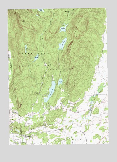
Putnam Mountain, NY USGS Topographic Map
Click on map above to begin viewing in our Map Viewer.

This topographic map contains these locations and features:
Feature Name Type Latitude Longitude GNIS ID View Map
Bacon PondLakeN43.4009°W73.5984°942766View Map
Bishop BrookStreamN43.3992°W73.5329°944040View Map
Browns CemeteryCemeteryN43.4022°W73.5811°2500235View Map
Buttermilk FallsFallsN43.4226°W73.5876°969944View Map
Camp Little NotchLocaleN43.4851°W73.5554°945617View Map
Camp WakpomineeLocaleN43.4565°W73.5865°945679View Map
Copeland PondLakeN43.4329°W73.5599°947412View Map
Fort Ann Rescue SquadBuildingN43.4141°W73.5005°2720154View Map
Goodmanor FarmsLocaleN43.4206°W73.5261°2708354View Map
Griswold CemeteryCemeteryN43.3937°W73.5809°2500236View Map
Hadlock PondReservoirN43.4235°W73.5723°951980View Map
Harris AirportAirportN43.4096°W73.5329°2717029View Map
Harrisena CemeteryCemeteryN43.4065°W73.6242°2559618View Map
Harrisena Community ChurchChurchN43.4070°W73.6236°952281View Map
Haskins CemeteryCemeteryN43.4060°W73.5387°965012View Map
Inman PondLakeN43.4942°W73.5878°953734View Map
Iron FurnacePopulated PlaceN43.4953°W73.5454°972655View Map
Kingsbury Wesleyan ChurchChurchN43.3841°W73.5315°2598356View Map
Lake NeboLakeN43.4676°W73.5560°958317View Map
Lake PondLakeN43.4816°W73.5547°960904View Map
Mount HopePopulated PlaceN43.4973°W73.5471°972819View Map
Mud PondSwampN43.3881°W73.6140°958105View Map
Orcutt CemeteryCemeteryN43.4535°W73.5803°959448View Map
Pattens MillsPopulated PlaceN43.3828°W73.6040°959986View Map
Pilot KnobSummitN43.4890°W73.6065°960407View Map
Putnam MountainSummitN43.4909°W73.5307°962012View Map
QueensburyPopulated PlaceN43.3773°W73.6132°962093View Map
River ChurchChurchN43.3820°W73.5304°2598358View Map
Sly PondLakeN43.4554°W73.5894°965441View Map
Sugar LoafSummitN43.4120°W73.6115°966717View Map
The Three PondsLakeN43.4611°W73.6026°967343View Map
Town of Fort AnnCivilN43.4698°W73.5231°978965View Map
TripoliPopulated PlaceN43.3909°W73.5796°973165View Map
West Fort AnnPopulated PlaceN43.4098°W73.5737°969226View Map
West Fort Ann Methodist ChurchChurchN43.4089°W73.5658°2500233View Map
West Fort Ann Volunteer Fire CompanyBuildingN43.4102°W73.5759°2718667View Map

Note: Coordinates in the location and feature list above are referenced to NAD83 datum.


Copyright (C) 2008-2025 Ryan Niemi / Sunset Dynamics ... All Rights Reserved