TopoQuest Logo
Do you find TopoQuest useful?
Help keep TopoQuest running and adding new maps/features by donating!
Bitcoin:  19c7KJd3qBynnjoSw5npx9KScwjBe4ifkT
Litecoin:  LXs6TkuXGGXo1vDsWCkWVdjQX94eUKd6ui
Home View Maps Find Maps Find Places Resources & Links


Quietus, Montana Topographic Map

USGS Map Title: Quietus, MT
USGS Map MRC: 45106A3
DRG (GeoTIFF) Download: o45106a3.tif


Neighboring USGS Topographic Map Quads:


  Stroud Creek, MT  
45106B4
 

  Hamilton Draw, MT  
45106B3
 

  Otter, MT  
45106B2
 

  Forks Ranch, MT  
45106A4
 

  Quietus, MT  
45106A3
 

  Bear Creek School, MT  
45106A2
 

  Roundup Draw, WY  
44106H4
 

  Box Elder Draw, WY  
44106H3
 

  Cabin Creek NW, WY  
44106H2


Map MRC Location:

N46°
W107°
N46°
W106°
H8 H7 H6 H5 H4 H3 H2 H1
G8 G7 G6 G5 G4 G3 G2 G1
F8 F7 F6 F5 F4 F3 F2 F1
E8 E7 E6 E5 E4 E3 E2 E1
D8 D7 D6 D5 D4 D3 D2 D1
C8 C7 C6 C5 C4 C3 C2 C1
B8 B7 B6 B5 B4 B3 B2 B1
A8 A7 A6 A5 A4 A3 A2 A1
N45°
W107°
N45°
W106°

Quietus, MT USGS 1:24K Topographic Map Preview:
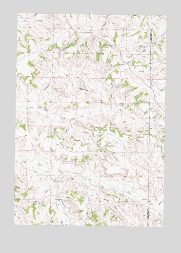
Quietus, MT USGS Topographic Map
Click on map above to begin viewing in our Map Viewer.

This topographic map contains these locations and features:
Feature Name Type Latitude Longitude GNIS ID View Map
08S44E20CBCC01 WellWellN45.1200°W106.3656°808014View Map
08S44E20CCBB01 WellWellN45.1197°W106.3653°808012View Map
08S44E22DCDB01 WellWellN45.1178°W106.3120°808002View Map
08S44E23DDDA01 SpringSpringN45.1178°W106.2845°808001View Map
08S44E24CBCA01 WellWellN45.1217°W106.2823°808024View Map
08S44E24CCAC01 SpringSpringN45.1186°W106.2834°808009View Map
08S44E24CCBC01 WellWellN45.1186°W106.2831°808008View Map
08S44E24CCDA01 SpringSpringN45.1175°W106.2800°807999View Map
08S44E24CDAB01 SpringSpringN45.1192°W106.2761°808011View Map
08S44E25DBDB01 SpringSpringN45.1070°W106.2705°807942View Map
08S44E27CCCC01 SpringSpringN45.1019°W106.3241°807917View Map
08S44E32DDAB01 WellWellN45.0892°W106.3473°807849View Map
08S44E35ADDC01 WellWellN45.0950°W106.2861°807888View Map
08S45E19CBCC01 SpringSpringN45.1200°W106.2628°808013View Map
08S45E30BCDA01 SpringSpringN45.1103°W106.2589°807955View Map
08S45E31BCCB01 WellWellN45.0955°W106.2623°807891View Map
09S44E01ADAA01 WellWellN45.0825°W106.2645°807790View Map
09S44E07AADD01 WellWellN45.0694°W106.3667°807692View Map
09S44E07ADAA01 WellWellN45.0686°W106.3661°807684View Map
09S44E07ADAB01 WellWellN45.0686°W106.3670°807685View Map
09S44E07ADAD01 WellWellN45.0680°W106.3673°807677View Map
09S44E07ADDC01 WellWellN45.0658°W106.3684°807657View Map
09S44E07ADDC02 WellWellN45.0650°W106.3675°807645View Map
09S44E07ADDC03 WellWellN45.0650°W106.3675°807644View Map
09S44E08BBAA01 WellWellN45.0708°W106.3617°807713View Map
09S44E08BBAA02 WellWellN45.0708°W106.3617°807714View Map
09S44E08BDDD01 WellWellN45.0650°W106.3567°807643View Map
09S44E09CBBD01 WellWellN45.0644°W106.3431°807638View Map
09S44E09CCAB01 WellWellN45.0617°W106.3423°807618View Map
09S44E10CBAD01 WellWellN45.0644°W106.3206°807637View Map
09S44E11BDAA01 WellWellN45.0686°W106.2953°807683View Map
09S44E16ABCC01 WellWellN45.0547°W106.3345°807571View Map
09S44E20DCAA01 WellWellN45.0325°W106.3514°807423View Map
09S44E27ABCB01 WellWellN45.0275°W106.3136°807392View Map
09S44E28CDCA02 SpringSpringN45.0167°W106.3381°807339View Map
09S44E28CDCD01 WellWellN45.0155°W106.3381°807335View Map
09S44E33BADB01 WellWellN45.0125°W106.3370°807314View Map
09S45E07CCAD01 WellWellN45.0605°W106.2595°807612View Map
Canyon Spring DrawValleyN45.0908°W106.3403°769579View Map
Cossit School (historical)SchoolN45.0225°W106.2923°1716412View Map
Iron Springs CreekStreamN45.0268°W106.3126°772732View Map
Mud SpringsSpringN45.1072°W106.2703°774479View Map
QuietusPopulated PlaceN45.0964°W106.2831°775514View Map
Quietus Post Office (historical)Post OfficeN45.0958°W106.2845°1716495View Map
San SpringSpringN45.0724°W106.2860°776155View Map
Sand DrawValleyN45.0053°W106.3325°1593855View Map
Sand DrawValleyN45.0053°W106.3325°776195View Map
Seventysix CreekStreamN45.0347°W106.3556°776380View Map
Son ProngStreamN45.0692°W106.2939°776739View Map
Spring CreekStreamN45.0122°W106.2556°777012View Map
Stagmire DrawValleyN45.0700°W106.3567°777146View Map
The PyramidSummitN45.0811°W106.3225°777534View Map
Tidwell DrawValleyN45.0614°W106.3303°777637View Map
Woods DrawValleyN45.0236°W106.3436°778682View Map

Note: Coordinates in the location and feature list above are referenced to NAD83 datum.


Copyright (C) 2008-2024 Ryan Niemi / Sunset Dynamics ... All Rights Reserved