TopoQuest Logo
Do you find TopoQuest useful?
Help keep TopoQuest running and adding new maps/features by donating!
Bitcoin:  19c7KJd3qBynnjoSw5npx9KScwjBe4ifkT
Litecoin:  LXs6TkuXGGXo1vDsWCkWVdjQX94eUKd6ui
Home View Maps Find Maps Find Places Resources & Links


Quogue, New York Topographic Map

USGS Map Title: Quogue, NY
USGS Map MRC: 40072G5
DRG (GeoTIFF) Download: o40072g5.tif


Neighboring USGS Topographic Map Quads:


  Riverhead, NY  
40072H6
 

  Mattituck, NY  
40072H5
 

  Southampton, NY  
40072H4
 

  Eastport, NY  
40072G6
 

  Quogue, NY  
40072G5
 

  Shinnecock Inlet, NY  
40072G4


Map MRC Location:

N41°
W73°
N41°
W72°
H8 H7 H6 H5 H4 H3 H2 H1
G8 G7 G6 G5 G4 G3 G2 G1
F8 F7 F6 F5 F4 F3 F2 F1
E8 E7 E6 E5 E4 E3 E2 E1
D8 D7 D6 D5 D4 D3 D2 D1
C8 C7 C6 C5 C4 C3 C2 C1
B8 B7 B6 B5 B4 B3 B2 B1
A8 A7 A6 A5 A4 A3 A2 A1
N40°
W73°
N40°
W72°

Quogue, NY USGS 1:24K Topographic Map Preview:
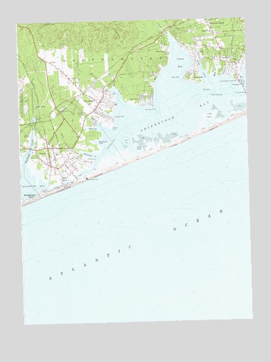
Quogue, NY USGS Topographic Map
Click on map above to begin viewing in our Map Viewer.

This topographic map contains these locations and features:
Feature Name Type Latitude Longitude GNIS ID View Map
Alcotts PondLakeN40.8368°W72.5892°942252View Map
Christ Our Saviour Lutheran ChurchChurchN40.8638°W72.5482°2714494View Map
Church of the AtonementChurchN40.8186°W72.6144°2076693View Map
Coast Guard Station ShinnecockMilitaryN40.8495°W72.5036°2512141View Map
Daves CreekStreamN40.8362°W72.5734°948051View Map
East PointCapeN40.8459°W72.5195°949211View Map
East QuoguePopulated PlaceN40.8407°W72.5815°949224View Map
East Quogue Census Designated PlaceCensusN40.8489°W72.5783°2389447View Map
East Quogue Fire StationBuildingN40.8433°W72.5786°2400253View Map
East Quogue Fire StationBuildingN40.8476°W72.5643°2735394View Map
East Quogue Methodist Church CemeteryCemeteryN40.8422°W72.5813°2105519View Map
East Quogue Mobile Home ParkPopulated PlaceN40.8536°W72.5792°2461069View Map
East Quogue Post OfficePost OfficeN40.8427°W72.5784°2713571View Map
East Quogue SchoolSchoolN40.8436°W72.5797°2075888View Map
East Quogue United Methodist ChurchChurchN40.8417°W72.5808°2076689View Map
Flanders HillSummitN40.8745°W72.6045°950230View Map
Hampton BaysPopulated PlaceN40.8690°W72.5176°952135View Map
Hampton Bays Assembly of God ChurchChurchN40.8654°W72.5145°2714529View Map
Hampton Bays Census Designated PlaceCensusN40.8692°W72.5227°2389893View Map
Hampton Bays Elementary SchoolSchoolN40.8700°W72.5189°2075894View Map
Hampton Bays Fire Department Sub StationBuildingN40.8653°W72.5163°2735312View Map
Hampton Bays Mobile Home ParkPopulated PlaceN40.8664°W72.5478°2461072View Map
Hampton Bays Public LibraryBuildingN40.8730°W72.5205°2715303View Map
Hampton Bays Secondary SchoolSchoolN40.8742°W72.5083°2075895View Map
Hampton BeachBeachN40.8083°W72.5925°2571109View Map
Hampton BeachPopulated PlaceN40.8090°W72.5906°952137View Map
Hampton PointCapeN40.8351°W72.5731°952145View Map
Henrys HollowBasinN40.8695°W72.5701°973450View Map
Lanes IslandIslandN40.8351°W72.5201°955030View Map
North PondReservoirN40.8398°W72.6157°958894View Map
OakvillePopulated PlaceN40.8590°W72.6095°972887View Map
Ogden PondLakeN40.8104°W72.6006°959227View Map
Old Ice PondReservoirN40.8350°W72.6170°959290View Map
Penniman CoveBayN40.8248°W72.5829°960150View Map
Penniman CreekBayN40.8195°W72.5859°960151View Map
Penny PondBayN40.8529°W72.5115°960162View Map
Phillips CreekBayN40.8334°W72.5829°960302View Map
Phillips PointCapeN40.8309°W72.5745°960306View Map
Pine NeckPopulated PlaceN40.8440°W72.5587°960525View Map
Pine Neck PointCapeN40.8390°W72.5509°960527View Map
PonquoguePopulated PlaceN40.8565°W72.5051°960906View Map
Ponquogue BridgeBridgeN40.8448°W72.5006°960907View Map
Ponquogue PointCapeN40.8473°W72.5020°960908View Map
Post Lane BridgeBridgeN40.8107°W72.5945°2715415View Map
Quantuck BayBayN40.8070°W72.6198°970507View Map
Quantuck CreekStreamN40.8126°W72.6226°962067View Map
QuoguePopulated PlaceN40.8232°W72.6095°962113View Map
Quogue Beach ClubLocaleN40.8104°W72.5887°974831View Map
Quogue CanalCanalN40.8090°W72.5979°962114View Map
Quogue Elementary SchoolSchoolN40.8203°W72.6044°2075914View Map
Quogue Field ClubLocaleN40.8169°W72.5936°2076248View Map
Quogue Fire DepartmentBuildingN40.8179°W72.6090°2400249View Map
Quogue LibraryBuildingN40.8189°W72.5989°2400251View Map
Quogue Life Saving Station (historical)LocaleN40.8064°W72.6011°2119939View Map
Quogue Post OfficePost OfficeN40.8164°W72.6081°2075854View Map
Quogue StationLocaleN40.8383°W72.6008°2076249View Map
Quogue Waterfowl RefugeParkN40.8420°W72.6170°962115View Map
RampasturePopulated PlaceN40.8520°W72.5284°962160View Map
Saint Mary's Episcopal ChurchChurchN40.8589°W72.5136°2076691View Map
Saint Paul African Methodist Episcopal Zion ChurchChurchN40.8233°W72.6089°2400250View Map
Saint Rosalies Roman Catholic MissionChurchN40.8417°W72.5797°2400252View Map
Sedge IslandIslandN40.8223°W72.5598°964792View Map
Shinnecock County Park WestParkN40.8325°W72.5103°2076438View Map
Shinnecock Yacht ClubLocaleN40.8181°W72.5872°2076256View Map
Smith CreekBayN40.8544°W72.5244°965476View Map
SpringvillePopulated PlaceN40.8676°W72.5279°966105View Map
Stone CreekBayN40.8307°W72.5840°966497View Map
Surf Club of QuogueLocaleN40.8064°W72.6006°2076266View Map
TianaPopulated PlaceN40.8720°W72.5415°967498View Map
Tiana BayBayN40.8573°W72.5362°967499View Map
Tiana BeachBeachN40.8307°W72.5145°967500View Map
Tiana CreekStreamN40.8665°W72.5412°967501View Map
Tiana Life Saving Station (historical)LocaleN40.8247°W72.5350°2119940View Map
Village of QuogueCivilN40.8215°W72.5987°2391085View Map
Village of Quogue Community HallBuildingN40.8171°W72.6087°2076071View Map
Weesuck CreekStreamN40.8412°W72.5698°969015View Map
Wells CreekBayN40.8542°W72.5166°969045View Map
West PointCapeN40.8512°W72.5356°970843View Map
West TianaPopulated PlaceN40.8598°W72.5437°970882View Map
Westhampton BeachPopulated PlaceN40.8032°W72.6145°970921View Map
Westhampton IslandIslandN40.8028°W72.6153°2634469View Map
WWHB-FM (Hampton Bays)TowerN40.8695°W72.5768°977733View Map

Note: Coordinates in the location and feature list above are referenced to NAD83 datum.


Copyright (C) 2008-2024 Ryan Niemi / Sunset Dynamics ... All Rights Reserved