TopoQuest Logo
Do you find TopoQuest useful?
Help keep TopoQuest running and adding new maps/features by donating!
Bitcoin:  19c7KJd3qBynnjoSw5npx9KScwjBe4ifkT
Litecoin:  LXs6TkuXGGXo1vDsWCkWVdjQX94eUKd6ui
Home View Maps Find Maps Find Places Resources & Links


Ralston Buttes, Colorado Topographic Map

USGS Map Title: Ralston Buttes, CO
USGS Map MRC: 39105G3
DRG (GeoTIFF) Download: o39105g3.tif


Neighboring USGS Topographic Map Quads:


  Tungsten, CO  
39105H4
 

  Eldorado Springs, CO  
39105H3
 

  Louisville, CO  
39105H2
 

  Black Hawk, CO  
39105G4
 

  Ralston Buttes, CO  
39105G3
 

  Golden, CO  
39105G2
 

  Squaw Pass, CO  
39105F4
 

  Evergreen, CO  
39105F3
 

  Morrison, CO  
39105F2


Map MRC Location:

N40°
W106°
N40°
W105°
H8 H7 H6 H5 H4 H3 H2 H1
G8 G7 G6 G5 G4 G3 G2 G1
F8 F7 F6 F5 F4 F3 F2 F1
E8 E7 E6 E5 E4 E3 E2 E1
D8 D7 D6 D5 D4 D3 D2 D1
C8 C7 C6 C5 C4 C3 C2 C1
B8 B7 B6 B5 B4 B3 B2 B1
A8 A7 A6 A5 A4 A3 A2 A1
N39°
W106°
N39°
W105°

Ralston Buttes, CO USGS 1:24K Topographic Map Preview:
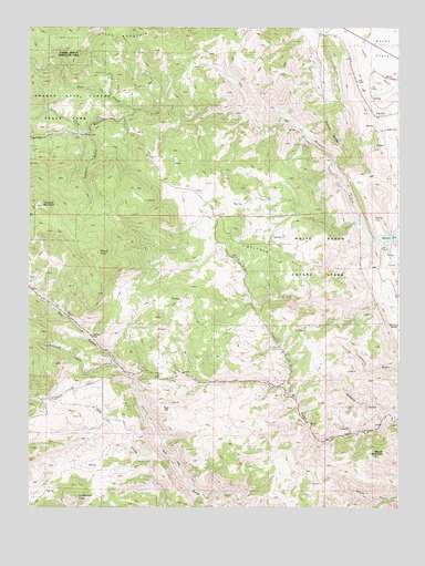
Ralston Buttes, CO USGS Topographic Map
Click on map above to begin viewing in our Map Viewer.

This topographic map contains these locations and features:
Feature Name Type Latitude Longitude GNIS ID View Map
Ascension MineMineN39.7767°W105.2855°1693602View Map
Aubrey Ladwig MineMineN39.7911°W105.2655°1693608View Map
B Gilman Ranch Pegmatite MineMineN39.8444°W105.3730°1693610View Map
Bachman Ranch Pegmatite MineMineN39.7897°W105.3147°1693609View Map
Belcher HillSummitN39.8217°W105.3058°181601View Map
Centennial ConeSummitN39.7525°W105.3589°181597View Map
Centennial RanchLocaleN39.7950°W105.3539°181602View Map
Centralia MountainSummitN39.8283°W105.3703°181604View Map
Cervi Lease MineMineN39.7767°W105.2855°1693600View Map
ClayLocaleN39.8586°W105.2639°181606View Map
Coal Creek Canyon Fire Department Station 3BuildingN39.8732°W105.2776°2368737View Map
Coors QuarryMineN39.8192°W105.3592°1693595View Map
Crawford GulchValleyN39.7786°W105.2868°181600View Map
Cressmans Gulch MineMineN39.7905°W105.2669°1693596View Map
Deer CreekStreamN39.8533°W105.3397°181125View Map
Drew Hill Pegmatite Mine Number OneMineN39.8372°W105.3283°1693597View Map
Elledge Beryl Prospect MineMineN39.7839°W105.3194°1693611View Map
Fire ClayLocaleN39.8519°W105.2575°181607View Map
Fork Prospect MineMineN39.7775°W105.2644°1693598View Map
Fred Pierce Ranch MineMineN39.7786°W105.2989°1693612View Map
Golden DivisionCivilN39.7907°W105.2938°1935474View Map
Golden Gate Fire Protection District Station 1BuildingN39.7770°W105.3682°2368664View Map
Golden Gate Fire Protection District Station 2BuildingN39.8253°W105.3117°2368663View Map
Grannys HeadSummitN39.8261°W105.3297°2100382View Map
Grosso MineMineN39.7911°W105.2669°1693603View Map
Guy HillSummitN39.7772°W105.3286°181598View Map
Halfmile GulchValleyN39.7728°W105.2505°181599View Map
Hoffmeister Uranium Prospect MineMineN39.8472°W105.3033°1693613View Map
Johnson MineMineN39.8411°W105.3686°1693614View Map
Johnson Number Two MineMineN39.8355°W105.2528°1693615View Map
K L Green Ranch Pegmatite MineMineN39.7555°W105.3603°1693616View Map
Ladwig Number Two MineMineN39.8639°W105.2603°1693634View Map
Ladwig Ranch Pegmatite MineMineN39.7869°W105.2700°1693618View Map
Ladwig-Grosso Pegmatite MineMineN39.7950°W105.2614°1693617View Map
Little Abner Pegmatite MineMineN39.7622°W105.3597°1693619View Map
Mena MineMineN39.8539°W105.3019°1693605View Map
Mount GalbraithSummitN39.7647°W105.2553°196506View Map
Mount TomSummitN39.8164°W105.3514°181603View Map
Murphy MineMineN39.8333°W105.2503°1693646View Map
Nott CreekStreamN39.8472°W105.3575°181162View Map
Ohman MineMineN39.7775°W105.2855°1693606View Map
Ralston ButtesSummitN39.8500°W105.2672°181608View Map
Ramstetter Ranch MineMineN39.7905°W105.3228°1693620View Map
Robinson GulchValleyN39.7877°W105.3462°181547View Map
Robinson Gulch MineMineN39.7903°W105.3405°1693621View Map
S B Strang Ralston Creek Pegmatite MineMineN39.7586°W105.3730°1693622View Map
Sawmill GulchValleyN39.8473°W105.3549°181605View Map
Schwartzwalder HeliportAirportN39.8469°W105.2822°204419View Map
Shewartzwalder MineMineN39.8447°W105.2808°181609View Map
U P Shaft MineMineN39.7767°W105.2655°1693599View Map
Wilson Clay MineMineN39.8586°W105.2622°1693623View Map

Note: Coordinates in the location and feature list above are referenced to NAD83 datum.


Copyright (C) 2008-2024 Ryan Niemi / Sunset Dynamics ... All Rights Reserved