TopoQuest Logo
Do you find TopoQuest useful?
Help keep TopoQuest running and adding new maps/features by donating!
Bitcoin:  19c7KJd3qBynnjoSw5npx9KScwjBe4ifkT
Litecoin:  LXs6TkuXGGXo1vDsWCkWVdjQX94eUKd6ui
Home View Maps Find Maps Find Places Resources & Links


Squaw Pass, Colorado Topographic Map

USGS Map Title: Squaw Pass, CO
USGS Map MRC: 39105F4
DRG (GeoTIFF) Download: o39105f4.tif


Neighboring USGS Topographic Map Quads:


  Central City, CO  
39105G5
 

  Black Hawk, CO  
39105G4
 

  Ralston Buttes, CO  
39105G3
 

  Idaho Springs, CO  
39105F5
 

  Squaw Pass, CO  
39105F4
 

  Evergreen, CO  
39105F3
 

  Harris Park, CO  
39105E5
 

  Meridian Hill, CO  
39105E4
 

  Conifer, CO  
39105E3


Map MRC Location:

N40°
W106°
N40°
W105°
H8 H7 H6 H5 H4 H3 H2 H1
G8 G7 G6 G5 G4 G3 G2 G1
F8 F7 F6 F5 F4 F3 F2 F1
E8 E7 E6 E5 E4 E3 E2 E1
D8 D7 D6 D5 D4 D3 D2 D1
C8 C7 C6 C5 C4 C3 C2 C1
B8 B7 B6 B5 B4 B3 B2 B1
A8 A7 A6 A5 A4 A3 A2 A1
N39°
W106°
N39°
W105°

Squaw Pass, CO USGS 1:24K Topographic Map Preview:
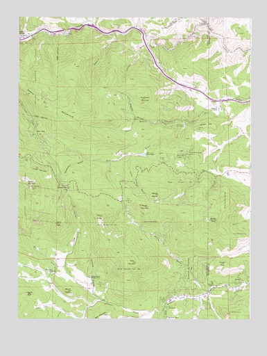
Squaw Pass, CO USGS Topographic Map
Click on map above to begin viewing in our Map Viewer.

This topographic map contains these locations and features:
Feature Name Type Latitude Longitude GNIS ID View Map
Arapaho Springs CampgroundLocaleN39.6917°W105.4956°197854View Map
Bald MountainSummitN39.6267°W105.4536°202863View Map
Barker Meadow DamDamN39.6333°W105.4672°198574View Map
Barker Meadow ReservoirReservoirN39.6333°W105.4672°198575View Map
Beaver Brook CanyonValleyN39.7107°W105.4027°182072View Map
Beaver Brook LodgeLocaleN39.6942°W105.4083°182056View Map
Beaver Brook Mica LodeMineN39.7061°W105.4089°1694323View Map
Beaver Brook MineMineN39.6889°W105.4192°1694322View Map
Beaver Brook Number 2 DamDamN39.7050°W105.4122°198526View Map
Beaver Brook Number 2 ReservoirReservoirN39.7052°W105.4110°198527View Map
Beaver Brook Number 3A DamDamN39.6933°W105.4322°198528View Map
Beaver Brook Number 3A ReservoirReservoirN39.6932°W105.4328°198529View Map
Beaver Brook RanchLocaleN39.7164°W105.3817°182074View Map
Bendemeer ValleyValleyN39.6342°W105.4024°182048View Map
Bergen PeakSummitN39.6661°W105.3953°182053View Map
Blue ValleyPopulated PlaceN39.6997°W105.4892°182064View Map
Brandt MineMineN39.7150°W105.3972°1694324View Map
BrookvalePopulated PlaceN39.6297°W105.4192°182045View Map
Brookvale RanchLocaleN39.6261°W105.4175°182046View Map
Captains RockPillarN39.6353°W105.4950°182038View Map
Clear Creek Fire Authority Fire Station 6 Floyd HillBuildingN39.7203°W105.4018°2667102View Map
Colorado State Patrol Idaho Springs PostBuildingN39.7423°W105.4965°2369928View Map
Corral CreekStreamN39.6275°W105.4278°182047View Map
Deadman GulchValleyN39.6910°W105.4637°182065View Map
Dodge Ranch HeadquartersLocaleN39.6422°W105.4614°182041View Map
Dry CreekStreamN39.6417°W105.4864°181948View Map
Edwards QuarryMineN39.6586°W105.3958°1763867View Map
Elmgreen RanchLocaleN39.7128°W105.3928°182073View Map
Evans Ranch HeadquartersLocaleN39.6444°W105.4806°182040View Map
Evergreen Fire / Rescue Station 5BuildingN39.6347°W105.4163°2368773View Map
Evergreen Fire / Rescue Station 7BuildingN39.7129°W105.3919°2368775View Map
Floyd Hill Census Designated PlaceCensusN39.7241°W105.4306°2583236View Map
Frosberg ParkParkN39.6914°W105.4225°182075View Map
Greystone HeliportAirportN39.6405°W105.3964°204393View Map
Greystone LodgeLocaleN39.6403°W105.3956°182050View Map
Grover MineMineN39.7080°W105.4403°1694325View Map
Haystack CanyonValleyN39.6348°W105.4597°182042View Map
Hicks MountainSummitN39.6486°W105.4392°182044View Map
Hicks Number 5 DitchCanalN39.6279°W105.4319°2722795View Map
Hiwan Number 4 DamDamN39.6850°W105.3872°198792View Map
Hiwan Number 4 ReservoirReservoirN39.6852°W105.3873°198793View Map
Horse CreekStreamN39.7497°W105.3992°181549View Map
Idaho Springs Police DepartmentBuildingN39.7425°W105.4952°2369860View Map
Idaho Springs Work CenterLocaleN39.7417°W105.4928°197855View Map
J Ira ValleyValleyN39.6348°W105.3973°182032View Map
Jacobson Ranch MineMineN39.7150°W105.4030°1694326View Map
Johnson GulchValleyN39.7412°W105.4286°182071View Map
KBDI-TV (Broomfield)TowerN39.6819°W105.4975°204915View Map
Koser SpringSpringN39.7103°W105.3933°197856View Map
Krinder PeakSummitN39.6480°W105.3908°182052View Map
KYGO-FM (Denver)TowerN39.6764°W105.4864°204897View Map
Lewis GulchValleyN39.6928°W105.4389°182059View Map
Lone Star Placer MineMineN39.7392°W105.4267°1694327View Map
Lucky Strike MineMineN39.7183°W105.4203°1694328View Map
Metz CreekStreamN39.6411°W105.4850°181947View Map
Mount Evans Elk Management AreaParkN39.6469°W105.4075°182051View Map
Mount JudgeSummitN39.6675°W105.4564°182062View Map
Mount Judge MineMineN39.6697°W105.4553°1735880View Map
Mount PenceSummitN39.6764°W105.4261°182060View Map
Mount SusanSummitN39.6367°W105.4731°182039View Map
Nabob MineMineN39.6889°W105.4192°1694321View Map
North Beaver BrookStreamN39.7069°W105.4119°182063View Map
North Clear CreekStreamN39.7464°W105.3980°181349View Map
Old Soda Creek School Pegmatite MineMineN39.7067°W105.4933°1694334View Map
Pat CreekStreamN39.7075°W105.4364°182069View Map
Pedee CreekStreamN39.6322°W105.4553°181950View Map
Ptarmigan HeliportAirportN39.6872°W105.3967°204392View Map
Quickie Iron MineMineN39.7061°W105.4206°1694329View Map
RosedalePopulated PlaceN39.6400°W105.3830°182049View Map
Saddleback MountainSummitN39.7161°W105.4317°182070View Map
Santa Fe MountainSummitN39.7103°W105.4717°202862View Map
Santa Fe Mountain MineMineN39.7197°W105.4636°1694330View Map
Sawmill GulchValleyN39.7437°W105.4489°182068View Map
Shaffer HillSummitN39.7044°W105.4033°182055View Map
Shaffer Hill MineMineN39.7105°W105.4005°1694331View Map
Silver Spruce MillLocaleN39.7397°W105.4983°182067View Map
Snyder Beryl Claim MineMineN39.7150°W105.4322°1694332View Map
Snyder GulchValleyN39.6967°W105.3905°182058View Map
Snyder MountainSummitN39.6714°W105.4319°182061View Map
Squaw MountainSummitN39.6794°W105.4928°182066View Map
Squaw Mountain LodgeLocaleN39.6900°W105.4119°182057View Map
Squaw PassGapN39.6792°W105.4736°204711View Map
Squaw Pass Picnic GroundLocaleN39.6789°W105.4739°197859View Map
Steel CreekStreamN39.6283°W105.4758°182030View Map
Tall Timber Number One MineMineN39.6467°W105.3825°1694335View Map
Tall Timber Number Two MineMineN39.6353°W105.4964°1694336View Map
Texaco MineMineN39.7214°W105.4089°1694333View Map
Upper Bear Creek Census Designated PlaceCensusN39.6319°W105.4154°2583309View Map
Vance CreekStreamN39.6278°W105.4272°181949View Map
Vance PeakSummitN39.6644°W105.4792°182043View Map
Witter GulchValleyN39.6365°W105.3979°182054View Map
Yankee CreekStreamN39.6289°W105.4219°182031View Map

Note: Coordinates in the location and feature list above are referenced to NAD83 datum.


Copyright (C) 2008-2024 Ryan Niemi / Sunset Dynamics ... All Rights Reserved