TopoQuest Logo
Do you find TopoQuest useful?
Help keep TopoQuest running and adding new maps/features by donating!
Bitcoin:  19c7KJd3qBynnjoSw5npx9KScwjBe4ifkT
Litecoin:  LXs6TkuXGGXo1vDsWCkWVdjQX94eUKd6ui
Home View Maps Find Maps Find Places Resources & Links


Ramsay, Montana Topographic Map

USGS Map Title: Ramsay, MT
USGS Map MRC: 46112A6
DRG (GeoTIFF) Download: o46112a6.tif


Neighboring USGS Topographic Map Quads:


  Warm Springs, MT  
46112B7
 

  Orofino Mountain, MT  
46112B6
 

  Lockhart Meadows, MT  
46112B5
 

  Opportunity, MT  
46112A7
 

  Ramsay, MT  
46112A6
 

  Butte North, MT  
46112A5
 

  Burnt Mountain, MT  
45112H7
 

  Buxton, MT  
45112H6
 

  Butte South, MT  
45112H5


Map MRC Location:

N47°
W113°
N47°
W112°
H8 H7 H6 H5 H4 H3 H2 H1
G8 G7 G6 G5 G4 G3 G2 G1
F8 F7 F6 F5 F4 F3 F2 F1
E8 E7 E6 E5 E4 E3 E2 E1
D8 D7 D6 D5 D4 D3 D2 D1
C8 C7 C6 C5 C4 C3 C2 C1
B8 B7 B6 B5 B4 B3 B2 B1
A8 A7 A6 A5 A4 A3 A2 A1
N46°
W113°
N46°
W112°

Ramsay, MT USGS 1:24K Topographic Map Preview:
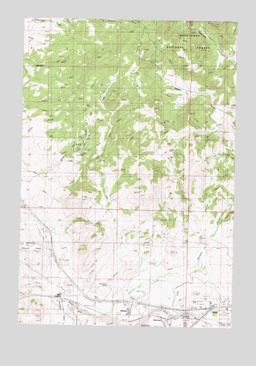
Ramsay, MT USGS Topographic Map
Click on map above to begin viewing in our Map Viewer.

This topographic map contains these locations and features:
Feature Name Type Latitude Longitude GNIS ID View Map
03N10W02CDAB01 WellWellN46.0385°W112.6467°813827View Map
04N09W04DD__01 WellWellN46.1233°W112.7178°814089View Map
04N09W05CD__01 WellWellN46.1233°W112.7489°814090View Map
Browns GulchValleyN46.0127°W112.6881°780459View Map
Butte and Zenith MineMineN46.0102°W112.6489°780690View Map
Butte-Silver Bow Northwest DivisionCivilN46.0342°W112.7184°1940709View Map
Chinamans SpringSpringN46.0169°W112.6995°781238View Map
Dawson (historical)LocaleN46.0077°W112.7100°799859View Map
Interchange 121CrossingN46.0080°W112.6370°1797984View Map
Interchange 216CrossingN46.0096°W112.6842°1797983View Map
KXTL-AM (Butte)TowerN46.0102°W112.6325°806624View Map
McCleery GulchValleyN46.0094°W112.7278°787005View Map
McMinnville (historical)LocaleN46.0005°W112.6264°1797842View Map
Miles (historical)LocaleN46.0124°W112.7261°1797839View Map
Miles CrossingPopulated PlaceN46.0124°W112.7261°787343View Map
NE SW Section 22 MineMineN46.0810°W112.7092°805245View Map
NisslerPopulated PlaceN46.0046°W112.6423°788024View Map
Nissler (historical)LocaleN46.0046°W112.6423°1797831View Map
Oro Fino GulchValleyN46.0335°W112.6250°788492View Map
RamsayPopulated PlaceN46.0058°W112.6861°789368View Map
RamsayLocaleN46.0021°W112.6814°1797823View Map
Ramsay Post OfficePost OfficeN46.0074°W112.6867°1797822View Map
Ramsay SchoolSchoolN46.0050°W112.6872°1797898View Map
Ross (historical)LocaleN46.0096°W112.7175°1797815View Map
Sand CreekStreamN46.0038°W112.6611°789997View Map
Sheep GulchValleyN46.0616°W112.7359°790346View Map
Silver BowPopulated PlaceN46.0035°W112.6678°790495View Map
Silver Bow Creek BridgeBridgeN46.0038°W112.6436°1797991View Map
Telegraph GulchValleyN46.1110°W112.6328°791944View Map
Tuxedo MineMineN46.0708°W112.7148°805180View Map

Note: Coordinates in the location and feature list above are referenced to NAD83 datum.


Copyright (C) 2008-2025 Ryan Niemi / Sunset Dynamics ... All Rights Reserved