TopoQuest Logo
Do you find TopoQuest useful?
Help keep TopoQuest running and adding new maps/features by donating!
Bitcoin:  19c7KJd3qBynnjoSw5npx9KScwjBe4ifkT
Litecoin:  LXs6TkuXGGXo1vDsWCkWVdjQX94eUKd6ui
Home View Maps Find Maps Find Places Resources & Links


Ravena, New York Topographic Map

USGS Map Title: Ravena, NY
USGS Map MRC: 42073D7
DRG (GeoTIFF) Download: o42073d7.tif


Neighboring USGS Topographic Map Quads:


  Clarksville, NY  
42073E8
 

  Delmar, NY  
42073E7
 

  East Greenbush, NY  
42073E6
 

  Alcove, NY  
42073D8
 

  Ravena, NY  
42073D7
 

  Kinderhook, NY  
42073D6
 

  Leeds, NY  
42073C8
 

  Hudson North, NY  
42073C7
 

  Stottville, NY  
42073C6


Map MRC Location:

N43°
W74°
N43°
W73°
H8 H7 H6 H5 H4 H3 H2 H1
G8 G7 G6 G5 G4 G3 G2 G1
F8 F7 F6 F5 F4 F3 F2 F1
E8 E7 E6 E5 E4 E3 E2 E1
D8 D7 D6 D5 D4 D3 D2 D1
C8 C7 C6 C5 C4 C3 C2 C1
B8 B7 B6 B5 B4 B3 B2 B1
A8 A7 A6 A5 A4 A3 A2 A1
N42°
W74°
N42°
W73°

Ravena, NY USGS 1:24K Topographic Map Preview:
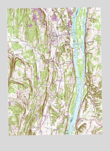
Ravena, NY USGS Topographic Map
Click on map above to begin viewing in our Map Viewer.

This topographic map contains these locations and features:
Feature Name Type Latitude Longitude GNIS ID View Map
AlbrightsPopulated PlaceN42.4264°W73.8161°2465992View Map
AquetuckPopulated PlaceN42.4606°W73.8385°942525View Map
Aquetuck Limestone QuarryMineN42.4906°W73.8333°2633292View Map
Aquetuck School (historical)SchoolN42.4665°W73.8635°942526View Map
Barren IslandIslandN42.4667°W73.7862°943077View Map
Bronck IslandIslandN42.4042°W73.7885°974190View Map
Chestnut Lawn CemeteryCemeteryN42.4484°W73.8160°946553View Map
CoeymansPopulated PlaceN42.4740°W73.7923°947000View Map
Coeymans BarBarN42.4334°W73.7829°973339View Map
Coeymans Census Designated PlaceCensusN42.4749°W73.7956°2389341View Map
Coeymans CreekStreamN42.4762°W73.7898°974198View Map
Coeymans Fire Company 1BuildingN42.4739°W73.7991°2718222View Map
Coxsackie CreekStreamN42.3931°W73.7946°947609View Map
Coxsackie LighthouseLocaleN42.3798°W73.7948°947611View Map
Coxsackie Toll PlazaLocaleN42.3941°W73.8275°2615140View Map
Deans MillPopulated PlaceN42.4501°W73.8310°972371View Map
Diedrich Mobile Home ParkPopulated PlaceN42.3778°W73.8345°2618216View Map
Firwood CemeteryCemeteryN42.3898°W73.7796°950119View Map
Grove CemeteryCemeteryN42.4676°W73.7945°951859View Map
Hannacrois CreekStreamN42.4629°W73.7851°952169View Map
HannacroixPopulated PlaceN42.4290°W73.8093°972591View Map
Hell GateStreamN42.4779°W73.7726°952539View Map
High RocksCliffN42.4031°W73.8285°952760View Map
Houghtaling IslandIslandN42.4448°W73.7782°953281View Map
Interchange 21BCrossingN42.3934°W73.8248°973840View Map
Lish Homestead CemeteryCemeteryN42.4155°W73.8352°955431View Map
Little Shodack IslandIslandN42.4840°W73.7718°973839View Map
Lower Schodack IslandIslandN42.4829°W73.7793°956108View Map
Matthew PointCapeN42.4309°W73.7837°956673View Map
Meadow FallsFallsN42.4326°W73.8360°956877View Map
Mill CreekStreamN42.4126°W73.7768°957224View Map
Mull Dike Post LightBuildingN42.4333°W73.7833°2678394View Map
Mull IslandIslandN42.4706°W73.7815°958138View Map
Mull Plaat (historical)PlainN42.4892°W73.7818°973834View Map
New BaltimorePopulated PlaceN42.4462°W73.7885°958390View Map
New Baltimore Fire District Cornell Hook and Ladder CompanyBuildingN42.4451°W73.7955°2718316View Map
New Baltimore Fire District Cornell Hook and Ladder CompanyBuildingN42.4198°W73.8290°2718532View Map
New Baltimore Post OfficePost OfficeN42.4464°W73.7900°2618035View Map
New Baltimore Rest AreaLocaleN42.4280°W73.8056°2615118View Map
New Baltimore Town HallBuildingN42.4236°W73.8298°2617650View Map
New Baltimore Town Sewer Treatment PlantLocaleN42.4564°W73.7875°2617740View Map
Otter HookPopulated PlaceN42.4042°W73.7990°972900View Map
Pieter B Coeymans SchoolSchoolN42.4750°W73.8003°2435640View Map
PoolsburgPopulated PlaceN42.4367°W73.7712°960917View Map
Rattlesnake IslandIslandN42.3756°W73.7965°962220View Map
RavenaPopulated PlaceN42.4684°W73.8162°962229View Map
Ravena Fire Department Hose CompanyBuildingN42.4717°W73.8105°2718655View Map
Ravena Middle SchoolSchoolN42.4962°W73.8221°2667565View Map
Ravena Rescue SquadBuildingN42.4707°W73.8105°2718519View Map
Ravena Senior High SchoolSchoolN42.4972°W73.8222°2435639View Map
Requea CemeteryCemeteryN42.4595°W73.7893°962393View Map
Riverside CemeteryCemeteryN42.3759°W73.8032°970529View Map
Roah HookPopulated PlaceN42.4840°W73.7893°973835View Map
Roberts HillPopulated PlaceN42.3954°W73.8368°973011View Map
Rocky Store School (historical)SchoolN42.4237°W73.8298°962795View Map
Saint John's Lutheran ChurchChurchN42.3901°W73.7723°2616939View Map
Saint Patrick CemeteryCemeteryN42.4681°W73.7932°964043View Map
Schodack CreekStreamN42.4231°W73.7773°964592View Map
Schodack LandingPopulated PlaceN42.4795°W73.7696°964593View Map
Schodack Landing Post OfficePost OfficeN42.4807°W73.7698°2618110View Map
Schodack Landing Reformed ChurchChurchN42.4803°W73.7697°2513552View Map
Schodack Landing Volunteer Fire CompanyBuildingN42.4807°W73.7678°2735186View Map
School Number 1 (historical)SchoolN42.3911°W73.8356°2465994View Map
School Number 11 (historical)SchoolN42.4972°W73.8708°2465987View Map
School Number 11 (historical)SchoolN42.3997°W73.8000°2465993View Map
School Number 4 (historical)SchoolN42.4953°W73.8250°2465988View Map
School Number 6 (historical)SchoolN42.4683°W73.7706°2465989View Map
School Number 7 (historical)SchoolN42.4269°W73.8639°2465995View Map
School Number 8 (historical)SchoolN42.4700°W73.8308°2465990View Map
School Number 9 (historical)SchoolN42.4394°W73.8114°2465991View Map
Shady Harbor MarinaLocaleN42.4512°W73.7869°2617492View Map
Sickles CreekStreamN42.3923°W73.8012°965209View Map
Stanton Hill CemeteryCemeteryN42.4315°W73.8731°966231View Map
StuyvesantPopulated PlaceN42.3904°W73.7815°966671View Map
Stuyvesant BrookStreamN42.3890°W73.7568°966672View Map
Stuyvesant Fire Company 1BuildingN42.3890°W73.7695°2718546View Map
Town of New BaltimoreCivilN42.4190°W73.8588°979255View Map
Town of StuyvesantCivilN42.4043°W73.7524°979534View Map
Van Zandt CemeteryCemeteryN42.4436°W73.7869°2547557View Map
Village of RavenaCivilN42.4756°W73.8113°2391087View Map
Waldron CemeteryCemeteryN42.4989°W73.8244°968667View Map
Wayne Delp AirportAirportN42.3973°W73.8704°2443566View Map

Note: Coordinates in the location and feature list above are referenced to NAD83 datum.


Copyright (C) 2008-2024 Ryan Niemi / Sunset Dynamics ... All Rights Reserved