TopoQuest Logo
Do you find TopoQuest useful?
Help keep TopoQuest running and adding new maps/features by donating!
Bitcoin:  19c7KJd3qBynnjoSw5npx9KScwjBe4ifkT
Litecoin:  LXs6TkuXGGXo1vDsWCkWVdjQX94eUKd6ui
Home View Maps Find Maps Find Places Resources & Links


Reading, Minnesota Topographic Map

USGS Map Title: Reading, MN
USGS Map MRC: 43095F6
DRG (GeoTIFF) Download: o43095f6.tif


Neighboring USGS Topographic Map Quads:


  Wilmont, MN  
43095G7
 

  Fulda SW, MN  
43095G6
 

  Fulda, MN  
43095G5
 

  Adrian NE, MN  
43095F7
 

  Reading, MN  
43095F6
 

  Worthington North, MN  
43095F5
 

  Rushmore, MN  
43095E7
 

  Bigelow, MN  
43095E6
 

  Worthington South, MN  
43095E5


Map MRC Location:

N44°
W96°
N44°
W95°
H8 H7 H6 H5 H4 H3 H2 H1
G8 G7 G6 G5 G4 G3 G2 G1
F8 F7 F6 F5 F4 F3 F2 F1
E8 E7 E6 E5 E4 E3 E2 E1
D8 D7 D6 D5 D4 D3 D2 D1
C8 C7 C6 C5 C4 C3 C2 C1
B8 B7 B6 B5 B4 B3 B2 B1
A8 A7 A6 A5 A4 A3 A2 A1
N43°
W96°
N43°
W95°

Reading, MN USGS 1:24K Topographic Map Preview:
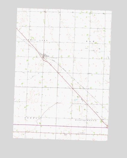
Reading, MN USGS Topographic Map
Click on map above to begin viewing in our Map Viewer.

This topographic map contains these locations and features:
Feature Name Type Latitude Longitude GNIS ID View Map
Bethel Presbyterian ChurchChurchN43.7052°W95.7097°2048981View Map
Brethren ChurchChurchN43.6891°W95.6536°640464View Map
Church of the Brethren CemeteryCemeteryN43.6888°W95.6539°2049021View Map
County Ditch Number FiveCanalN43.6886°W95.7472°642159View Map
Garden of MemoriesCemeteryN43.6319°W95.6628°644023View Map
Herlein-Boote State Wildlife Management AreaParkN43.6583°W95.6947°2048852View Map
KWOA-AM (Worthington)TowerN43.6300°W95.6758°662998View Map
KWOA-FM (Worthington)TowerN43.6300°W95.6758°663142View Map
Prairie View Golf LinksLocaleN43.6472°W95.6331°2048878View Map
ReadingPopulated PlaceN43.7036°W95.7131°649856View Map
Reading (historical)LocaleN43.7069°W95.7128°2048979View Map
Reading Post Office (historical)Post OfficeN43.7036°W95.7131°2048980View Map
Summit Lake CemeteryCemeteryN43.7030°W95.7020°652796View Map
Township of ElkCivilN43.7180°W95.6332°664067View Map
Township of WorthingtonCivilN43.6324°W95.6421°666053View Map
Worthington Junior High SchoolSchoolN43.6302°W95.6295°2048917View Map

Note: Coordinates in the location and feature list above are referenced to NAD83 datum.


Copyright (C) 2008-2025 Ryan Niemi / Sunset Dynamics ... All Rights Reserved