TopoQuest Logo
Do you find TopoQuest useful?
Help keep TopoQuest running and adding new maps/features by donating!
Bitcoin:  19c7KJd3qBynnjoSw5npx9KScwjBe4ifkT
Litecoin:  LXs6TkuXGGXo1vDsWCkWVdjQX94eUKd6ui
Home View Maps Find Maps Find Places Resources & Links


Readsboro, Vermont Topographic Map

USGS Map Title: Readsboro, VT
USGS Map MRC: 42072G8
DRG (GeoTIFF) Download: o42072g8.tif


Neighboring USGS Topographic Map Quads:


  Woodford, VT  
42073H1
 

  Mount Snow, VT  
42072H8
 

  West Dover, VT  
42072H7
 

  Stamford, VT  
42073G1
 

  Readsboro, VT  
42072G8
 

  Jacksonville, VT  
42072G7


  Rowe, MA  
42072F8


Map MRC Location:

N43°
W73°
N43°
W72°
H8 H7 H6 H5 H4 H3 H2 H1
G8 G7 G6 G5 G4 G3 G2 G1
F8 F7 F6 F5 F4 F3 F2 F1
E8 E7 E6 E5 E4 E3 E2 E1
D8 D7 D6 D5 D4 D3 D2 D1
C8 C7 C6 C5 C4 C3 C2 C1
B8 B7 B6 B5 B4 B3 B2 B1
A8 A7 A6 A5 A4 A3 A2 A1
N42°
W73°
N42°
W72°

Readsboro, VT USGS 1:24K Topographic Map Preview:
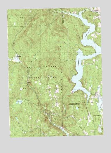
Readsboro, VT USGS Topographic Map
Click on map above to begin viewing in our Map Viewer.

This topographic map contains these locations and features:
Feature Name Type Latitude Longitude GNIS ID View Map
Atherton MeadowLakeN42.7770°W72.9092°1460534View Map
Atherton Meadow State Wildlife Management AreaParkN42.7751°W72.8993°1461654View Map
Beaver BrookStreamN42.7573°W72.9840°1460580View Map
Beaver MeadowLakeN42.7678°W72.9896°1460583View Map
Binney BrookStreamN42.8720°W72.8865°1460615View Map
Boyd BrookStreamN42.8434°W72.9020°1460639View Map
Carley CemeteryCemeteryN42.7534°W72.9011°1460702View Map
Castle HillSummitN42.8667°W72.8909°1460709View Map
Clara LakeLakeN42.7960°W72.8791°1460730View Map
Fairington CemeteryCemeteryN42.8602°W72.9746°1460858View Map
Gillett CemeteryCemeteryN42.7732°W72.8781°1460902View Map
Graves BrookStreamN42.8234°W72.9104°1460929View Map
Harriman DamDamN42.7929°W72.9151°1460965View Map
Harriman Power PlantLocaleN42.7576°W72.9279°1461794View Map
Harriman ReservoirReservoirN42.8334°W72.8793°1460966View Map
HeartwellvillePopulated PlaceN42.8298°W72.9876°1460980View Map
Heartwellville CemeteryCemeteryN42.8282°W72.9860°1920279View Map
Heather BrookStreamN42.8715°W72.9295°1460981View Map
Hoosac RangeRangeN42.8167°W72.9995°1461001View Map
Howe PondLakeN42.7846°W72.9860°1461011View Map
Howe Pond BrookStreamN42.7815°W72.9607°1461012View Map
Jarvis HillSummitN42.7667°W72.9412°1461019View Map
Jewell - Wheeler Hill CemeteryCemeteryN42.8253°W72.9254°1921038View Map
Lake ClaraReservoirN42.7958°W72.8808°1766318View Map
Lake Clara DamDamN42.7951°W72.8812°1766317View Map
Lake Sadawga DamDamN42.7888°W72.8807°1766319View Map
Lamb BrookStreamN42.8142°W72.9743°1461056View Map
Medbury BrookStreamN42.8712°W72.9323°1461137View Map
MedburyvillePopulated PlaceN42.8704°W72.9204°1461138View Map
Medburyville BridgeBridgeN42.8706°W72.9195°1921067View Map
North Branch Deerfield RiverStreamN42.8673°W72.9012°1461216View Map
North DamDamN42.7584°W72.8795°1766518View Map
North HillSummitN42.7959°W72.9473°1461226View Map
North Hill - Amidon CemeteryCemeteryN42.7883°W72.9437°1920352View Map
North Hill CemeteryCemeteryN42.7879°W72.9434°1461227View Map
Number Nine BrookStreamN42.7898°W72.8948°1461211View Map
Pine LakeReservoirN42.7549°W72.8789°1461655View Map
ReadsboroPopulated PlaceN42.7717°W72.9473°1461314View Map
Readsboro Census Designated PlaceCensusN42.7684°W72.9490°2584793View Map
Readsboro Central SchoolSchoolN42.7718°W72.9404°1920392View Map
Readsboro Community LibraryBuildingN42.7737°W72.9515°1920391View Map
Readsboro FallsPopulated PlaceN42.8034°W72.9748°1461315View Map
Readsboro Fire DepartmentBuildingN42.7710°W72.9478°2121244View Map
Readsboro Municipal ForestForestN42.7779°W72.9568°1920394View Map
Readsboro Municipal ForestForestN42.7798°W72.9884°1920395View Map
Readsboro Post OfficePost OfficeN42.7741°W72.9520°1920390View Map
Readsboro Town HallBuildingN42.7720°W72.9420°1920396View Map
Readsboro Village CemeteryCemeteryN42.7753°W72.9436°1920397View Map
Sadawga CemeteryCemeteryN42.7884°W72.8754°1921146View Map
Sadawga LakeReservoirN42.7809°W72.8780°1461365View Map
South Hill CemeteryCemeteryN42.7551°W72.9573°1920449View Map
Tobey BrookStreamN42.7690°W72.9307°1461546View Map
Town of ReadsboroCivilN42.7988°W72.9718°1462184View Map
West Branch Deerfield RiverStreamN42.7698°W72.9473°1461587View Map
WhitinghamPopulated PlaceN42.7892°W72.8851°1461613View Map
Whitingham Ambulance Service Whitingham StationBuildingN42.7919°W72.8820°2578068View Map
Whitingham Post OfficePost OfficeN42.7890°W72.8843°1921270View Map
Whitingham Volunteer Fire DepartmentBuildingN42.7919°W72.8821°2121218View Map
Wilder BrookStreamN42.8320°W72.9073°1461615View Map
Windham Southwest Supervisory UnionSchoolN42.8742°W72.8893°2427559View Map

Note: Coordinates in the location and feature list above are referenced to NAD83 datum.


Copyright (C) 2008-2024 Ryan Niemi / Sunset Dynamics ... All Rights Reserved