TopoQuest Logo
Do you find TopoQuest useful?
Help keep TopoQuest running and adding new maps/features by donating!
Bitcoin:  19c7KJd3qBynnjoSw5npx9KScwjBe4ifkT
Litecoin:  LXs6TkuXGGXo1vDsWCkWVdjQX94eUKd6ui
Home View Maps Find Maps Find Places Resources & Links


West Dover, Vermont Topographic Map

USGS Map Title: West Dover, VT
USGS Map MRC: 42072H7
DRG (GeoTIFF) Download: o42072h7.tif


Neighboring USGS Topographic Map Quads:


  Stratton Mountain, VT  
43072A8
 

  Jamaica, VT  
43072A7


  Mount Snow, VT  
42072H8
 

  West Dover, VT  
42072H7


  Readsboro, VT  
42072G8
 

  Jacksonville, VT  
42072G7


Map MRC Location:

N43°
W73°
N43°
W72°
H8 H7 H6 H5 H4 H3 H2 H1
G8 G7 G6 G5 G4 G3 G2 G1
F8 F7 F6 F5 F4 F3 F2 F1
E8 E7 E6 E5 E4 E3 E2 E1
D8 D7 D6 D5 D4 D3 D2 D1
C8 C7 C6 C5 C4 C3 C2 C1
B8 B7 B6 B5 B4 B3 B2 B1
A8 A7 A6 A5 A4 A3 A2 A1
N42°
W73°
N42°
W72°

West Dover, VT USGS 1:24K Topographic Map Preview:
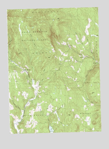
West Dover, VT USGS Topographic Map
Click on map above to begin viewing in our Map Viewer.

This topographic map contains these locations and features:
Feature Name Type Latitude Longitude GNIS ID View Map
Adams BrookStreamN42.9490°W72.7579°1460517View Map
Baldwin CemeteryCemeteryN42.9532°W72.8544°1460550View Map
Bemis BrookStreamN42.9565°W72.7620°1460598View Map
Bill BrookStreamN42.9084°W72.8470°1460609View Map
Blue BrookStreamN42.9473°W72.8698°1460626View Map
BrooksidePopulated PlaceN42.9451°W72.7532°1461755View Map
Cheney BrookStreamN42.9476°W72.8443°1460720View Map
Cold BrookStreamN42.8962°W72.8557°1460742View Map
Cooper HillSummitN42.9506°W72.8229°1460757View Map
Cutting CemeteryCemeteryN42.9135°W72.8364°1460769View Map
Deerfield Valley Elementary SchoolSchoolN42.8895°W72.8624°1920906View Map
Deerfield Valley Regional AirportAirportN42.9268°W72.8649°1461974View Map
DoverPopulated PlaceN42.9437°W72.8040°1460802View Map
Dover Center CemeteryCemeteryN42.9480°W72.8014°1460804View Map
Dover CommonParkN42.9445°W72.8023°1920910View Map
Dover Elementary SchoolSchoolN42.9388°W72.8099°1920911View Map
Dover Free LibraryBuildingN42.9487°W72.7715°1920912View Map
Dover Post OfficePost OfficeN42.9423°W72.8026°1920913View Map
Dover Town HallBuildingN42.9440°W72.8023°1920914View Map
Dover Town OfficesBuildingN42.9387°W72.8518°1920915View Map
East DoverPopulated PlaceN42.9512°W72.7690°1460825View Map
East Dover Baptist ChurchChurchN42.9492°W72.7715°1920925View Map
East Dover CemeteryCemeteryN42.9495°W72.7720°1920924View Map
East Dover Post OfficePost OfficeN42.9510°W72.7687°1920926View Map
East Dover Volunteer Fire DepartmentBuildingN42.9503°W72.7701°2121225View Map
Ellis BrookStreamN42.9179°W72.8390°1460844View Map
Elwin MeadowLakeN42.9717°W72.7558°1460847View Map
Goose CityPopulated PlaceN42.9612°W72.7915°1460912View Map
Hall BrookStreamN42.8920°W72.8237°1460949View Map
Hathaway CemeteryCemeteryN42.9649°W72.8581°1460972View Map
Higley HillSummitN42.8937°W72.7907°1460990View Map
Hunter BrookStreamN42.9437°W72.7532°1461013View Map
Johnson HillSummitN42.9554°W72.8601°1461030View Map
Lake RapondaLakeN42.8752°W72.8187°1461310View Map
Meadow BrookStreamN42.8967°W72.8145°1461134View Map
Mount Snow Golf CourseLocaleN42.9348°W72.8690°1921077View Map
Negus BrookStreamN42.9204°W72.8390°1461201View Map
New Riverview CemeteryCemeteryN42.8765°W72.8593°1921083View Map
Powers CemeteryCemeteryN42.9245°W72.7734°1921115View Map
Rice HillSummitN42.9784°W72.8287°1461325View Map
Riverview CemeteryCemeteryN42.8768°W72.8593°1461335View Map
Sitzmark Cross Country Ski CenterLocaleN42.9217°W72.8373°1921172View Map
Sitzmark Golf CourseLocaleN42.9209°W72.8401°1921173View Map
Stratton HillSummitN42.9134°W72.7634°1461478View Map
Taft BrookStreamN42.9498°W72.7701°1461504View Map
Timson Moore CemeteryCemeteryN42.9592°W72.7577°1921215View Map
Town of DoverCivilN42.9572°W72.8419°1462083View Map
Town of WilmingtonCivilN42.8763°W72.8623°1462264View Map
West DoverPopulated PlaceN42.9392°W72.8529°1461590View Map
West Dover Congregational ChurchChurchN42.9392°W72.8509°1921243View Map
West Dover Fire DepartmentBuildingN42.9485°W72.8728°2121221View Map
West Dover Historic DistrictParkN42.9390°W72.8518°1921244View Map
West Dover Police DepartmentBuildingN42.9488°W72.8715°2752792View Map
West Dover Post OfficePost OfficeN42.9461°W72.8664°1921245View Map
West Dover Village CemeteryCemeteryN42.9386°W72.8551°1921246View Map
Whites HillSummitN42.9881°W72.8059°1461612View Map

Note: Coordinates in the location and feature list above are referenced to NAD83 datum.


Copyright (C) 2008-2024 Ryan Niemi / Sunset Dynamics ... All Rights Reserved