TopoQuest Logo
Do you find TopoQuest useful?
Help keep TopoQuest running and adding new maps/features by donating!
Bitcoin:  19c7KJd3qBynnjoSw5npx9KScwjBe4ifkT
Litecoin:  LXs6TkuXGGXo1vDsWCkWVdjQX94eUKd6ui
Home View Maps Find Maps Find Places Resources & Links


Red Creek Reservoir, Utah Topographic Map

USGS Map Title: Red Creek Reservoir, UT
USGS Map MRC: 37112G6
DRG (GeoTIFF) Download: o37112g6.tif


Neighboring USGS Topographic Map Quads:


  Paragonah, UT  
37112H7
 

  Cottonwood Mountain, UT  
37112H6
 

  Little Creek Peak, UT  
37112H5
 

  Parowan, UT  
37112G7
 

  Red Creek Reservoir, UT  
37112G6
 

  Fivemile Ridge, UT  
37112G5
 

  Brian Head, UT  
37112F7
 

  Panguitch Lake, UT  
37112F6
 

  Haycock Mountain, UT  
37112F5


Map MRC Location:

N38°
W113°
N38°
W112°
H8 H7 H6 H5 H4 H3 H2 H1
G8 G7 G6 G5 G4 G3 G2 G1
F8 F7 F6 F5 F4 F3 F2 F1
E8 E7 E6 E5 E4 E3 E2 E1
D8 D7 D6 D5 D4 D3 D2 D1
C8 C7 C6 C5 C4 C3 C2 C1
B8 B7 B6 B5 B4 B3 B2 B1
A8 A7 A6 A5 A4 A3 A2 A1
N37°
W113°
N37°
W112°

Red Creek Reservoir, UT USGS 1:24K Topographic Map Preview:
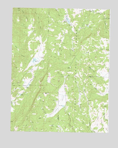
Red Creek Reservoir, UT USGS Topographic Map
Click on map above to begin viewing in our Map Viewer.

This topographic map contains these locations and features:
Feature Name Type Latitude Longitude GNIS ID View Map
Cove SpringSpringN37.7637°W112.7116°1440075View Map
Dry ForkStreamN37.7547°W112.6472°1440615View Map
Forks ValleyValleyN37.8066°W112.6855°1441172View Map
Foster DamDamN37.8203°W112.7258°1447655View Map
Foster ReservoirReservoirN37.8203°W112.7258°1447654View Map
Hoosier CreekStreamN37.8194°W112.7213°1441837View Map
Hoosier LakeLakeN37.7979°W112.7277°1441838View Map
Horse LakeLakeN37.7763°W112.6830°1441884View Map
Horse ValleyBasinN37.7808°W112.6858°1441900View Map
Horse Valley PeakSummitN37.7900°W112.7074°1441905View Map
Kings ValleyValleyN37.7664°W112.7013°1442333View Map
Left Fork Haycock CreekStreamN37.7650°W112.6491°1442500View Map
Little ValleysBasinN37.8250°W112.6258°1442804View Map
Mud SpringsSpringN37.7566°W112.6986°1443721View Map
Myers ValleyValleyN37.7883°W112.6285°1443753View Map
Red Creek DamDamN37.8666°W112.6808°1447657View Map
Red Creek ReservoirReservoirN37.8627°W112.6788°1447656View Map
Right Fork Haycock CreekStreamN37.7650°W112.6491°1444923View Map
Robinson ReservoirReservoirN37.7869°W112.7385°1445027View Map
Round MeadowFlatN37.8589°W112.6544°1445169View Map
Shakespeare HollowValleyN37.8108°W112.6427°1445464View Map
Spruce TrailTrailN37.7539°W112.7322°1446064View Map
Trail CreekStreamN37.8672°W112.6341°1446671View Map
Water System CanyonValleyN37.8744°W112.7447°1447067View Map
Willow SpringSpringN37.8149°W112.6754°1447432View Map

Note: Coordinates in the location and feature list above are referenced to NAD83 datum.


Copyright (C) 2008-2025 Ryan Niemi / Sunset Dynamics ... All Rights Reserved