TopoQuest Logo
Do you find TopoQuest useful?
Help keep TopoQuest running and adding new maps/features by donating!
Bitcoin:  19c7KJd3qBynnjoSw5npx9KScwjBe4ifkT
Litecoin:  LXs6TkuXGGXo1vDsWCkWVdjQX94eUKd6ui
Home View Maps Find Maps Find Places Resources & Links


Red Top Mountain, Washington Topographic Map

USGS Map Title: Red Top Mountain, WA
USGS Map MRC: 47120C7
DRG (GeoTIFF) Download: o47120c7.tif


Neighboring USGS Topographic Map Quads:


  Mount Stuart, WA  
47120D8
 

  Enchantment Lakes, WA  
47120D7
 

  Blewett, WA  
47120D6
 

  Teanaway Butte, WA  
47120C8
 

  Red Top Mountain, WA  
47120C7
 

  Liberty, WA  
47120C6
 

  Cle Elum, WA  
47120B8
 

  Teanaway, WA  
47120B7
 

  Swauk Prairie, WA  
47120B6


Map MRC Location:

N48°
W121°
N48°
W120°
H8 H7 H6 H5 H4 H3 H2 H1
G8 G7 G6 G5 G4 G3 G2 G1
F8 F7 F6 F5 F4 F3 F2 F1
E8 E7 E6 E5 E4 E3 E2 E1
D8 D7 D6 D5 D4 D3 D2 D1
C8 C7 C6 C5 C4 C3 C2 C1
B8 B7 B6 B5 B4 B3 B2 B1
A8 A7 A6 A5 A4 A3 A2 A1
N47°
W121°
N47°
W120°

Red Top Mountain, WA USGS 1:24K Topographic Map Preview:
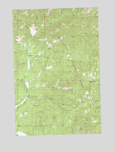
Red Top Mountain, WA USGS Topographic Map
Click on map above to begin viewing in our Map Viewer.

This topographic map contains these locations and features:
Feature Name Type Latitude Longitude GNIS ID View Map
Bear CreekStreamN47.3657°W120.8023°1516235View Map
Dickey CreekStreamN47.2876°W120.8590°1518766View Map
Dickey Creek CampgroundLocaleN47.2893°W120.8592°1528404View Map
Dickey Creek TrailTrailN47.2882°W120.7937°1518767View Map
Indian CreekStreamN47.2996°W120.8584°1521167View Map
Jack CreekStreamN47.3187°W120.8548°1521285View Map
Jungle CreekStreamN47.3326°W120.8559°1521524View Map
Middle CreekStreamN47.2951°W120.8565°1523053View Map
Miller CreekStreamN47.3690°W120.7837°1523179View Map
North Fork Bear CreekStreamN47.3662°W120.7570°1523736View Map
Red Top Agate BedsLocaleN47.3137°W120.7559°1530074View Map
Red Top MountainSummitN47.3012°W120.7604°1524958View Map
Red Top Mountain LookoutLocaleN47.3018°W120.7609°1530239View Map
Rye CreekStreamN47.3198°W120.8568°1525318View Map
RyepatchLocaleN47.3171°W120.8515°1530238View Map
Shirk CreekStreamN47.3035°W120.8606°1525690View Map
South Fork Bear CreekStreamN47.3657°W120.7573°1526154View Map
Stafford CreekStreamN47.3460°W120.8484°1526474View Map
Stafford Creek Recreation AreaLocaleN47.3565°W120.8348°1534130View Map
Stafford LookoutLocaleN47.3582°W120.8437°1526476View Map
Standup CreekStreamN47.3560°W120.8359°1526491View Map
Story CreekStreamN47.2551°W120.8742°1526605View Map
Teanaway RidgeRidgeN47.2968°W120.7595°1526964View Map
Twentynine Pines CampgroundLocaleN47.3276°W120.8537°1527508View Map

Note: Coordinates in the location and feature list above are referenced to NAD83 datum.


Copyright (C) 2008-2024 Ryan Niemi / Sunset Dynamics ... All Rights Reserved