TopoQuest Logo
Do you find TopoQuest useful?
Help keep TopoQuest running and adding new maps/features by donating!
Bitcoin:  19c7KJd3qBynnjoSw5npx9KScwjBe4ifkT
Litecoin:  LXs6TkuXGGXo1vDsWCkWVdjQX94eUKd6ui
Home View Maps Find Maps Find Places Resources & Links


Swauk Prairie, Washington Topographic Map

USGS Map Title: Swauk Prairie, WA
USGS Map MRC: 47120B6
DRG (GeoTIFF) Download: o47120b6.tif


Neighboring USGS Topographic Map Quads:


  Red Top Mountain, WA  
47120C7
 

  Liberty, WA  
47120C6
 

  Blewett Pass, WA  
47120C5
 

  Teanaway, WA  
47120B7
 

  Swauk Prairie, WA  
47120B6
 

  Reecer Canyon, WA  
47120B5
 

  Taneum Canyon, WA  
47120A7
 

  Thorp, WA  
47120A6
 

  Ellensburg North, WA  
47120A5


Map MRC Location:

N48°
W121°
N48°
W120°
H8 H7 H6 H5 H4 H3 H2 H1
G8 G7 G6 G5 G4 G3 G2 G1
F8 F7 F6 F5 F4 F3 F2 F1
E8 E7 E6 E5 E4 E3 E2 E1
D8 D7 D6 D5 D4 D3 D2 D1
C8 C7 C6 C5 C4 C3 C2 C1
B8 B7 B6 B5 B4 B3 B2 B1
A8 A7 A6 A5 A4 A3 A2 A1
N47°
W121°
N47°
W120°

Swauk Prairie, WA USGS 1:24K Topographic Map Preview:
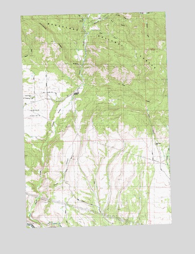
Swauk Prairie, WA USGS Topographic Map
Click on map above to begin viewing in our Map Viewer.

This topographic map contains these locations and features:
Feature Name Type Latitude Longitude GNIS ID View Map
Deer GulchValleyN47.2396°W120.6940°1518628View Map
First CreekStreamN47.2082°W120.7006°1519566View Map
Flying Rock Airpark (historical)AirportN47.1546°W120.6348°2443363View Map
Green CanyonValleyN47.1696°W120.6334°1520284View Map
Green Canyon RanchLocaleN47.1740°W120.6387°1520287View Map
Harness GulchValleyN47.2471°W120.6740°1520559View Map
Hidden ValleyValleyN47.1737°W120.7334°1520765View Map
Horse CanyonValleyN47.1460°W120.7367°1520924View Map
Lauderdale JunctionPopulated PlaceN47.2029°W120.7092°1527721View Map
Liberty Guard StationLocaleN47.2473°W120.6948°1522058View Map
Mill CreekStreamN47.2462°W120.6967°1523162View Map
Mill PondLakeN47.1987°W120.7106°1523174View Map
Old Placer MineMineN47.2368°W120.6942°1524010View Map
Pine GulchValleyN47.2476°W120.6776°1524446View Map
Robinson GulchValleyN47.2479°W120.6467°1525104View Map
Swauk PrairieFlatN47.1926°W120.7415°1526844View Map
Swauk Prairie CemeteryCemeteryN47.2020°W120.7420°1526845View Map
Williams CreekStreamN47.2432°W120.6970°1528171View Map

Note: Coordinates in the location and feature list above are referenced to NAD83 datum.


Copyright (C) 2008-2024 Ryan Niemi / Sunset Dynamics ... All Rights Reserved