TopoQuest Logo
Do you find TopoQuest useful?
Help keep TopoQuest running and adding new maps/features by donating!
Bitcoin:  19c7KJd3qBynnjoSw5npx9KScwjBe4ifkT
Litecoin:  LXs6TkuXGGXo1vDsWCkWVdjQX94eUKd6ui
Home View Maps Find Maps Find Places Resources & Links


Redford, Missouri Topographic Map

USGS Map Title: Redford, MO
USGS Map MRC: 37090C8
DRG (GeoTIFF) Download: o37090c8.tif


Neighboring USGS Topographic Map Quads:


  Corridon, MO  
37091D1
 

  Centerville, MO  
37090D8
 

  Lesterville, MO  
37090D7
 

  Corridon SE, MO  
37091C1
 

  Redford, MO  
37090C8
 

  Lesterville SE, MO  
37090C7
 

  Exchange, MO  
37091B1
 

  Ellington, MO  
37090B8
 

  Clearwater Dam, MO  
37090B7


Map MRC Location:

N38°
W91°
N38°
W90°
H8 H7 H6 H5 H4 H3 H2 H1
G8 G7 G6 G5 G4 G3 G2 G1
F8 F7 F6 F5 F4 F3 F2 F1
E8 E7 E6 E5 E4 E3 E2 E1
D8 D7 D6 D5 D4 D3 D2 D1
C8 C7 C6 C5 C4 C3 C2 C1
B8 B7 B6 B5 B4 B3 B2 B1
A8 A7 A6 A5 A4 A3 A2 A1
N37°
W91°
N37°
W90°

Redford, MO USGS 1:24K Topographic Map Preview:
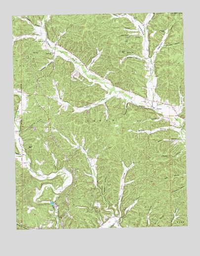
Redford, MO USGS Topographic Map
Click on map above to begin viewing in our Map Viewer.

This topographic map contains these locations and features:
Feature Name Type Latitude Longitude GNIS ID View Map
Alamode (historical)Populated PlaceN37.3131°W90.9962°740088View Map
Alamode Post Office (historical)Post OfficeN37.3131°W90.9962°1802779View Map
Amsden HollowValleyN37.3670°W90.9801°748583View Map
Ball HollowValleyN37.2512°W90.9382°739928View Map
Boiler HollowValleyN37.2689°W90.9351°714488View Map
Bowles HollowValleyN37.3475°W90.9029°714580View Map
Bowles PondLakeN37.3525°W90.9201°714581View Map
Brawley HollowValleyN37.3514°W90.9685°714656View Map
Bryson HollowValleyN37.3059°W90.8793°714941View Map
Buzzard HollowValleyN37.2931°W90.9935°715152View Map
Camelite ChurchChurchN37.3073°W90.9962°715232View Map
Camelite HollowValleyN37.3073°W90.9957°715233View Map
Cox HollowValleyN37.3156°W90.8798°716432View Map
Durham CemeteryCemeteryN37.3484°W90.9032°717206View Map
Ed HollowValleyN37.2842°W90.9690°717395View Map
Farrie (historical)LocaleN37.3637°W90.9790°740539View Map
Harrison ValleyValleyN37.3231°W90.8982°750244View Map
Harrison Valley School (historical)SchoolN37.3489°W90.8996°748093View Map
Hill PondReservoirN37.3528°W90.9854°719605View Map
Lily PondLakeN37.3587°W90.9176°721061View Map
Lincoln HollowValleyN37.3648°W90.9082°721081View Map
LyonsLocaleN37.3734°W90.9957°740092View Map
Maury PondLakeN37.2981°W90.9904°721990View Map
Morton HollowValleyN37.3009°W90.8773°722667View Map
Old Redford CemeteryCemeteryN37.3239°W90.9035°723777View Map
Pleasant Hill ChurchChurchN37.3531°W90.9718°724527View Map
Pogue HollowValleyN37.3428°W90.9443°724688View Map
Price CemeteryCemeteryN37.3342°W90.9260°724922View Map
Pyles CemeteryCemeteryN37.3281°W90.9912°725015View Map
Pyrtle SpringSpringN37.3600°W90.9757°725019View Map
Radford HollowValleyN37.3245°W90.9160°725055View Map
Ratliff CemeteryCemeteryN37.2609°W90.9729°725110View Map
Rayfield HollowValleyN37.3742°W90.9160°751816View Map
RedfordPopulated PlaceN37.3200°W90.8985°725175View Map
ReedsLocaleN37.2514°W90.9665°740094View Map
Reynolds CountyCivilN37.3623°W90.9691°758544View Map
Road HollowValleyN37.2537°W90.9251°725369View Map
Robinson HollowValleyN37.3478°W90.8982°751915View Map
Robinson PondLakeN37.3642°W90.8885°725420View Map
Rock HollowValleyN37.3142°W90.8904°725459View Map
Round HillSummitN37.3523°W90.9168°725600View Map
Saint Ann ChurchChurchN37.2562°W90.9662°725722View Map
Skyline SchoolSchoolN37.2867°W90.9607°748092View Map
Snow HollowValleyN37.2559°W90.9246°726672View Map
Spring ValleyValleyN37.2559°W90.9287°726948View Map
Upper Dry Valley School (historical)SchoolN37.3200°W90.9979°748091View Map
Vinson BranchStreamN37.3298°W90.9240°731663View Map
Vinson HollowValleyN37.3612°W90.9046°728210View Map
Vinson PondLakeN37.3623°W90.9151°728211View Map
White Oak HollowValleyN37.3553°W90.8898°728754View Map

Note: Coordinates in the location and feature list above are referenced to NAD83 datum.


Copyright (C) 2008-2025 Ryan Niemi / Sunset Dynamics ... All Rights Reserved