TopoQuest Logo
Do you find TopoQuest useful?
Help keep TopoQuest running and adding new maps/features by donating!
Bitcoin:  19c7KJd3qBynnjoSw5npx9KScwjBe4ifkT
Litecoin:  LXs6TkuXGGXo1vDsWCkWVdjQX94eUKd6ui
Home View Maps Find Maps Find Places Resources & Links


Corridon, Missouri Topographic Map

USGS Map Title: Corridon, MO
USGS Map MRC: 37091D1
DRG (GeoTIFF) Download: o37091d1.tif


Neighboring USGS Topographic Map Quads:


  Greeley, MO  
37091E2
 

  Oates, MO  
37091E1
 

  Edgehill, MO  
37090E8
 

  Bunker, MO  
37091D2
 

  Corridon, MO  
37091D1
 

  Centerville, MO  
37090D8
 

  Midridge, MO  
37091C2
 

  Corridon SE, MO  
37091C1
 

  Redford, MO  
37090C8


Map MRC Location:

N38°
W92°
N38°
W91°
H8 H7 H6 H5 H4 H3 H2 H1
G8 G7 G6 G5 G4 G3 G2 G1
F8 F7 F6 F5 F4 F3 F2 F1
E8 E7 E6 E5 E4 E3 E2 E1
D8 D7 D6 D5 D4 D3 D2 D1
C8 C7 C6 C5 C4 C3 C2 C1
B8 B7 B6 B5 B4 B3 B2 B1
A8 A7 A6 A5 A4 A3 A2 A1
N37°
W92°
N37°
W91°

Corridon, MO USGS 1:24K Topographic Map Preview:
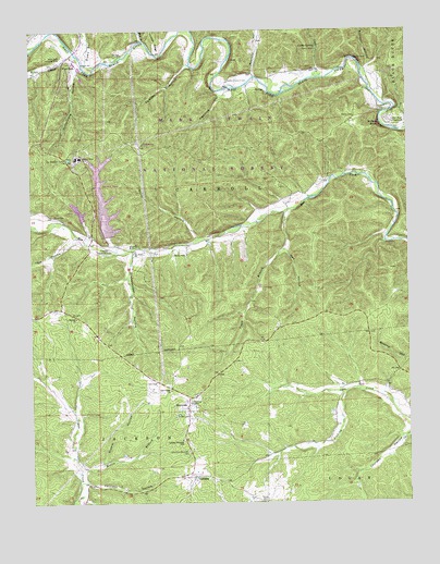
Corridon, MO USGS Topographic Map
Click on map above to begin viewing in our Map Viewer.

This topographic map contains these locations and features:
Feature Name Type Latitude Longitude GNIS ID View Map
Bailey HollowValleyN37.4984°W91.0607°748640View Map
Bee ForkPopulated PlaceN37.4414°W91.0846°730441View Map
Bee Fork ChurchChurchN37.4412°W91.0912°748762View Map
Brown BranchStreamN37.4903°W91.1065°749037View Map
Camden HollowValleyN37.4906°W91.0729°749167View Map
Cooks CreekStreamN37.4875°W91.0296°749455View Map
Cooks SpringSpringN37.4956°W91.0301°749456View Map
Cooks Spring Picnic AreaLocaleN37.4950°W91.0301°754965View Map
CorridonPopulated PlaceN37.3820°W91.0723°749482View Map
Corridon HollowValleyN37.3806°W91.1074°749483View Map
Corridon-Reynolds CemeteryCemeteryN37.3887°W91.0737°749484View Map
Corridon-Reynolds SchoolSchoolN37.3917°W91.0760°749485View Map
Davis CemeteryCemeteryN37.4514°W91.1176°749576View Map
Fishtrap HollowValleyN37.4823°W91.0618°749925View Map
Fletcher Clarification DamDamN37.4634°W91.0018°765061View Map
Fletcher Landing Strip (historical)AirportN37.4425°W91.1007°754067View Map
Fletcher MineMineN37.4664°W91.1087°755548View Map
Fletcher Mine Clarification BasinReservoirN37.4524°W91.1092°764955View Map
Fletcher Mine Clarification DamDamN37.4500°W91.1085°764954View Map
Fletcher Tailings DamDamN37.4350°W91.1001°763814View Map
Fletcher Tailings Pond DamDamN37.4634°W91.1035°763812View Map
Full Gospel ChurchChurchN37.4048°W91.0796°750007View Map
Gober (historical)LocaleN37.3906°W91.0343°740339View Map
Grasshopper HollowValleyN37.4403°W91.0921°750106View Map
Jay Lookout TowerTowerN37.4662°W91.1129°755235View Map
Jourdan HollowValleyN37.3925°W91.0012°750549View Map
Kitchel BranchStreamN37.4487°W91.1235°750626View Map
Little Radford CemeteryCemeteryN37.4870°W91.0596°750793View Map
Lower Bee Fork School (historical)SchoolN37.4445°W91.0643°747886View Map
Mayers CemeteryCemeteryN37.4773°W91.0176°750973View Map
McNail School (historical)SchoolN37.4059°W91.0104°747887View Map
Mill BranchStreamN37.4975°W91.0873°751056View Map
North HollowValleyN37.4450°W91.0704°751348View Map
Number 46 LakeReservoirN37.4518°W91.1007°763813View Map
Number 47 LakeReservoirN37.4350°W91.1001°763815View Map
OhlmanPopulated PlaceN37.4264°W91.1154°739915View Map
Ohlman ChurchChurchN37.4239°W91.1104°751411View Map
Radford HollowValleyN37.4884°W91.0507°751793View Map
ReynoldsPopulated PlaceN37.4009°W91.0735°751857View Map
Silver LakeLakeN37.4853°W91.0604°730440View Map
Silver Lake School (historical)SchoolN37.4864°W91.0501°747885View Map
South Branch Bee ForkStreamN37.4523°W91.0407°752248View Map
Stable HollowValleyN37.3867°W91.1018°752333View Map
Stillwell HollowValleyN37.4895°W91.0135°752373View Map
Sutterfield HollowValleyN37.4912°W91.1093°752442View Map
Sutterfield SchoolSchoolN37.4937°W91.0951°747884View Map
Sutton BluffCliffN37.4737°W91.0112°752443View Map
Sutton Bluff CampgroundLocaleN37.4756°W91.0065°752444View Map
Tarvid CemeteryCemeteryN37.3756°W91.0479°752491View Map
Toms CreekStreamN37.4937°W91.1099°752558View Map
Township of CarrollCivilN37.4828°W91.1088°767277View Map
Vest HollowValleyN37.4448°W91.1112°752703View Map
Weible CemeteryCemeteryN37.4409°W91.0782°752795View Map
West ForkPopulated PlaceN37.4917°W91.1090°752811View Map
West Fork CemeteryCemeteryN37.4925°W91.1023°752817View Map
West Fork HollowValleyN37.4425°W91.0968°752819View Map
West Fork Landing Strip (historical)AirportN37.4939°W91.1165°754064View Map
Wet HollowValleyN37.4420°W91.0404°752838View Map
Willis BranchStreamN37.3839°W91.1093°752919View Map

Note: Coordinates in the location and feature list above are referenced to NAD83 datum.


Copyright (C) 2008-2024 Ryan Niemi / Sunset Dynamics ... All Rights Reserved