TopoQuest Logo
Do you find TopoQuest useful?
Help keep TopoQuest running and adding new maps/features by donating!
Bitcoin:  19c7KJd3qBynnjoSw5npx9KScwjBe4ifkT
Litecoin:  LXs6TkuXGGXo1vDsWCkWVdjQX94eUKd6ui
Home View Maps Find Maps Find Places Resources & Links


Reed City South, Michigan Topographic Map

USGS Map Title: Reed City South, MI
USGS Map MRC: 43085G5
DRG (GeoTIFF) Download: o43085g5.tif


Neighboring USGS Topographic Map Quads:


  Chase, MI  
43085H6
 

  Reed City North, MI  
43085H5


  Whipple Lake, MI  
43085G6
 

  Reed City South, MI  
43085G5


  Woodville, MI  
43085F6
 

  Woodville NE, MI  
43085F5
 

  Big Rapids, MI  
43085F4


Map MRC Location:

N44°
W86°
N44°
W85°
H8 H7 H6 H5 H4 H3 H2 H1
G8 G7 G6 G5 G4 G3 G2 G1
F8 F7 F6 F5 F4 F3 F2 F1
E8 E7 E6 E5 E4 E3 E2 E1
D8 D7 D6 D5 D4 D3 D2 D1
C8 C7 C6 C5 C4 C3 C2 C1
B8 B7 B6 B5 B4 B3 B2 B1
A8 A7 A6 A5 A4 A3 A2 A1
N43°
W86°
N43°
W85°

Reed City South, MI USGS 1:24K Topographic Map Preview:
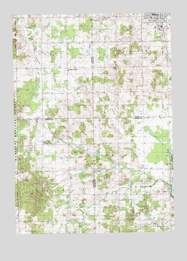
Reed City South, MI USGS Topographic Map
Click on map above to begin viewing in our Map Viewer.

This topographic map contains these locations and features:
Feature Name Type Latitude Longitude GNIS ID View Map
Barton Township CemeteryCemeteryN43.7733°W85.5819°2541881View Map
Barton Township ParkParkN43.8006°W85.6083°2500850View Map
Booth SchoolSchoolN43.7711°W85.5434°1619284View Map
Buckhorn CreekStreamN43.7917°W85.5003°1619353View Map
Calvary Baptist ChurchChurchN43.8733°W85.5114°2514652View Map
Charity Baptist ChurchChurchN43.7569°W85.5028°2519002View Map
Chase Township CemeteryCemeteryN43.8725°W85.6014°2513394View Map
Church of AntiochChurchN43.8733°W85.5097°2514647View Map
Church of Christ of Big RapidsChurchN43.7731°W85.5031°2519003View Map
City of Reed CityCivilN43.8724°W85.5068°1626961View Map
Cornell SchoolSchoolN43.8300°W85.5828°1619587View Map
Country Mobile Home ParkPopulated PlaceN43.7833°W85.5014°2519005View Map
Davenport SchoolSchoolN43.7731°W85.5814°1619666View Map
Davis SchoolSchoolN43.8000°W85.6223°1619675View Map
Donley SchoolSchoolN43.7997°W85.5437°1619739View Map
GT Norman Elementary SchoolSchoolN43.8722°W85.5153°2514661View Map
HawkinsPopulated PlaceN43.8006°W85.6031°1620149View Map
Hawkins Post Office (historical)Post OfficeN43.8006°W85.6031°2541836View Map
Haymarsh Lake State Game Area-Paris UnitParkN43.7958°W85.5056°2518976View Map
Kellars CornersLocaleN43.8442°W85.5826°1620404View Map
Knuth CreekStreamN43.8711°W85.5542°1622487View Map
Liberty Baptist ChurchChurchN43.8225°W85.5033°2514642View Map
Mennonite CemeteryCemeteryN43.8519°W85.5033°2514767View Map
Michigan State Police DepartmentBuildingN43.8661°W85.5102°2737497View Map
Morris SchoolSchoolN43.8303°W85.5439°1620901View Map
ParisPopulated PlaceN43.7734°W85.5025°1621153View Map
Paris CreekStreamN43.7756°W85.5017°1621154View Map
Paris Fish Hatchery Historical MarkerParkN43.7867°W85.5022°2519062View Map
Paris ParkParkN43.7867°W85.5014°2519006View Map
Paris Post OfficePost OfficeN43.7731°W85.5033°2519004View Map
Paris Station (historical)LocaleN43.7736°W85.5028°2519000View Map
Paris United Methodist ChurchChurchN43.7736°W85.5042°2519001View Map
Parkhill CemeteryCemeteryN43.7864°W85.5284°1621157View Map
Reed City High SchoolSchoolN43.8667°W85.5125°2514663View Map
Reed City Police DepartmentBuildingN43.8716°W85.5069°2514640View Map
Reed City Volunteer Fire DepartmentBuildingN43.8716°W85.5080°2627043View Map
Saint Ann ChurchChurchN43.7853°W85.5614°1621471View Map
Saint Anne's CemeteryCemeteryN43.7867°W85.5592°2519045View Map
Saint Paul Lutheran ChurchChurchN43.8733°W85.5361°2514644View Map
Saint Paul's Evangelical Lutheran CemeteryCemeteryN43.8450°W85.5328°2514765View Map
Saint Philip Neri Catholic ChurchChurchN43.8642°W85.5125°2514646View Map
Samis SchoolSchoolN43.8439°W85.6031°1621499View Map
Sanders CreekStreamN43.7834°W85.5223°2014029View Map
Seventh-Day Adventist ChurchChurchN43.8728°W85.5106°2514648View Map
Shepherd ChurchChurchN43.7564°W85.5631°1621583View Map
Township of BartonCivilN43.7720°W85.6220°1625886View Map
Township of ChaseCivilN43.8588°W85.6221°1626064View Map
Township of RichmondCivilN43.8578°W85.5033°1626978View Map
Trinity Lutheran ChurchChurchN43.8694°W85.5114°2514645View Map
Trinity Lutheran SchoolSchoolN43.8694°W85.5114°2514664View Map
United Methodist ChurchChurchN43.8714°W85.5106°2514649View Map
Upper Elementary SchoolSchoolN43.8722°W85.5133°2514662View Map
White Birch Estates Mobile Home ParkPopulated PlaceN43.8625°W85.5072°2514657View Map
Woodland CemeteryCemeteryN43.8706°W85.5209°1622207View Map
Youngs Trailer ParkPopulated PlaceN43.8694°W85.5008°2514658View Map

Note: Coordinates in the location and feature list above are referenced to NAD83 datum.


Copyright (C) 2008-2024 Ryan Niemi / Sunset Dynamics ... All Rights Reserved