TopoQuest Logo
Do you find TopoQuest useful?
Help keep TopoQuest running and adding new maps/features by donating!
Bitcoin:  19c7KJd3qBynnjoSw5npx9KScwjBe4ifkT
Litecoin:  LXs6TkuXGGXo1vDsWCkWVdjQX94eUKd6ui
Home View Maps Find Maps Find Places Resources & Links


Rheims, New York Topographic Map

USGS Map Title: Rheims, NY
USGS Map MRC: 42077D3
DRG (GeoTIFF) Download: o42077d3.tif


Neighboring USGS Topographic Map Quads:


  Naples, NY  
42077E4
 

  Prattsburg, NY  
42077E3
 

  Pulteney, NY  
42077E2
 

  Avoca, NY  
42077D4
 

  Rheims, NY  
42077D3
 

  Hammondsport, NY  
42077D2
 

  Towlesville, NY  
42077C4
 

  Bath, NY  
42077C3
 

  Savona, NY  
42077C2


Map MRC Location:

N43°
W78°
N43°
W77°
H8 H7 H6 H5 H4 H3 H2 H1
G8 G7 G6 G5 G4 G3 G2 G1
F8 F7 F6 F5 F4 F3 F2 F1
E8 E7 E6 E5 E4 E3 E2 E1
D8 D7 D6 D5 D4 D3 D2 D1
C8 C7 C6 C5 C4 C3 C2 C1
B8 B7 B6 B5 B4 B3 B2 B1
A8 A7 A6 A5 A4 A3 A2 A1
N42°
W78°
N42°
W77°

Rheims, NY USGS 1:24K Topographic Map Preview:
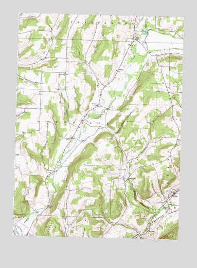
Rheims, NY USGS Topographic Map
Click on map above to begin viewing in our Map Viewer.

This topographic map contains these locations and features:
Feature Name Type Latitude Longitude GNIS ID View Map
Beans StationLocaleN42.4873°W77.2880°943243View Map
Cold BrookStreamN42.3778°W77.2791°947032View Map
Deer Lick RunStreamN42.4726°W77.3214°948206View Map
DinehartsPopulated PlaceN42.4490°W77.3133°972386View Map
Free Baptist CemeteryCemeteryN42.4297°W77.2528°2547906View Map
Harvest Baptist ChurchChurchN42.3961°W77.2612°2598032View Map
HermitagePopulated PlaceN42.3792°W77.2730°952628View Map
Hickory HillSummitN42.3834°W77.3458°952688View Map
Hillview Blueberry FarmLocaleN42.4875°W77.2822°2544486View Map
Kanona Volunteer Fire DepartmentBuildingN42.3763°W77.3644°2701023View Map
Kershener HillSummitN42.3803°W77.3169°954557View Map
Markhams Tree FarmLocaleN42.3911°W77.2869°2544481View Map
MarshallsPopulated PlaceN42.4117°W77.3450°972769View Map
MitchellsvillePopulated PlaceN42.4081°W77.2897°957453View Map
Mitchellsville CemeteryCemeteryN42.4050°W77.2916°2547902View Map
Mitchellsville CreekStreamN42.3915°W77.2633°957454View Map
Mud LakeLakeN42.4914°W77.2792°958023View Map
Pleasant ValleyPopulated PlaceN42.3926°W77.2575°960719View Map
Pleasant Valley CemeteryCemeteryN42.3916°W77.2564°2547905View Map
Pleasant Valley Mennonite ChurchChurchN42.3938°W77.2573°2597946View Map
RenchansPopulated PlaceN42.4403°W77.3250°972995View Map
RheimsPopulated PlaceN42.4009°W77.2539°973000View Map
Softwater CreekStreamN42.3778°W77.2791°965626View Map
StickneysPopulated PlaceN42.4692°W77.2991°973117View Map
Town of WheelerCivilN42.4424°W77.3426°979634View Map
Trout RunStreamN42.4467°W77.3100°967899View Map
Waldo CreekStreamN42.4917°W77.2847°968662View Map
WheelerPopulated PlaceN42.4303°W77.3325°970994View Map
Wheeler CemeteryCemeteryN42.4347°W77.3287°2547903View Map
Wheeler Family CemeteryCemeteryN42.4488°W77.3128°2547904View Map
Wheeler Hill ChurchChurchN42.4662°W77.3389°971009View Map

Note: Coordinates in the location and feature list above are referenced to NAD83 datum.


Copyright (C) 2008-2024 Ryan Niemi / Sunset Dynamics ... All Rights Reserved