TopoQuest Logo
Do you find TopoQuest useful?
Help keep TopoQuest running and adding new maps/features by donating!
Bitcoin:  19c7KJd3qBynnjoSw5npx9KScwjBe4ifkT
Litecoin:  LXs6TkuXGGXo1vDsWCkWVdjQX94eUKd6ui
Home View Maps Find Maps Find Places Resources & Links


Ricardo, Texas Topographic Map

USGS Map Title: Ricardo, TX
USGS Map MRC: 27097D7
DRG (GeoTIFF) Download: o27097d7.tif


Neighboring USGS Topographic Map Quads:


  Kingsville West, TX  
27097E8
 

  Kingsville East, TX  
27097E7
 

  Concordia, TX  
27097E6
 

  Escondido Lake, TX  
27097D8
 

  Ricardo, TX  
27097D7
 

  Riviera Beach NW, TX  
27097D6
 

  Paisano Lake, TX  
27097C8
 

  Riviera, TX  
27097C7
 

  Riviera Beach, TX  
27097C6


Map MRC Location:

N28°
W98°
N28°
W97°
H8 H7 H6 H5 H4 H3 H2 H1
G8 G7 G6 G5 G4 G3 G2 G1
F8 F7 F6 F5 F4 F3 F2 F1
E8 E7 E6 E5 E4 E3 E2 E1
D8 D7 D6 D5 D4 D3 D2 D1
C8 C7 C6 C5 C4 C3 C2 C1
B8 B7 B6 B5 B4 B3 B2 B1
A8 A7 A6 A5 A4 A3 A2 A1
N27°
W98°
N27°
W97°

Ricardo, TX USGS 1:24K Topographic Map Preview:
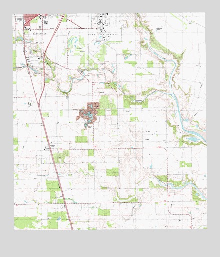
Ricardo, TX USGS Topographic Map
Click on map above to begin viewing in our Map Viewer.

This topographic map contains these locations and features:
Feature Name Type Latitude Longitude GNIS ID View Map
Bordo Nuevo WindmillLocaleN27.4911°W97.7819°1372682View Map
Christus Spohn Hospital - KlebergHospitalN27.4903°W97.8506°2015806View Map
Dick Kleberg ParkParkN27.4720°W97.8606°2028499View Map
Dick Kleberg Park DamDamN27.4670°W97.8603°1859104View Map
Dick Kleberg Park LakeReservoirN27.4682°W97.8622°1859105View Map
Ebanito CreekStreamN27.3950°W97.7961°1373577View Map
Escondido CreekStreamN27.4625°W97.8500°1373665View Map
King High SchoolSchoolN27.4955°W97.8543°2007000View Map
Kingsville Post OfficePost OfficeN27.4958°W97.8184°2731180View Map
Kleberg County ParkParkN27.4817°W97.8369°2029060View Map
Kleberg ParkParkN27.4725°W97.8617°1374393View Map
Leoncitos WellWellN27.4939°W97.7589°1374510View Map
Northway Exposition CenterBuildingN27.4742°W97.8572°1375212View Map
Pan American SchoolSchoolN27.4484°W97.8653°1375345View Map
Perez Elementary SchoolSchoolN27.4985°W97.8538°2007006View Map
Perez SchoolSchoolN27.4984°W97.8536°1375418View Map
RicardoPopulated PlaceN27.4214°W97.8511°1375725View Map
Ricardo Census Designated PlaceCensusN27.4186°W97.8476°2586979View Map
Ricardo Elementary SchoolSchoolN27.4217°W97.8554°2434425View Map
Ricardo Middle SchoolSchoolN27.4217°W97.8554°2434235View Map
Ricardo Volunteer Fire DepartmentBuildingN27.4217°W97.8541°2552347View Map
Santa Gertrudis CreekStreamN27.4536°W97.7717°1376015View Map
Vinatero WellWellN27.4592°W97.7539°1376600View Map

Note: Coordinates in the location and feature list above are referenced to NAD83 datum.


Copyright (C) 2008-2025 Ryan Niemi / Sunset Dynamics ... All Rights Reserved