TopoQuest Logo
Do you find TopoQuest useful?
Help keep TopoQuest running and adding new maps/features by donating!
Bitcoin:  19c7KJd3qBynnjoSw5npx9KScwjBe4ifkT
Litecoin:  LXs6TkuXGGXo1vDsWCkWVdjQX94eUKd6ui
Home View Maps Find Maps Find Places Resources & Links


Richvalley, Indiana Topographic Map

USGS Map Title: Richvalley, IN
USGS Map MRC: 40085G8
DRG (GeoTIFF) Download: o40085g8.tif


Neighboring USGS Topographic Map Quads:


  Deedsville, IN  
40086H1
 

  Roann, IN  
40085H8
 

  North Manchester South, IN  
40085H7
 

  Peru, IN  
40086G1
 

  Richvalley, IN  
40085G8
 

  Wabash, IN  
40085G7
 

  Bunker Hill, IN  
40086F1
 

  Peoria, IN  
40085F8
 

  Somerset, IN  
40085F7


Map MRC Location:

N41°
W86°
N41°
W85°
H8 H7 H6 H5 H4 H3 H2 H1
G8 G7 G6 G5 G4 G3 G2 G1
F8 F7 F6 F5 F4 F3 F2 F1
E8 E7 E6 E5 E4 E3 E2 E1
D8 D7 D6 D5 D4 D3 D2 D1
C8 C7 C6 C5 C4 C3 C2 C1
B8 B7 B6 B5 B4 B3 B2 B1
A8 A7 A6 A5 A4 A3 A2 A1
N40°
W86°
N40°
W85°

Richvalley, IN USGS 1:24K Topographic Map Preview:
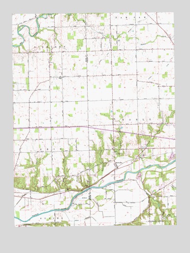
Richvalley, IN USGS Topographic Map
Click on map above to begin viewing in our Map Viewer.

This topographic map contains these locations and features:
Feature Name Type Latitude Longitude GNIS ID View Map
Asher BranchStreamN40.7595°W85.9625°430307View Map
Bachelor CreekStreamN40.8656°W85.9378°430383View Map
Beamer DitchCanalN40.8689°W85.9030°430606View Map
Busick DitchCanalN40.8487°W85.9289°431893View Map
Carlin BranchStreamN40.7814°W85.9092°432131View Map
Center ChapelChurchN40.8375°W85.9619°432317View Map
Engleman CreekStreamN40.7728°W85.9339°434201View Map
EriePopulated PlaceN40.8012°W85.9914°434228View Map
Francis Godfroy CemeteryCemeteryN40.7509°W85.9930°434754View Map
Gilbert BranchStreamN40.7623°W85.9564°435062View Map
Higley Curve Gravel PitMineN40.7786°W85.9033°2649435View Map
Huff CemeteryCemeteryN40.8586°W85.9189°436579View Map
Johnson DitchCanalN40.8412°W85.8850°437056View Map
Kentner CreekStreamN40.7837°W85.8986°437257View Map
Mill CreekStreamN40.7820°W85.9028°439161View Map
Paw Paw CreekStreamN40.8734°W85.9769°440943View Map
Reserve Number ElevenReserveN40.7709°W85.9125°446940View Map
Reserve Number ThirteenReserveN40.7792°W85.8875°446939View Map
Reserve Number TwelveReserveN40.7667°W85.9333°446941View Map
RichvalleyPopulated PlaceN40.7850°W85.9203°449717View Map
Richvalley CemeteryCemeteryN40.7924°W85.9200°441980View Map
Ridgeway CreekStreamN40.7542°W85.8833°442003View Map
Schrom CreekStreamN40.7670°W85.9542°443114View Map
Stauffer DitchCanalN40.7723°W85.8769°444099View Map
Township of ErieCivilN40.7914°W85.9800°453278View Map
Unger DitchCanalN40.7612°W85.9111°445045View Map
Wallace CemeteryCemeteryN40.8096°W85.8850°445389View Map

Note: Coordinates in the location and feature list above are referenced to NAD83 datum.


Copyright (C) 2008-2024 Ryan Niemi / Sunset Dynamics ... All Rights Reserved