TopoQuest Logo
Do you find TopoQuest useful?
Help keep TopoQuest running and adding new maps/features by donating!
Bitcoin:  19c7KJd3qBynnjoSw5npx9KScwjBe4ifkT
Litecoin:  LXs6TkuXGGXo1vDsWCkWVdjQX94eUKd6ui
Home View Maps Find Maps Find Places Resources & Links


Riddle, Idaho Topographic Map

USGS Map Title: Riddle, ID
USGS Map MRC: 42116B1
DRG (GeoTIFF) Download: o42116b1.tif


Neighboring USGS Topographic Map Quads:


  Nichol Flat, ID  
42116C2
 

  Little Blue Table, ID  
42116C1
 

  Grasmere Reservoir, ID  
42115C8
 

  Flying H Ranch, ID  
42116B2
 

  Riddle, ID  
42116B1
 

  Buckhorn, ID  
42115B8
 

  Mountain View Lake, ID  
42116A2
 

  Three Forks, ID  
42116A1
 

  Indian Hay Meadows, ID  
42115A8


Map MRC Location:

N43°
W117°
N43°
W116°
H8 H7 H6 H5 H4 H3 H2 H1
G8 G7 G6 G5 G4 G3 G2 G1
F8 F7 F6 F5 F4 F3 F2 F1
E8 E7 E6 E5 E4 E3 E2 E1
D8 D7 D6 D5 D4 D3 D2 D1
C8 C7 C6 C5 C4 C3 C2 C1
B8 B7 B6 B5 B4 B3 B2 B1
A8 A7 A6 A5 A4 A3 A2 A1
N42°
W117°
N42°
W116°

Riddle, ID USGS 1:24K Topographic Map Preview:
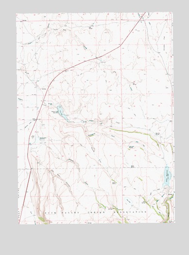
Riddle, ID USGS Topographic Map
Click on map above to begin viewing in our Map Viewer.

This topographic map contains these locations and features:
Feature Name Type Latitude Longitude GNIS ID View Map
Alder DamDamN42.1587°W116.0061°398687View Map
Cat SpringSpringN42.2082°W116.0325°371915View Map
Chicken FlatFlatN42.2324°W116.0070°371991View Map
Cold SpringsSpringN42.2420°W116.0663°372088View Map
Dry CreekStreamN42.1363°W116.1198°372468View Map
Dry LakeLakeN42.1383°W116.0369°372486View Map
Harris LakeLakeN42.1251°W116.0012°372997View Map
Heifer SpringSpringN42.1579°W116.0350°383047View Map
Indian CreekStreamN42.1752°W116.1076°373218View Map
Indian Creek ReservoirReservoirN42.1750°W116.1093°373225View Map
Moorcastle CreekStreamN42.1852°W116.0740°374015View Map
Moorcastle SpringsSpringN42.1709°W116.0364°374016View Map
Old Man CanyonValleyN42.1685°W116.1112°374257View Map
Otter ButtesSummitN42.1360°W116.0173°397967View Map
Otter CreekStreamN42.1480°W116.0065°374277View Map
Otter ReservoirReservoirN42.1588°W116.0059°397968View Map
Otter SpringsSpringN42.1374°W116.0226°388022View Map
Pig CreekStreamN42.2368°W116.1073°374393View Map
RiddlePopulated PlaceN42.1868°W116.1104°398043View Map
Riddle Airport (historical)AirportN42.1841°W116.1154°400912View Map
Sage Hen SpringsSpringN42.1767°W116.0153°374844View Map
Squaw Creek DamDamN42.1947°W116.0929°398834View Map
Squaw Creek ReservoirReservoirN42.1913°W116.0897°398171View Map
Squaw FlatFlatN42.1646°W116.0620°375236View Map
Squaw SpringSpringN42.1489°W116.0463°375239View Map
Summit FlatFlatN42.2474°W116.0243°375334View Map

Note: Coordinates in the location and feature list above are referenced to NAD83 datum.


Copyright (C) 2008-2024 Ryan Niemi / Sunset Dynamics ... All Rights Reserved