TopoQuest Logo
Do you find TopoQuest useful?
Help keep TopoQuest running and adding new maps/features by donating!
Bitcoin:  19c7KJd3qBynnjoSw5npx9KScwjBe4ifkT
Litecoin:  LXs6TkuXGGXo1vDsWCkWVdjQX94eUKd6ui
Home View Maps Find Maps Find Places Resources & Links


Ridgeway, Iowa Topographic Map

USGS Map Title: Ridgeway, IA
USGS Map MRC: 43091C8
DRG (GeoTIFF) Download: o43091c8.tif


Neighboring USGS Topographic Map Quads:


  Cresco NE, IA  
43092D1
 

  Bluffton, IA  
43091D8
 

  Burr Oak, IA  
43091D7
 

  Cresco SE, IA  
43092C1
 

  Ridgeway, IA  
43091C8
 

  Decorah, IA  
43091C7
 

  Protivin, IA  
43092B1
 

  Fort Atkinson, IA  
43091B8
 

  Calmar, IA  
43091B7


Map MRC Location:

N44°
W92°
N44°
W91°
H8 H7 H6 H5 H4 H3 H2 H1
G8 G7 G6 G5 G4 G3 G2 G1
F8 F7 F6 F5 F4 F3 F2 F1
E8 E7 E6 E5 E4 E3 E2 E1
D8 D7 D6 D5 D4 D3 D2 D1
C8 C7 C6 C5 C4 C3 C2 C1
B8 B7 B6 B5 B4 B3 B2 B1
A8 A7 A6 A5 A4 A3 A2 A1
N43°
W92°
N43°
W91°

Ridgeway, IA USGS 1:24K Topographic Map Preview:
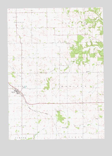
Ridgeway, IA USGS Topographic Map
Click on map above to begin viewing in our Map Viewer.

This topographic map contains these locations and features:
Feature Name Type Latitude Longitude GNIS ID View Map
Burr Oak Springs Post Office (historical)Post OfficeN43.2564°W91.9613°1941315View Map
City of RidgewayCivilN43.2971°W91.9924°2396374View Map
East Madison CemeteryCemeteryN43.3135°W91.8986°456176View Map
Lincoln CemeteryCemeteryN43.2632°W91.9823°458362View Map
Madison CemeteryCemeteryN43.3136°W91.9240°458719View Map
Madison ChurchChurchN43.3136°W91.9235°458723View Map
Madison Settlement CemeteryCemeteryN43.2610°W91.9234°458730View Map
McIntosh CemeteryCemeteryN43.2696°W91.8833°458920View Map
Orleans CemeteryCemeteryN43.3583°W91.9916°459898View Map
Orleans ChurchChurchN43.3711°W91.9793°459900View Map
Peace Lutheran ChurchChurchN43.2969°W91.9924°1941435View Map
Prairie Farmer Recreational TrailTrailN43.2791°W91.9710°1941505View Map
RidgewayPopulated PlaceN43.2977°W91.9877°460629View Map
Ridgeway (historical)LocaleN43.2966°W91.9882°1941430View Map
Ridgeway Elementary SchoolSchoolN43.2944°W91.9877°1941434View Map
Ridgeway Fire DepartmentBuildingN43.2968°W91.9889°1941431View Map
Ridgeway Post OfficePost OfficeN43.2966°W91.9896°1941433View Map
Ridgeway Roadside ParkParkN43.2930°W91.9818°1941436View Map
Ridgeway Town HallBuildingN43.2966°W91.9896°1941432View Map
Ten Mile Creek BridgeBridgeN43.3377°W91.8882°1941504View Map
Township of MadisonCivilN43.2986°W91.9030°468329View Map
Walnut CreekStreamN43.2986°W91.9710°462635View Map

Note: Coordinates in the location and feature list above are referenced to NAD83 datum.


Copyright (C) 2008-2024 Ryan Niemi / Sunset Dynamics ... All Rights Reserved