TopoQuest Logo
Do you find TopoQuest useful?
Help keep TopoQuest running and adding new maps/features by donating!
Bitcoin:  19c7KJd3qBynnjoSw5npx9KScwjBe4ifkT
Litecoin:  LXs6TkuXGGXo1vDsWCkWVdjQX94eUKd6ui
Home View Maps Find Maps Find Places Resources & Links


Calmar, Iowa Topographic Map

USGS Map Title: Calmar, IA
USGS Map MRC: 43091B7
DRG (GeoTIFF) Download: o43091b7.tif


Neighboring USGS Topographic Map Quads:


  Ridgeway, IA  
43091C8
 

  Decorah, IA  
43091C7
 

  Freeport, IA  
43091C6
 

  Fort Atkinson, IA  
43091B8
 

  Calmar, IA  
43091B7
 

  Postville NW, IA  
43091B6
 

  Saint Lucas, IA  
43091A8
 

  Festina, IA  
43091A7
 

  Castalia, IA  
43091A6


Map MRC Location:

N44°
W92°
N44°
W91°
H8 H7 H6 H5 H4 H3 H2 H1
G8 G7 G6 G5 G4 G3 G2 G1
F8 F7 F6 F5 F4 F3 F2 F1
E8 E7 E6 E5 E4 E3 E2 E1
D8 D7 D6 D5 D4 D3 D2 D1
C8 C7 C6 C5 C4 C3 C2 C1
B8 B7 B6 B5 B4 B3 B2 B1
A8 A7 A6 A5 A4 A3 A2 A1
N43°
W92°
N43°
W91°

Calmar, IA USGS 1:24K Topographic Map Preview:
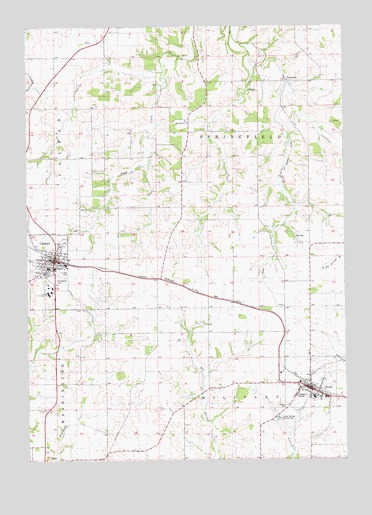
Calmar, IA USGS Topographic Map
Click on map above to begin viewing in our Map Viewer.

This topographic map contains these locations and features:
Feature Name Type Latitude Longitude GNIS ID View Map
Bruvold Farm CemeteryCemeteryN43.2222°W91.7510°1941402View Map
CalmarPopulated PlaceN43.1836°W91.8640°455057View Map
CalmarLocaleN43.1839°W91.8643°1941478View Map
Calmar Bible FellowshipChurchN43.1828°W91.8660°1941487View Map
Calmar City ParkParkN43.1878°W91.8621°1941493View Map
Calmar Community CemeteryCemeteryN43.1785°W91.8731°455058View Map
Calmar Community United Methodist ChurchChurchN43.1828°W91.8668°1941485View Map
Calmar DepotBuildingN43.1839°W91.8640°1941479View Map
Calmar Festina Spillville Catholic SchoolSchoolN43.1806°W91.8646°1941492View Map
Calmar Fire DepartmentBuildingN43.1828°W91.8680°1941481View Map
Calmar LibraryBuildingN43.1828°W91.8660°1941482View Map
Calmar Lutheran ChurchChurchN43.1830°W91.8588°1941484View Map
Calmar Police DepartmentBuildingN43.1826°W91.8661°1941489View Map
Calmar Post OfficePost OfficeN43.1825°W91.8646°1941480View Map
Christian Family SchoolSchoolN43.1800°W91.8640°1941491View Map
City of CalmarCivilN43.1811°W91.8679°2393499View Map
City of OssianCivilN43.1470°W91.7646°2396099View Map
De Sales SchoolSchoolN43.1431°W91.7584°1941448View Map
Gunderson ClinicHospitalN43.1830°W91.8649°1941477View Map
Gunderson Clinic - OssianHospitalN43.1455°W91.7635°1941444View Map
Hillside CemeteryCemeteryN43.1405°W91.7737°1941403View Map
NordnessPopulated PlaceN43.2344°W91.7718°464671View Map
Nordness (historical)LocaleN43.2344°W91.7718°1941297View Map
Nordness Post Office (historical)Post OfficeN43.2344°W91.7718°1941296View Map
Northeast Iowa Community College - Calmar CampusSchoolN43.1750°W91.8656°454223View Map
Northeast Iowa Community College LibraryBuildingN43.1753°W91.8665°1941488View Map
OssianPopulated PlaceN43.1464°W91.7646°459910View Map
OssianLocaleN43.1458°W91.7632°1941440View Map
Ossian Agri Center ElevatorLocaleN43.1464°W91.7646°1941438View Map
Ossian City ParkParkN43.1464°W91.7682°1941439View Map
Ossian Community CemeteryCemeteryN43.1405°W91.7738°459911View Map
Ossian Fire Department and Ambulance ServiceBuildingN43.1458°W91.7643°2577506View Map
Ossian LibraryBuildingN43.1464°W91.7654°1941443View Map
Ossian Police DepartmentBuildingN43.1464°W91.7654°1941442View Map
Ossian Post OfficePost OfficeN43.1464°W91.7646°1941437View Map
Saint Aloysius Catholic ChurchChurchN43.1803°W91.8646°1941483View Map
Saint Aloysius CemeteryCemeteryN43.1772°W91.8638°460918View Map
Saint Francis De Sales ChurchChurchN43.1425°W91.7571°1941447View Map
Saint Francis DeSales CemeteryCemeteryN43.1419°W91.7571°1941446View Map
Silver Springs County ParkParkN43.1372°W91.7763°1825124View Map
Silver Springs Golf ClubLocaleN43.1347°W91.7835°1941445View Map
South Winneshiek Area First Responders CalamarBuildingN43.1828°W91.8680°2577454View Map
South Winneshiek Elementary SchoolSchoolN43.1427°W91.7630°2719868View Map
South Winneshiek High SchoolSchoolN43.1808°W91.8666°1941490View Map
South Winneshiek Middle SchoolSchoolN43.1428°W91.7626°1941441View Map
Springfield CemeteryCemeteryN43.2222°W91.8181°461919View Map
Springfield ChurchChurchN43.2228°W91.8115°461920View Map
Township of MilitaryCivilN43.1254°W91.7845°468382View Map
Township of SpringfieldCivilN43.2120°W91.7838°468742View Map
Tri-Township Fire DepartmentBuildingN43.1458°W91.7644°2371685View Map
Trinity Lutheran ChurchChurchN43.1819°W91.8679°1941486View Map
Twin SpringsPopulated PlaceN43.1253°W91.8585°465352View Map

Note: Coordinates in the location and feature list above are referenced to NAD83 datum.


Copyright (C) 2008-2025 Ryan Niemi / Sunset Dynamics ... All Rights Reserved