TopoQuest Logo
Do you find TopoQuest useful?
Help keep TopoQuest running and adding new maps/features by donating!
Bitcoin:  19c7KJd3qBynnjoSw5npx9KScwjBe4ifkT
Litecoin:  LXs6TkuXGGXo1vDsWCkWVdjQX94eUKd6ui
Home View Maps Find Maps Find Places Resources & Links


Ringbolt Rapids, Arizona Topographic Map

USGS Map Title: Ringbolt Rapids, AZ
USGS Map MRC: 35114H6
DRG (GeoTIFF) Download: o35114h6.tif


Neighboring USGS Topographic Map Quads:


  Boulder Beach, NV  
36114A7
 

  Hoover Dam, NV  
36114A6
 

  Petroglyph Wash, AZ  
36114A5
 

  Boulder City, NV  
35114H7
 

  Ringbolt Rapids, AZ  
35114H6
 

  Mount Wilson, AZ  
35114H5
 

  Boulder City SE, NV  
35114G7
 

  Willow Beach, AZ  
35114G6
 

  Housholder Pass, AZ  
35114G5


Map MRC Location:

N36°
W115°
N36°
W114°
H8 H7 H6 H5 H4 H3 H2 H1
G8 G7 G6 G5 G4 G3 G2 G1
F8 F7 F6 F5 F4 F3 F2 F1
E8 E7 E6 E5 E4 E3 E2 E1
D8 D7 D6 D5 D4 D3 D2 D1
C8 C7 C6 C5 C4 C3 C2 C1
B8 B7 B6 B5 B4 B3 B2 B1
A8 A7 A6 A5 A4 A3 A2 A1
N35°
W115°
N35°
W114°

Ringbolt Rapids, AZ USGS 1:24K Topographic Map Preview:
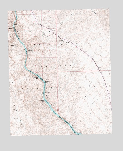
Ringbolt Rapids, AZ USGS Topographic Map
Click on map above to begin viewing in our Map Viewer.

This topographic map contains these locations and features:
Feature Name Type Latitude Longitude GNIS ID View Map
Big Sand BarBarN35.9283°W114.7091°838757View Map
Big Sand Bar RapidsRapidsN35.9286°W114.7080°1358View Map
Bighorn Sheep SpringSpringN35.9392°W114.7342°2743312View Map
Black Canyon WildernessReserveN35.9227°W114.7365°2542649View Map
Boy Scout CanyonValleyN35.9847°W114.7444°1738066View Map
Cranes Nest RapidsRapidsN35.9098°W114.7068°3543View Map
Cranes Nest WashStreamN35.9105°W114.7058°43077View Map
Cross Current RapidsRapidsN35.9329°W114.7134°3590View Map
Horseshoe RapidsRapidsN35.9174°W114.7083°6018View Map
Horsethief SpringSpringN35.9990°W114.6324°2707727View Map
Hot SpringSpringN35.9605°W114.7255°23002View Map
Hot SpringSpringN35.9447°W114.7322°841136View Map
Hot SpringSpringN35.9653°W114.7434°841137View Map
Hot SpringsSpringN35.9832°W114.7489°841151View Map
Indian RapidsRapidsN35.8974°W114.6962°6223View Map
Liberty Bell ArchArchN35.9750°W114.7244°2611541View Map
Lost Man Hot SpringSpringN35.9855°W114.7416°43004View Map
Maidenhair SpringSpringN35.9897°W114.7431°2711986View Map
Narrows SpringSpringN35.9886°W114.7450°2743313View Map
Nebula SpringSpringN35.9997°W114.7402°2707809View Map
Palm Tree SpringsSpringN35.9945°W114.7370°2707801View Map
Ringbolt Hot SpringSpringN35.9605°W114.7258°43003View Map
Ringbolt RapidsRapidsN35.9613°W114.7295°10305View Map
Rocky RapidsRapidsN35.9000°W114.7008°24042View Map
Stomp SpringSpringN35.9906°W114.7430°2711987View Map
The ChuteValleyN35.9489°W114.7300°43079View Map
The ChuteValleyN35.9489°W114.7300°863717View Map
Two Mile Hot SpringSpringN35.9833°W114.7489°863742View Map
White Rock CanyonValleyN35.9633°W114.7297°13656View Map

Note: Coordinates in the location and feature list above are referenced to NAD83 datum.


Copyright (C) 2008-2024 Ryan Niemi / Sunset Dynamics ... All Rights Reserved