TopoQuest Logo
Do you find TopoQuest useful?
Help keep TopoQuest running and adding new maps/features by donating!
Bitcoin:  19c7KJd3qBynnjoSw5npx9KScwjBe4ifkT
Litecoin:  LXs6TkuXGGXo1vDsWCkWVdjQX94eUKd6ui
Home View Maps Find Maps Find Places Resources & Links


Riverdale, Nebraska Topographic Map

USGS Map Title: Riverdale, NE
USGS Map MRC: 40099G2
DRG (GeoTIFF) Download: o40099g2.tif


Neighboring USGS Topographic Map Quads:


  Miller NE, NE  
40099H3
 

  Pleasanton NW, NE  
40099H2
 

  Pleasanton, NE  
40099H1
 

  Amherst, NE  
40099G3
 

  Riverdale, NE  
40099G2
 

  Pleasanton SE, NE  
40099G1
 

  Elm Creek East, NE  
40099F3
 

  Alfalfa Center, NE  
40099F2
 

  Kearney, NE  
40099F1


Map MRC Location:

N41°
W100°
N41°
W99°
H8 H7 H6 H5 H4 H3 H2 H1
G8 G7 G6 G5 G4 G3 G2 G1
F8 F7 F6 F5 F4 F3 F2 F1
E8 E7 E6 E5 E4 E3 E2 E1
D8 D7 D6 D5 D4 D3 D2 D1
C8 C7 C6 C5 C4 C3 C2 C1
B8 B7 B6 B5 B4 B3 B2 B1
A8 A7 A6 A5 A4 A3 A2 A1
N40°
W100°
N40°
W99°

Riverdale, NE USGS 1:24K Topographic Map Preview:
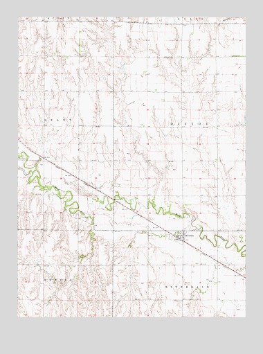
Riverdale, NE USGS Topographic Map
Click on map above to begin viewing in our Map Viewer.

This topographic map contains these locations and features:
Feature Name Type Latitude Longitude GNIS ID View Map
Eisele DamDamN40.8517°W99.1920°1767652View Map
Eisele ReservoirReservoirN40.8534°W99.1926°1767653View Map
Election Precinct 28CivilN40.7573°W99.1600°2784123View Map
Hadwiger DamDamN40.7717°W99.1887°1769956View Map
Hadwiger Dam Number 1DamN40.8600°W99.2120°1767654View Map
Hadwiger ReservoirReservoirN40.7710°W99.1877°1769957View Map
Hadwiger Reservoir Number 1ReservoirN40.8610°W99.2127°1767655View Map
Jacobson DamDamN40.7700°W99.2087°1767900View Map
Jacobson ReservoirReservoirN40.7697°W99.2082°1767901View Map
Lutheran CemeteryCemeteryN40.8589°W99.1340°830960View Map
Onion Crest AirparkAirportN40.7699°W99.1547°837695View Map
RiverdaleLocaleN40.7820°W99.1598°1875296View Map
RiverdalePopulated PlaceN40.7845°W99.1623°832573View Map
Riverdale Post OfficePost OfficeN40.7838°W99.1627°1875295View Map
Riverdale Public SchoolSchoolN40.7833°W99.1595°1875297View Map
Riverdale Rural Fire District 1BuildingN40.7841°W99.1621°2553482View Map
School Number 55SchoolN40.8583°W99.1701°836866View Map
Township of Divide (historical)CivilN40.8294°W99.1314°837963View Map
Township of Riverdale (historical)CivilN40.7579°W99.1325°838213View Map
Village of RiverdaleCivilN40.7839°W99.1605°2399087View Map

Note: Coordinates in the location and feature list above are referenced to NAD83 datum.


Copyright (C) 2008-2024 Ryan Niemi / Sunset Dynamics ... All Rights Reserved