TopoQuest Logo
Do you find TopoQuest useful?
Help keep TopoQuest running and adding new maps/features by donating!
Bitcoin:  19c7KJd3qBynnjoSw5npx9KScwjBe4ifkT
Litecoin:  LXs6TkuXGGXo1vDsWCkWVdjQX94eUKd6ui
Home View Maps Find Maps Find Places Resources & Links


Riverdale, Michigan Topographic Map

USGS Map Title: Riverdale, MI
USGS Map MRC: 43084D7
DRG (GeoTIFF) Download: o43084d7.tif


Neighboring USGS Topographic Map Quads:


  Winn, MI  
43084E8
 

  Mount Pleasant, MI  
43084E7
 

  Shepherd, MI  
43084E6
 

  Vestaburg, MI  
43084D8
 

  Riverdale, MI  
43084D7
 

  Alma North, MI  
43084D6
 

  Crystal, MI  
43084C8
 

  Sumner, MI  
43084C7
 

  Alma South, MI  
43084C6


Map MRC Location:

N44°
W85°
N44°
W84°
H8 H7 H6 H5 H4 H3 H2 H1
G8 G7 G6 G5 G4 G3 G2 G1
F8 F7 F6 F5 F4 F3 F2 F1
E8 E7 E6 E5 E4 E3 E2 E1
D8 D7 D6 D5 D4 D3 D2 D1
C8 C7 C6 C5 C4 C3 C2 C1
B8 B7 B6 B5 B4 B3 B2 B1
A8 A7 A6 A5 A4 A3 A2 A1
N43°
W85°
N43°
W84°

Riverdale, MI USGS 1:24K Topographic Map Preview:
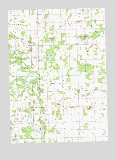
Riverdale, MI USGS Topographic Map
Click on map above to begin viewing in our Map Viewer.

This topographic map contains these locations and features:
Feature Name Type Latitude Longitude GNIS ID View Map
Bass LakeLakeN43.4689°W84.8172°620692View Map
Bass Lake DrainCanalN43.4375°W84.8108°620718View Map
Beaver Creek Post Office (historical)Post OfficeN43.4278°W84.8367°2562140View Map
Brown CemeteryCemeteryN43.4956°W84.7917°622068View Map
Half Moon LakeLakeN43.4557°W84.8245°627619View Map
Half Moon Lake CampgroundLocaleN43.4556°W84.8306°2562074View Map
Hamp AirportAirportN43.3990°W84.8055°1623887View Map
Irishtown CemeteryCemeteryN43.4655°W84.7611°2562148View Map
Irishtown ChurchChurchN43.4661°W84.7608°629071View Map
Jerseyville ChurchChurchN43.4875°W84.7864°629267View Map
Jerseyville Post Office (historical)Post OfficeN43.4864°W84.7867°2543892View Map
Kittle LakeLakeN43.4724°W84.8226°629775View Map
LaStrange LakeLakeN43.4759°W84.7600°629920View Map
Lighthouse Baptist ChurchChurchN43.3958°W84.8375°2562070View Map
Lincoln Road United Methodist ChurchChurchN43.3792°W84.7972°2562072View Map
Lumberjack ParkParkN43.4245°W84.8367°631211View Map
Lumberjack Park Historical MarkerParkN43.4242°W84.8369°2562154View Map
Lyons LakeLakeN43.4737°W84.7714°631252View Map
Mud CreekStreamN43.4239°W84.8331°632872View Map
Mud LakeLakeN43.4865°W84.7687°632968View Map
North Branch Pine RiverStreamN43.4342°W84.8383°633531View Map
Parcher DrainStreamN43.4814°W84.8064°634352View Map
Peterman LakeLakeN43.4053°W84.7523°634699View Map
RiverdalePopulated PlaceN43.3856°W84.8356°635974View Map
Riverdale CemeteryCemeteryN43.3970°W84.8314°635975View Map
Riverdale Post OfficePost OfficeN43.3983°W84.8375°2562071View Map
Riverdale Station (historical)LocaleN43.3903°W84.8364°2562073View Map
Robbins LakeLakeN43.4000°W84.8494°636033View Map
Rust and Hay SchoolSchoolN43.4803°W84.8664°636411View Map
Seville CemeteryCemeteryN43.4225°W84.7697°2562149View Map
Seville ChurchChurchN43.4225°W84.7692°637607View Map
Sibley CemeteryCemeteryN43.4222°W84.8311°637868View Map
StricklandPopulated PlaceN43.4950°W84.8353°1617875View Map
Strickland Baptist ChurchChurchN43.4947°W84.8364°2544006View Map
Strickland Post Office (historical)Post OfficeN43.4950°W84.8353°2543877View Map
Tabernacle ChurchChurchN43.4081°W84.8639°1614529View Map
Timber Country Mobile Home ParkPopulated PlaceN43.4083°W84.7667°2562063View Map
Township of SevilleCivilN43.4228°W84.7861°1627060View Map
Twin LakeLakeN43.3782°W84.8720°1615239View Map
Tyman BranchStreamN43.4375°W84.7764°1615305View Map

Note: Coordinates in the location and feature list above are referenced to NAD83 datum.


Copyright (C) 2008-2025 Ryan Niemi / Sunset Dynamics ... All Rights Reserved