TopoQuest Logo
Do you find TopoQuest useful?
Help keep TopoQuest running and adding new maps/features by donating!
Bitcoin:  19c7KJd3qBynnjoSw5npx9KScwjBe4ifkT
Litecoin:  LXs6TkuXGGXo1vDsWCkWVdjQX94eUKd6ui
Home View Maps Find Maps Find Places Resources & Links


Riverside, Washington Topographic Map

USGS Map Title: Riverside, WA
USGS Map MRC: 48119E5
DRG (GeoTIFF) Download: o48119e5.tif


Neighboring USGS Topographic Map Quads:


  Blue Goat Mountain, WA  
48119F6
 

  Aeneas Lake, WA  
48119F5
 

  Tonasket, WA  
48119F4
 

  Conconully East, WA  
48119E6
 

  Riverside, WA  
48119E5
 

  Keystone, WA  
48119E4
 

  Ruby Hill, WA  
48119D6
 

  Omak, WA  
48119D5
 

  The Pothole, WA  
48119D4


Map MRC Location:

N49°
W120°
N49°
W119°
H8 H7 H6 H5 H4 H3 H2 H1
G8 G7 G6 G5 G4 G3 G2 G1
F8 F7 F6 F5 F4 F3 F2 F1
E8 E7 E6 E5 E4 E3 E2 E1
D8 D7 D6 D5 D4 D3 D2 D1
C8 C7 C6 C5 C4 C3 C2 C1
B8 B7 B6 B5 B4 B3 B2 B1
A8 A7 A6 A5 A4 A3 A2 A1
N48°
W120°
N48°
W119°

Riverside, WA USGS 1:24K Topographic Map Preview:
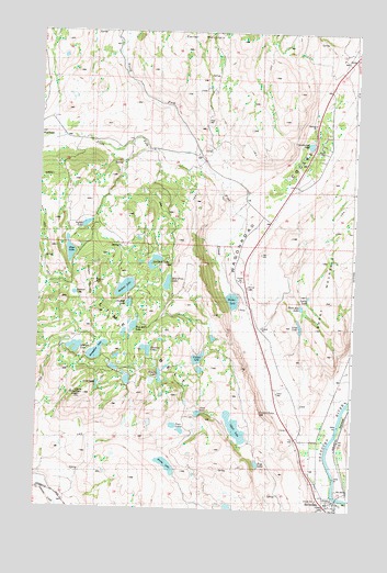
Riverside, WA USGS Topographic Map
Click on map above to begin viewing in our Map Viewer.

This topographic map contains these locations and features:
Feature Name Type Latitude Longitude GNIS ID View Map
Albright LakeLakeN48.5411°W119.6104°1528975View Map
Alkali LakeLakeN48.5215°W119.5463°1515811View Map
Amy LakeLakeN48.5251°W119.5610°1528980View Map
Blue LakeLakeN48.5669°W119.6127°1516699View Map
Booher LakeLakeN48.5547°W119.5483°1516794View Map
Burden DrawArroyoN48.5977°W119.6165°1528470View Map
Castor LakeLakeN48.5395°W119.5614°1517480View Map
Cave LakeSwampN48.5322°W119.6014°1528976View Map
Cave MountainSummitN48.5293°W119.6059°1517514View Map
Chilson MountainSummitN48.5588°W119.6028°1528745View Map
Crumbacker LakeLakeN48.5956°W119.5185°1518363View Map
Dick Price LakeLakeN48.5591°W119.5741°1528744View Map
Duckett LakeLakeN48.5537°W119.5892°1528940View Map
Evans LakeLakeN48.5114°W119.5731°1519401View Map
Frye LakeLakeN48.5121°W119.5376°1519845View Map
Horseshoe LakeLakeN48.5409°W119.6016°1520958View Map
Johnson CreekStreamN48.5029°W119.5042°1521434View Map
Lattig LakeLakeN48.5559°W119.5184°1528935View Map
Lighthouse Chapel Assembly God ChurchChurchN48.5011°W119.5109°2609821View Map
Lime BeltSummitN48.5485°W119.5956°1528887View Map
Long LakeLakeN48.5481°W119.5216°1528981View Map
Margie's Recreational Vehicle ParkLocaleN48.5005°W119.5043°2608237View Map
Medicine LakeLakeN48.5578°W119.5908°1522986View Map
North Fork Pine CreekStreamN48.5935°W119.5628°1523820View Map
Okanogan County Fire District 7BuildingN48.5021°W119.5065°2643573View Map
Pine CreekStreamN48.5574°W119.5503°1524440View Map
Poison LakeLakeN48.5346°W119.5764°1528978View Map
RiversidePopulated PlaceN48.5024°W119.5064°1531498View Map
Scanlon LakeLakeN48.5415°W119.5819°1525476View Map
Shellberg LakeLakeN48.5631°W119.5791°1528743View Map
Short MountainSummitN48.5546°W119.5098°1531511View Map
Short Mountain LakeLakeN48.5531°W119.5212°1528936View Map
South Fork Pine CreekStreamN48.5932°W119.5623°1526229View Map
Stewart LakeLakeN48.5562°W119.6108°1528939View Map
Sutton LakeLakeN48.5741°W119.6068°1528742View Map
Town of RiversideCivilN48.5001°W119.5095°2412556View Map
Tule Bill LakeLakeN48.5476°W119.5872°1528941View Map
Twin LakesLakeN48.5218°W119.5708°1528979View Map
Wagonroad CouleeValleyN48.5621°W119.5503°1527752View Map

Note: Coordinates in the location and feature list above are referenced to NAD83 datum.


Copyright (C) 2008-2024 Ryan Niemi / Sunset Dynamics ... All Rights Reserved