TopoQuest Logo
Do you find TopoQuest useful?
Help keep TopoQuest running and adding new maps/features by donating!
Bitcoin:  19c7KJd3qBynnjoSw5npx9KScwjBe4ifkT
Litecoin:  LXs6TkuXGGXo1vDsWCkWVdjQX94eUKd6ui
Home View Maps Find Maps Find Places Resources & Links


Riverton, Tennessee Topographic Map

USGS Map Title: Riverton, TN
USGS Map MRC: 36085D1
DRG (GeoTIFF) Download: o36085d1.tif


Neighboring USGS Topographic Map Quads:


  Byrdstown, TN  
36085E2
 

  Moodyville, TN  
36085E1
 

  Pall Mall, TN  
36084E8
 

  Alpine, TN  
36085D2
 

  Riverton, TN  
36085D1
 

  Jamestown, TN  
36084D8
 

  Crawford, TN  
36085C2
 

  Wilder, TN  
36085C1
 

  Grimsley, TN  
36084C8


Map MRC Location:

N37°
W86°
N37°
W85°
H8 H7 H6 H5 H4 H3 H2 H1
G8 G7 G6 G5 G4 G3 G2 G1
F8 F7 F6 F5 F4 F3 F2 F1
E8 E7 E6 E5 E4 E3 E2 E1
D8 D7 D6 D5 D4 D3 D2 D1
C8 C7 C6 C5 C4 C3 C2 C1
B8 B7 B6 B5 B4 B3 B2 B1
A8 A7 A6 A5 A4 A3 A2 A1
N36°
W86°
N36°
W85°

Riverton, TN USGS 1:24K Topographic Map Preview:
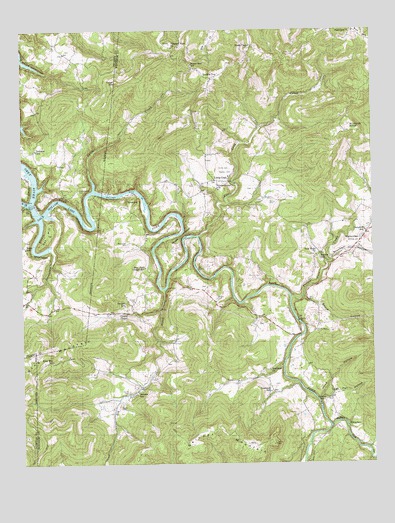
Riverton, TN USGS Topographic Map
Click on map above to begin viewing in our Map Viewer.

This topographic map contains these locations and features:
Feature Name Type Latitude Longitude GNIS ID View Map
Beatytown CemeteryCemeteryN36.4384°W85.0877°1305035View Map
Big Indian CreekStreamN36.4253°W85.0747°1277333View Map
BoatlandPopulated PlaceN36.3987°W85.0375°1309747View Map
Boatland ChurchChurchN36.4020°W85.0372°1277854View Map
Boatland SchoolSchoolN36.3956°W85.0369°1277855View Map
Boles SchoolSchoolN36.4373°W85.1238°1277903View Map
Bowden CemeteryCemeteryN36.4589°W85.0499°1278039View Map
Bowden SchoolSchoolN36.3928°W85.0180°1278041View Map
Branham HollowValleyN36.4342°W85.0153°1278233View Map
Broad Door SchoolSchoolN36.4901°W85.0636°1278431View Map
Buffalo Cove CreekStreamN36.3856°W85.0152°1269396View Map
Buzzards RoostSummitN36.4717°W85.0074°1279231View Map
Campbell SchoolSchoolN36.4417°W85.0024°1279469View Map
Cat HillSummitN36.4415°W85.1155°1279870View Map
Cat Pen HollowValleyN36.3947°W85.0183°1279873View Map
Cedar Grove ChurchChurchN36.4540°W85.0552°1305773View Map
CooperPopulated PlaceN36.4195°W85.0875°1647215View Map
Cooper CemeteryCemeteryN36.4220°W85.0844°1281200View Map
Cooper ChapelChurchN36.4184°W85.0875°1281203View Map
Cooper SchoolSchoolN36.4206°W85.0886°1281222View Map
Cricket CreekStreamN36.4540°W85.0991°1281619View Map
Dark HollowValleyN36.4675°W85.0469°1309745View Map
Double TopPopulated PlaceN36.4862°W85.0566°1282710View Map
Dungan CemeteryCemeteryN36.3912°W85.0905°1283179View Map
East Fork Chapel SchoolSchoolN36.4315°W85.0811°1283335View Map
East Fork Obey RiverStreamN36.4503°W85.1216°1303447View Map
EastportPopulated PlaceN36.4487°W85.1236°1309710View Map
Eastport DockLocaleN36.4495°W85.1227°1283431View Map
Eastport Ferry (historical)LocaleN36.4501°W85.1216°1643358View Map
FairviewPopulated PlaceN36.4998°W85.0061°1269568View Map
Fairview School (historical)SchoolN36.4992°W85.0077°1320833View Map
Fentress County Volunteer Fire Department Station 10 Double TopBuildingN36.4866°W85.0584°2654914View Map
Fentress County Volunteer Fire Department Station 9 West FentressBuildingN36.4158°W85.0361°2654915View Map
GlenobeyPopulated PlaceN36.3853°W85.0091°1315122View Map
Goose NeckBendN36.4409°W85.0677°1285678View Map
Gould HollowValleyN36.4230°W85.0249°1285755View Map
HelenaPopulated PlaceN36.4356°W85.0188°1647213View Map
Helena SchoolSchoolN36.4340°W85.0186°1287334View Map
Hinds CemeteryCemeteryN36.4603°W85.0511°1287869View Map
Hinds ChapelChurchN36.4956°W85.0419°1287870View Map
Hinds Chapel School (historical)SchoolN36.4956°W85.0424°1320839View Map
Hood HollowValleyN36.3931°W85.0195°1288229View Map
King MountainSummitN36.4040°W85.1211°1290229View Map
King Mountain SchoolSchoolN36.4045°W85.1147°1290230View Map
Little CrabPopulated PlaceN36.4570°W85.0563°1291442View Map
Little Crab CreekStreamN36.4406°W85.0625°1291443View Map
Little Crab School (historical)SchoolN36.4562°W85.0583°1320842View Map
MansonPopulated PlaceN36.3973°W85.0833°1647214View Map
Manson SchoolSchoolN36.3959°W85.0841°1292603View Map
New Hope CemeteryCemeteryN36.4353°W85.0205°1320845View Map
New Hope United Baptist ChurchChurchN36.4351°W85.0200°1295563View Map
Pleasant View ChurchChurchN36.4953°W85.0700°1297959View Map
Poplar CoveValleyN36.4230°W85.0290°1309746View Map
Poplar Cove CreekStreamN36.4231°W85.0294°1298176View Map
Poplar Cove Creek ChurchChurchN36.4390°W85.0038°1298177View Map
Reynolds MountainSummitN36.4942°W85.0322°1309743View Map
RivertonPopulated PlaceN36.4503°W85.0872°1315813View Map
Robbins SchoolSchoolN36.4659°W85.1197°1299593View Map
Robbinstown CemeteryCemeteryN36.4537°W85.1044°1299595View Map
Rockhouse BranchStreamN36.4462°W85.1186°1299815View Map
Skinner MountainSummitN36.3798°W85.0666°1270442View Map
Smith CemeteryCemeteryN36.3956°W85.0875°1270638View Map
Storie CemeteryCemeteryN36.4512°W85.0358°1271532View Map
Tater HillSummitN36.4848°W85.0905°1272162View Map
Taylor HollowValleyN36.4719°W85.0398°1309744View Map
West Fork Obey RiverStreamN36.4503°W85.1213°1304467View Map
Wright CemeteryCemeteryN36.4226°W85.0558°1275171View Map

Note: Coordinates in the location and feature list above are referenced to NAD83 datum.


Copyright (C) 2008-2025 Ryan Niemi / Sunset Dynamics ... All Rights Reserved