TopoQuest Logo
Do you find TopoQuest useful?
Help keep TopoQuest running and adding new maps/features by donating!
Bitcoin:  19c7KJd3qBynnjoSw5npx9KScwjBe4ifkT
Litecoin:  LXs6TkuXGGXo1vDsWCkWVdjQX94eUKd6ui
Home View Maps Find Maps Find Places Resources & Links


Riverton East, Wyoming Topographic Map

USGS Map Title: Riverton East, WY
USGS Map MRC: 43108A3
DRG (GeoTIFF) Download: o43108a3.tif


Neighboring USGS Topographic Map Quads:


  Lost Wells Butte, WY  
43108B4
 

  Riverton NE, WY  
43108B3
 

  Hidden Valley, WY  
43108B2
 

  Riverton West, WY  
43108A4
 

  Riverton East, WY  
43108A3
 

  Indian Butte, WY  
43108A2
 

  Arapahoe, WY  
42108H4
 

  Arapahoe NE, WY  
42108H3
 

  Alkali Butte, WY  
42108H2


Map MRC Location:

N44°
W109°
N44°
W108°
H8 H7 H6 H5 H4 H3 H2 H1
G8 G7 G6 G5 G4 G3 G2 G1
F8 F7 F6 F5 F4 F3 F2 F1
E8 E7 E6 E5 E4 E3 E2 E1
D8 D7 D6 D5 D4 D3 D2 D1
C8 C7 C6 C5 C4 C3 C2 C1
B8 B7 B6 B5 B4 B3 B2 B1
A8 A7 A6 A5 A4 A3 A2 A1
N43°
W109°
N43°
W108°

Riverton East, WY USGS 1:24K Topographic Map Preview:
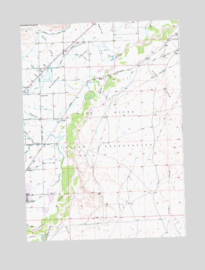
Riverton East, WY USGS Topographic Map
Click on map above to begin viewing in our Map Viewer.

This topographic map contains these locations and features:
Feature Name Type Latitude Longitude GNIS ID View Map
Albright DrawValleyN43.0925°W108.3607°1584730View Map
Botts CreekStreamN43.0997°W108.3534°1585797View Map
Brown DrawValleyN43.1002°W108.3459°1585968View Map
DelfelderLocaleN43.0694°W108.3454°1597284View Map
Delfelder HallLocaleN43.0838°W108.3607°1587525View Map
Doughty DrawValleyN43.1183°W108.3090°1587749View Map
Farmers SidingLocaleN43.0933°W108.3145°1588387View Map
Fremont County Fire Protection District Battalion 1 RivertonBuildingN43.0201°W108.3654°2673517View Map
Fremont County Fire Protection District HeadquartersBuildingN43.0225°W108.3602°2673519View Map
Gibbons DrawValleyN43.0863°W108.3707°1588887View Map
Haymaker CreekStreamN43.0719°W108.3268°1589426View Map
Ice SloughGutN43.0869°W108.3745°1589856View Map
Kirby DrawValleyN43.1119°W108.2790°1590379View Map
KVOW-AM (Riverton)TowerN43.0263°W108.3465°1608813View Map
LairdLocaleN43.0541°W108.3607°1597374View Map
Little Wind RiverStreamN43.0080°W108.3534°1590901View Map
Madden DrawValleyN43.0563°W108.3665°1591157View Map
Midvale Irrigation PitMineN43.1053°W108.3517°1746025View Map
NebleLocaleN43.1100°W108.2620°1597428View Map
Neble HillSummitN43.1038°W108.2620°1591969View Map
Prison Farm DrawValleyN43.0550°W108.3479°1593038View Map
Riverton DrawValleyN43.0558°W108.3709°1593490View Map
Riverton Number 2 CanalCanalN43.1194°W108.3470°1605455View Map
Rush SloughGutN43.1088°W108.3423°1593707View Map
Shriner DrawValleyN43.0933°W108.3570°1594301View Map
Spencer DrawValleyN43.0511°W108.3470°1594780View Map
Wyoming Fire AcademyBuildingN43.0228°W108.3602°2673442View Map
Wyoming Penitentiary FarmLocaleN43.0597°W108.3701°1596658View Map

Note: Coordinates in the location and feature list above are referenced to NAD83 datum.


Copyright (C) 2008-2024 Ryan Niemi / Sunset Dynamics ... All Rights Reserved