TopoQuest Logo
Do you find TopoQuest useful?
Help keep TopoQuest running and adding new maps/features by donating!
Bitcoin:  19c7KJd3qBynnjoSw5npx9KScwjBe4ifkT
Litecoin:  LXs6TkuXGGXo1vDsWCkWVdjQX94eUKd6ui
Home View Maps Find Maps Find Places Resources & Links


Robersonville West, North Carolina Topographic Map

USGS Map Title: Robersonville West, NC
USGS Map MRC: 35077G3
DRG (GeoTIFF) Download: o35077g3.tif


Neighboring USGS Topographic Map Quads:


  Speed, NC  
35077H4
 

  Oak City, NC  
35077H3
 

  Hamilton, NC  
35077H2
 

  Conetoe, NC  
35077G4
 

  Robersonville West, NC  
35077G3
 

  Robersonville East, NC  
35077G2
 

  Greenville NW, NC  
35077F4
 

  Greenville NE, NC  
35077F3
 

  Leggetts Crossroads, NC  
35077F2


Map MRC Location:

N36°
W78°
N36°
W77°
H8 H7 H6 H5 H4 H3 H2 H1
G8 G7 G6 G5 G4 G3 G2 G1
F8 F7 F6 F5 F4 F3 F2 F1
E8 E7 E6 E5 E4 E3 E2 E1
D8 D7 D6 D5 D4 D3 D2 D1
C8 C7 C6 C5 C4 C3 C2 C1
B8 B7 B6 B5 B4 B3 B2 B1
A8 A7 A6 A5 A4 A3 A2 A1
N35°
W78°
N35°
W77°

Robersonville West, NC USGS 1:24K Topographic Map Preview:
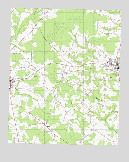
Robersonville West, NC USGS Topographic Map
Click on map above to begin viewing in our Map Viewer.

This topographic map contains these locations and features:
Feature Name Type Latitude Longitude GNIS ID View Map
Bethel Elementary SchoolSchoolN35.8093°W77.3741°1007464View Map
Bethel Police DepartmentBuildingN35.8095°W77.3742°2130926View Map
Bethel Post OfficePost OfficeN35.8080°W77.3716°2774243View Map
Bethel Volunteer Fire and Rescue DepartmentBuildingN35.8077°W77.3746°2638288View Map
First Swamp ChurchChurchN35.7968°W77.2866°1003992View Map
Flat SwampSwampN35.8032°W77.2555°985194View Map
Flat SwampStreamN35.7727°W77.2650°1024590View Map
Hickory Grove ChurchChurchN35.7615°W77.3266°1003991View Map
OakleyPopulated PlaceN35.7579°W77.2866°1000771View Map
ParmelePopulated PlaceN35.8165°W77.3141°991886View Map
Parmele Post OfficePost OfficeN35.8169°W77.3122°2774181View Map
Robersonville Fire DepartmentBuildingN35.8236°W77.2535°2639190View Map
Robersonville Police DepartmentBuildingN35.8230°W77.2534°2130879View Map
Robersonville Post OfficePost OfficeN35.8237°W77.2552°2766599View Map
Robersonville Rescue Squad and Emergency Medical ServicesBuildingN35.8229°W77.2535°2720691View Map
Suggs BranchCanalN35.8163°W77.3502°1003990View Map
Town HallBuildingN35.8079°W77.3736°1007606View Map
Town of ParmeleCivilN35.8190°W77.3146°2407075View Map
Town of RobersonvilleCivilN35.8248°W77.2529°2407229View Map
Township of BethelCivilN35.7776°W77.3707°1027056View Map
Township of RobersonvilleCivilN35.8327°W77.2664°1026927View Map
WhitehurstPopulated PlaceN35.7660°W77.3322°997226View Map

Note: Coordinates in the location and feature list above are referenced to NAD83 datum.


Copyright (C) 2008-2024 Ryan Niemi / Sunset Dynamics ... All Rights Reserved