TopoQuest Logo
Do you find TopoQuest useful?
Help keep TopoQuest running and adding new maps/features by donating!
Bitcoin:  19c7KJd3qBynnjoSw5npx9KScwjBe4ifkT
Litecoin:  LXs6TkuXGGXo1vDsWCkWVdjQX94eUKd6ui
Home View Maps Find Maps Find Places Resources & Links


Greenville NE, North Carolina Topographic Map

USGS Map Title: Greenville NE, NC
USGS Map MRC: 35077F3
DRG (GeoTIFF) Download: o35077f3.tif


Neighboring USGS Topographic Map Quads:


  Conetoe, NC  
35077G4
 

  Robersonville West, NC  
35077G3
 

  Robersonville East, NC  
35077G2
 

  Greenville NW, NC  
35077F4
 

  Greenville NE, NC  
35077F3
 

  Leggetts Crossroads, NC  
35077F2
 

  Greenville SW, NC  
35077E4
 

  Greenville SE, NC  
35077E3
 

  Grimesland, NC  
35077E2


Map MRC Location:

N36°
W78°
N36°
W77°
H8 H7 H6 H5 H4 H3 H2 H1
G8 G7 G6 G5 G4 G3 G2 G1
F8 F7 F6 F5 F4 F3 F2 F1
E8 E7 E6 E5 E4 E3 E2 E1
D8 D7 D6 D5 D4 D3 D2 D1
C8 C7 C6 C5 C4 C3 C2 C1
B8 B7 B6 B5 B4 B3 B2 B1
A8 A7 A6 A5 A4 A3 A2 A1
N35°
W78°
N35°
W77°

Greenville NE, NC USGS 1:24K Topographic Map Preview:
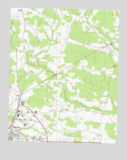
Greenville NE, NC USGS Topographic Map
Click on map above to begin viewing in our Map Viewer.

This topographic map contains these locations and features:
Feature Name Type Latitude Longitude GNIS ID View Map
Alwood Post OfficePost OfficeN35.6885°W77.3547°1023793View Map
Bethel Rescue SquadBuildingN35.7458°W77.3614°2720543View Map
Buck Mobil Home ParkPopulated PlaceN35.6310°W77.3516°1005618View Map
Burning Bush ChurchChurchN35.6774°W77.3339°1024692View Map
Cannon SwampSwampN35.6315°W77.2908°982610View Map
Carson Memorial ChurchChurchN35.6290°W77.3461°1024464View Map
Chad Mobile Home ParkPopulated PlaceN35.6387°W77.3045°2505428View Map
Cherry Lane ChurchChurchN35.6440°W77.2691°1024687View Map
Ebenezer Seventh Day Adventist ChurchChurchN35.6282°W77.3517°2505875View Map
Greenfield TerracePopulated PlaceN35.6485°W77.3552°1005621View Map
Greenville Fire and Rescue Station 4BuildingN35.6514°W77.3625°2638533View Map
Greenville Industrial AreaLocaleN35.6479°W77.3597°1023617View Map
Grindle Creek ChurchChurchN35.6540°W77.2972°1024463View Map
HousePopulated PlaceN35.6546°W77.3650°987164View Map
Kingdom Hall of Jehovahs WitnessesChurchN35.6556°W77.3723°2506103View Map
LangleyPopulated PlaceN35.6368°W77.3211°1008181View Map
MeadowbrookPopulated PlaceN35.6313°W77.3683°1005620View Map
Minnie BertPopulated PlaceN35.6999°W77.3452°1023594View Map
North Pitt High SchoolSchoolN35.7475°W77.3646°1024688View Map
Parkers Chapel F W B ChurchChurchN35.6265°W77.3369°1007384View Map
Post Oak Grove ChurchChurchN35.7452°W77.2536°1024689View Map
Potters PlaceChurchN35.6540°W77.2970°2506228View Map
River Park NorthParkN35.6277°W77.3561°1007277View Map
Saint Johns ChurchChurchN35.7177°W77.2597°1024690View Map
Saint Mary ChurchChurchN35.6860°W77.3594°1024691View Map
Saint Peters Missionary Baptist ChurchChurchN35.6284°W77.3553°2506253View Map
Shady Knoll Mobile EstatesPopulated PlaceN35.6271°W77.3469°1005619View Map
StatonPopulated PlaceN35.6888°W77.3547°1022781View Map
Staton House Fire and Rescue Station 1BuildingN35.6547°W77.3656°2639302View Map
Staton House Fire and Rescue Station 2BuildingN35.6995°W77.3455°2639387View Map
StokesPopulated PlaceN35.7165°W77.2647°995527View Map
Stokes Census Designated PlaceCensusN35.7105°W77.2676°2584330View Map
Stokes Fire DepartmentBuildingN35.7170°W77.2622°2638482View Map
Stokes Post OfficePost OfficeN35.7163°W77.2639°2774173View Map
Sweet Gum Grove ChurchChurchN35.7029°W77.3333°1024461View Map
Sycamore ChapelChurchN35.6549°W77.3072°1024462View Map
Township of CarolinaCivilN35.7230°W77.2835°1027057View Map
Truth Temple Church of GodChurchN35.6734°W77.3528°2506290View Map
United Industrial ParkPopulated PlaceN35.6496°W77.3514°1005622View Map
Wellcome Middle SchoolSchoolN35.6664°W77.3628°1024868View Map
Westwood Mobile Home ParkPopulated PlaceN35.6643°W77.3658°2505689View Map
WhichardPopulated PlaceN35.6971°W77.2550°1023193View Map

Note: Coordinates in the location and feature list above are referenced to NAD83 datum.


Copyright (C) 2008-2024 Ryan Niemi / Sunset Dynamics ... All Rights Reserved