TopoQuest Logo
Do you find TopoQuest useful?
Help keep TopoQuest running and adding new maps/features by donating!
Bitcoin:  19c7KJd3qBynnjoSw5npx9KScwjBe4ifkT
Litecoin:  LXs6TkuXGGXo1vDsWCkWVdjQX94eUKd6ui
Home View Maps Find Maps Find Places Resources & Links


Robert Lee, Texas Topographic Map

USGS Map Title: Robert Lee, TX
USGS Map MRC: 31100H4
DRG (GeoTIFF) Download: o31100h4.tif


Neighboring USGS Topographic Map Quads:


  Sanco, TX  
32100A5
 

  Blackwell SW, TX  
32100A4
 

  Blackwell, TX  
32100A3
 

  Edith, TX  
31100H5
 

  Robert Lee, TX  
31100H4
 

  Bronte, TX  
31100H3
 

  Millican Mountains, TX  
31100G5
 

  Cement Mountain, TX  
31100G4
 

  Shawville, TX  
31100G3


Map MRC Location:

N32°
W101°
N32°
W100°
H8 H7 H6 H5 H4 H3 H2 H1
G8 G7 G6 G5 G4 G3 G2 G1
F8 F7 F6 F5 F4 F3 F2 F1
E8 E7 E6 E5 E4 E3 E2 E1
D8 D7 D6 D5 D4 D3 D2 D1
C8 C7 C6 C5 C4 C3 C2 C1
B8 B7 B6 B5 B4 B3 B2 B1
A8 A7 A6 A5 A4 A3 A2 A1
N31°
W101°
N31°
W100°

Robert Lee, TX USGS 1:24K Topographic Map Preview:
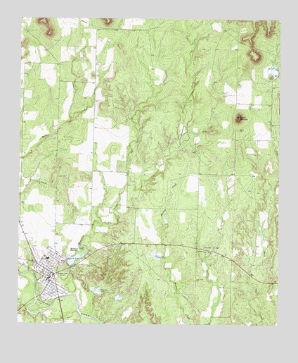
Robert Lee, TX USGS Topographic Map
Click on map above to begin viewing in our Map Viewer.

This topographic map contains these locations and features:
Feature Name Type Latitude Longitude GNIS ID View Map
City of Robert LeeCivilN31.8954°W100.4856°2410970View Map
Coke County Constable's Office Precinct 1BuildingN31.8925°W100.4857°2750692View Map
Coke County JailBuildingN31.8926°W100.4858°2738738View Map
Coke County Sheriff's OfficeBuildingN31.8925°W100.4858°2750457View Map
Hayrick CemeteryCemeteryN31.9549°W100.3951°1337506View Map
Hayrick MountainSummitN31.9599°W100.3945°1337507View Map
Indian Creek CemeteryCemeteryN31.8929°W100.4145°1338421View Map
McCuthen Oil FieldOilfieldN31.9060°W100.4070°1341177View Map
Messbox CreekStreamN31.8954°W100.4998°1341427View Map
Mountain CreekStreamN31.8871°W100.4743°1342163View Map
Mountain Creek DamDamN31.9001°W100.4754°1861191View Map
Mountain Creek ReservoirReservoirN31.9009°W100.4748°1342166View Map
Munn Oil FieldOilfieldN31.9507°W100.4773°1342274View Map
Old City LakeReservoirN31.8882°W100.4625°1343132View Map
Old City Lake DamDamN31.8868°W100.4637°1861193View Map
Robert LeePopulated PlaceN31.8924°W100.4848°1345308View Map
Robert Lee City HallBuildingN31.8932°W100.4857°2753908View Map
Robert Lee Post OfficePost OfficeN31.8924°W100.4831°2731456View Map
Robert Lee Volunteer Fire DepartmentBuildingN31.8951°W100.4836°2551130View Map
Soil Conservation Service Site 1 DamDamN31.9768°W100.3770°1861189View Map
Soil Conservation Service Site 1 ReservoirReservoirN31.9784°W100.3777°1861190View Map
West Coke County Emergency Medical ServicesBuildingN31.8934°W100.4823°2655880View Map

Note: Coordinates in the location and feature list above are referenced to NAD83 datum.


Copyright (C) 2008-2025 Ryan Niemi / Sunset Dynamics ... All Rights Reserved