TopoQuest Logo
Do you find TopoQuest useful?
Help keep TopoQuest running and adding new maps/features by donating!
Bitcoin:  19c7KJd3qBynnjoSw5npx9KScwjBe4ifkT
Litecoin:  LXs6TkuXGGXo1vDsWCkWVdjQX94eUKd6ui
Home View Maps Find Maps Find Places Resources & Links


Roberts, Wisconsin Topographic Map

USGS Map Title: Roberts, WI
USGS Map MRC: 44092H5
DRG (GeoTIFF) Download: o44092h5.tif


Neighboring USGS Topographic Map Quads:


  Somerset South, WI  
45092A6
 

  New Richmond South, WI  
45092A5
 

  Jewett, WI  
45092A4
 

  Northline, WI  
44092H6
 

  Roberts, WI  
44092H5
 

  Baldwin West, WI  
44092H4
 

  River Falls West, WI  
44092G6
 

  River Falls East, WI  
44092G5
 

  Martell, WI  
44092G4


Map MRC Location:

N45°
W93°
N45°
W92°
H8 H7 H6 H5 H4 H3 H2 H1
G8 G7 G6 G5 G4 G3 G2 G1
F8 F7 F6 F5 F4 F3 F2 F1
E8 E7 E6 E5 E4 E3 E2 E1
D8 D7 D6 D5 D4 D3 D2 D1
C8 C7 C6 C5 C4 C3 C2 C1
B8 B7 B6 B5 B4 B3 B2 B1
A8 A7 A6 A5 A4 A3 A2 A1
N44°
W93°
N44°
W92°

Roberts, WI USGS 1:24K Topographic Map Preview:
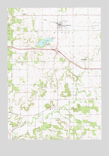
Roberts, WI USGS Topographic Map
Click on map above to begin viewing in our Map Viewer.

This topographic map contains these locations and features:
Feature Name Type Latitude Longitude GNIS ID View Map
Elm Lawn School (historical)SchoolN44.9633°W92.5169°1581777View Map
Hillside School (historical)SchoolN44.9127°W92.5171°1581782View Map
Kelly CreekStreamN44.9130°W92.5341°1581661View Map
Kinnickinnic CemeteryCemeteryN44.9172°W92.5388°1581662View Map
Kinnickinnic Church (historical)ChurchN44.9133°W92.5430°1581784View Map
Kinnickinnic River State Fishery AreaParkN44.9508°W92.5180°1581664View Map
Kinnickinnic TownhallBuildingN44.9125°W92.5588°1831668View Map
Monument School (historical)SchoolN44.9127°W92.5560°1581790View Map
Nineteen Hundred School (historical)SchoolN44.8980°W92.5888°1581791View Map
Nye CreekStreamN44.9064°W92.5521°1581688View Map
Oak Valley School (historical)SchoolN44.9464°W92.5963°1581797View Map
Parker CreekStreamN44.9200°W92.5302°1581694View Map
RobertsPopulated PlaceN44.9839°W92.5560°1581705View Map
Roberts Police DepartmentBuildingN44.9838°W92.5525°2759553View Map
Roberts Warren Fire and Rescue DepartmentBuildingN44.9819°W92.5577°2696924View Map
Roberts Wastewater Treatment FacilityLocaleN44.9708°W92.5617°2646880View Map
Saint Croix Central Elementary SchoolSchoolN44.9822°W92.5516°1831780View Map
South Branch Kinnickinnic RiverStreamN44.9550°W92.5074°1581727View Map
Ted CreekStreamN44.9014°W92.5580°1581741View Map
Town of KinnickinnicCivilN44.9069°W92.5570°1583486View Map
Town of WarrenCivilN44.9940°W92.5586°1584345View Map
Trout Brook School (historical)SchoolN44.9352°W92.5246°1581807View Map
Twin LakesLakeN44.9664°W92.5792°1581748View Map
Twin Lakes State Access PointLocaleN44.9650°W92.5755°1581749View Map
Village of RobertsCivilN44.9620°W92.5694°1584045View Map
Warren CemeteryCemeteryN44.9969°W92.5571°1581752View Map

Note: Coordinates in the location and feature list above are referenced to NAD83 datum.


Copyright (C) 2008-2025 Ryan Niemi / Sunset Dynamics ... All Rights Reserved