TopoQuest Logo
Do you find TopoQuest useful?
Help keep TopoQuest running and adding new maps/features by donating!
Bitcoin:  19c7KJd3qBynnjoSw5npx9KScwjBe4ifkT
Litecoin:  LXs6TkuXGGXo1vDsWCkWVdjQX94eUKd6ui
Home View Maps Find Maps Find Places Resources & Links


Roberts Mountain, Wyoming Topographic Map

USGS Map Title: Roberts Mountain, WY
USGS Map MRC: 42109H3
DRG (GeoTIFF) Download: o42109h3.tif


Neighboring USGS Topographic Map Quads:


  Alpine Lake, WY  
43109A4
 

  Paradise Basin, WY  
43109A3
 

  Saint Lawrence Basin, WY  
43109A2
 

  Halls Mountain, WY  
42109H4
 

  Roberts Mountain, WY  
42109H3
 

  Washakie Park, WY  
42109H2
 

  Raid Lake, WY  
42109G4
 

  Mount Bonneville, WY  
42109G3
 

  Lizard Head Peak, WY  
42109G2


Map MRC Location:

N43°
W110°
N43°
W109°
H8 H7 H6 H5 H4 H3 H2 H1
G8 G7 G6 G5 G4 G3 G2 G1
F8 F7 F6 F5 F4 F3 F2 F1
E8 E7 E6 E5 E4 E3 E2 E1
D8 D7 D6 D5 D4 D3 D2 D1
C8 C7 C6 C5 C4 C3 C2 C1
B8 B7 B6 B5 B4 B3 B2 B1
A8 A7 A6 A5 A4 A3 A2 A1
N42°
W110°
N42°
W109°

Roberts Mountain, WY USGS 1:24K Topographic Map Preview:
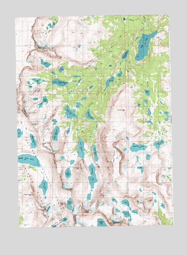
Roberts Mountain, WY USGS Topographic Map
Click on map above to begin viewing in our Map Viewer.

This topographic map contains these locations and features:
Feature Name Type Latitude Longitude GNIS ID View Map
Baily PeakSummitN42.8983°W109.3393°1603971View Map
Bewmark LakeLakeN42.9260°W109.3622°1598127View Map
Darren LakeLakeN42.9069°W109.3345°1604718View Map
Dragon Head PeakSummitN42.8944°W109.3640°1599315View Map
Entigo CreekStreamN42.9944°W109.2693°1599626View Map
Fremont TrailTrailN42.9902°W109.3599°1599858View Map
Glacier CreekStreamN42.9608°W109.3018°1599943View Map
Ice LakesLakeN42.9100°W109.3335°1600477View Map
Kagevah PassGapN42.9250°W109.3562°1600673View Map
Kagevah PeakSummitN42.9191°W109.3460°1600674View Map
Lake DonnaLakeN42.8859°W109.3511°1604721View Map
Lake HeebeecheecheLakeN42.9606°W109.3399°1600281View Map
Lake KagevahLakeN42.9305°W109.3437°1600675View Map
Lake PolarisLakeN42.9185°W109.3122°1602236View Map
Lake SolitudeLakeN42.9213°W109.3236°1603075View Map
Lee LakeLakeN42.8993°W109.3542°1600878View Map
Middle Fork LakeLakeN42.9151°W109.3679°1601401View Map
Moraine LakeLakeN42.9050°W109.3148°1601554View Map
Mount LanderSummitN42.8838°W109.3221°1600832View Map
Movo LakeLakeN42.9764°W109.2863°1601592View Map
Musembeah PeakSummitN42.8763°W109.3007°1602110View Map
Noel LakeLakeN42.8889°W109.3337°1604720View Map
Nylon PeakSummitN42.8888°W109.3385°1601883View Map
Odyssey PeakSummitN42.9363°W109.3621°1609134View Map
Petroleum PeakSummitN42.9094°W109.3246°1604613View Map
Pronghorn PeakSummitN42.8852°W109.3543°1602311View Map
Raft LakeLakeN42.9817°W109.2706°1602355View Map
Roberts LakeLakeN42.9213°W109.2776°1602560View Map
Roberts MountainSummitN42.9155°W109.2957°1602561View Map
Saddle MountainSummitN42.9800°W109.3451°1604725View Map
Shelia LakeLakeN42.8794°W109.3379°1604747View Map
Sonnicant LakeLakeN42.9425°W109.3316°1609159View Map
Spider LakeLakeN42.9496°W109.3532°1604717View Map
Tepee PassGapN42.9075°W109.2524°1603571View Map
Trail LakeLakeN42.9232°W109.2606°1603740View Map
Twenty Lakes CreekStreamN42.9725°W109.2762°1603816View Map
Wilson CreekStreamN42.9894°W109.2632°1604231View Map
Wind River Roadless AreaAreaN42.9872°W109.2549°1604814View Map
Wolf CreekStreamN42.9791°W109.2849°1604258View Map
Wolverine PeakSummitN42.9819°W109.3574°1604273View Map
Wykee LakeLakeN42.9411°W109.3165°1604292View Map
Wykee PeakSummitN42.9436°W109.2874°1604293View Map

Note: Coordinates in the location and feature list above are referenced to NAD83 datum.


Copyright (C) 2008-2024 Ryan Niemi / Sunset Dynamics ... All Rights Reserved