TopoQuest Logo
Do you find TopoQuest useful?
Help keep TopoQuest running and adding new maps/features by donating!
Bitcoin:  19c7KJd3qBynnjoSw5npx9KScwjBe4ifkT
Litecoin:  LXs6TkuXGGXo1vDsWCkWVdjQX94eUKd6ui
Home View Maps Find Maps Find Places Resources & Links


Halls Mountain, Wyoming Topographic Map

USGS Map Title: Halls Mountain, WY
USGS Map MRC: 42109H4
DRG (GeoTIFF) Download: o42109h4.tif


Neighboring USGS Topographic Map Quads:


  Fremont Peak South, WY  
43109A5
 

  Alpine Lake, WY  
43109A4
 

  Paradise Basin, WY  
43109A3
 

  Horseshoe Lake, WY  
42109H5
 

  Halls Mountain, WY  
42109H4
 

  Roberts Mountain, WY  
42109H3
 

  Scab Creek, WY  
42109G5
 

  Raid Lake, WY  
42109G4
 

  Mount Bonneville, WY  
42109G3


Map MRC Location:

N43°
W110°
N43°
W109°
H8 H7 H6 H5 H4 H3 H2 H1
G8 G7 G6 G5 G4 G3 G2 G1
F8 F7 F6 F5 F4 F3 F2 F1
E8 E7 E6 E5 E4 E3 E2 E1
D8 D7 D6 D5 D4 D3 D2 D1
C8 C7 C6 C5 C4 C3 C2 C1
B8 B7 B6 B5 B4 B3 B2 B1
A8 A7 A6 A5 A4 A3 A2 A1
N42°
W110°
N42°
W109°

Halls Mountain, WY USGS 1:24K Topographic Map Preview:
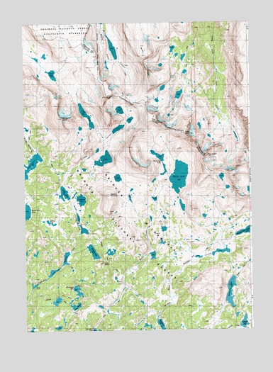
Halls Mountain, WY USGS Topographic Map
Click on map above to begin viewing in our Map Viewer.

This topographic map contains these locations and features:
Feature Name Type Latitude Longitude GNIS ID View Map
Europe CanyonValleyN42.9388°W109.4804°1599640View Map
Europe Canyon TrailTrailN42.9402°W109.4571°1604668View Map
Europe PeakSummitN42.9702°W109.4538°1599641View Map
Fire Hole LakesLakeN42.8883°W109.4768°1599708View Map
Firehole TrailTrailN42.8941°W109.4588°1605600View Map
Glacier LakeLakeN42.9793°W109.4841°1599947View Map
Halls ButteSummitN42.9025°W109.4565°1600178View Map
Halls LakeLakeN42.9375°W109.4143°1600181View Map
Halls Lake TrailTrailN42.8994°W109.4149°1604667View Map
Halls MountainSummitN42.9552°W109.4107°1600183View Map
Howard LakeLakeN42.9070°W109.4625°1600442View Map
Lake IsabellaLakeN42.9000°W109.4824°1600539View Map
Lake Isabella TrailTrailN42.8925°W109.4696°1605536View Map
Lake PrueLakeN42.9283°W109.4687°1602320View Map
Lake SusanLakeN42.8843°W109.4727°1603465View Map
Lake VeraLakeN42.8936°W109.4949°1603921View Map
Lake VictorLakeN42.9416°W109.4983°1603928View Map
Long LakeLakeN42.9625°W109.4656°1601109View Map
Medina LakeLakeN42.9190°W109.4857°1601344View Map
Medina MountainSummitN42.9305°W109.4529°1601345View Map
Middle Fork TrailTrailN42.9180°W109.3760°1604838View Map
Mount VictorSummitN42.9613°W109.4790°1603929View Map
North Fork CanyonValleyN42.9491°W109.4932°1601749View Map
Photo PassGapN42.9436°W109.3751°1602131View Map
Pipe OrganSummitN42.9461°W109.3990°1602192View Map
Pipestone LakesLakeN42.9210°W109.4706°1602194View Map
Rainbow LakeLakeN42.8905°W109.3867°1602364View Map
Sandpoint LakeLakeN42.8763°W109.4249°1602722View Map
Shoestring LakeLakeN42.9457°W109.4257°1604671View Map
Sunrise LakeLakeN42.8778°W109.3795°1603448View Map
Valley LakeLakeN42.9309°W109.4782°1603909View Map
Wilderness LakeLakeN42.8910°W109.4713°1604670View Map

Note: Coordinates in the location and feature list above are referenced to NAD83 datum.


Copyright (C) 2008-2024 Ryan Niemi / Sunset Dynamics ... All Rights Reserved