TopoQuest Logo
Do you find TopoQuest useful?
Help keep TopoQuest running and adding new maps/features by donating!
Bitcoin:  19c7KJd3qBynnjoSw5npx9KScwjBe4ifkT
Litecoin:  LXs6TkuXGGXo1vDsWCkWVdjQX94eUKd6ui
Home View Maps Find Maps Find Places Resources & Links


Robinson Mountain, Montana Topographic Map

USGS Map Title: Robinson Mountain, MT
USGS Map MRC: 48115H4
DRG (GeoTIFF) Download: o48115h4.tif


Neighboring USGS Topographic Map Quads:


  Mount Henry, MT  
48115H5
 

  Robinson Mountain, MT  
48115H4
 

  Red Mountain, MT  
48115H3
 

  Lost Horse Mountain, MT  
48115G5
 

  Boulder Lakes, MT  
48115G4
 

  Webb Mountain, MT  
48115G3


Map MRC Location:

N49°
W116°
N49°
W115°
H8 H7 H6 H5 H4 H3 H2 H1
G8 G7 G6 G5 G4 G3 G2 G1
F8 F7 F6 F5 F4 F3 F2 F1
E8 E7 E6 E5 E4 E3 E2 E1
D8 D7 D6 D5 D4 D3 D2 D1
C8 C7 C6 C5 C4 C3 C2 C1
B8 B7 B6 B5 B4 B3 B2 B1
A8 A7 A6 A5 A4 A3 A2 A1
N48°
W116°
N48°
W115°

Robinson Mountain, MT USGS 1:24K Topographic Map Preview:
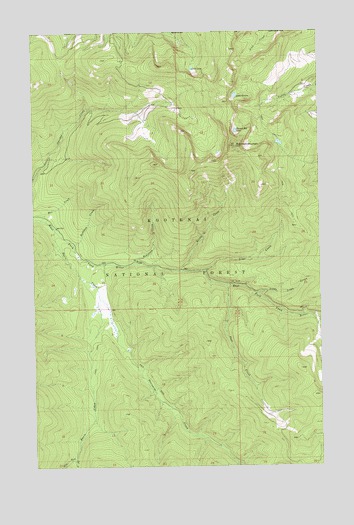
Robinson Mountain, MT USGS Topographic Map
Click on map above to begin viewing in our Map Viewer.

This topographic map contains these locations and features:
Feature Name Type Latitude Longitude GNIS ID View Map
Basin CreekStreamN48.9430°W115.4913°779408View Map
Bridge CreekStreamN48.9313°W115.4366°780394View Map
East Fork Basin CreekStreamN48.8775°W115.4832°782799View Map
Fast CreekStreamN48.9272°W115.4166°783313View Map
Gold CreekStreamN48.9897°W115.4316°801929View Map
Gold LakeLakeN48.9894°W115.4309°784065View Map
Hubbard CreekStreamN48.9391°W115.4832°785127View Map
Lake GenevaLakeN48.9817°W115.4122°783888View Map
Lime CreekStreamN48.9313°W115.4260°786129View Map
Little Lime CreekStreamN48.9247°W115.4035°786321View Map
Max CreekStreamN48.9463°W115.4974°786943View Map
Plumb Bob LakeLakeN48.9715°W115.4121°789006View Map
Porcupine CreekStreamN48.9233°W115.4721°789102View Map
Robinson CreekStreamN48.9336°W115.4563°789647View Map
Robinson MountainSummitN48.9672°W115.4121°789652View Map
West Fork Basin CreekStreamN48.8777°W115.4832°792976View Map

Note: Coordinates in the location and feature list above are referenced to NAD83 datum.


Copyright (C) 2008-2025 Ryan Niemi / Sunset Dynamics ... All Rights Reserved