TopoQuest Logo
Do you find TopoQuest useful?
Help keep TopoQuest running and adding new maps/features by donating!
Bitcoin:  19c7KJd3qBynnjoSw5npx9KScwjBe4ifkT
Litecoin:  LXs6TkuXGGXo1vDsWCkWVdjQX94eUKd6ui
Home View Maps Find Maps Find Places Resources & Links


Mount Henry, Montana Topographic Map

USGS Map Title: Mount Henry, MT
USGS Map MRC: 48115H5
DRG (GeoTIFF) Download: o48115h5.tif


Neighboring USGS Topographic Map Quads:


  Bonnet Top, MT  
48115H6
 

  Mount Henry, MT  
48115H5
 

  Robinson Mountain, MT  
48115H4
 

  Yaak, MT  
48115G6
 

  Lost Horse Mountain, MT  
48115G5
 

  Boulder Lakes, MT  
48115G4


Map MRC Location:

N49°
W116°
N49°
W115°
H8 H7 H6 H5 H4 H3 H2 H1
G8 G7 G6 G5 G4 G3 G2 G1
F8 F7 F6 F5 F4 F3 F2 F1
E8 E7 E6 E5 E4 E3 E2 E1
D8 D7 D6 D5 D4 D3 D2 D1
C8 C7 C6 C5 C4 C3 C2 C1
B8 B7 B6 B5 B4 B3 B2 B1
A8 A7 A6 A5 A4 A3 A2 A1
N48°
W116°
N48°
W115°

Mount Henry, MT USGS 1:24K Topographic Map Preview:
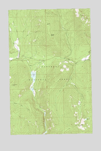
Mount Henry, MT USGS Topographic Map
Click on map above to begin viewing in our Map Viewer.

This topographic map contains these locations and features:
Feature Name Type Latitude Longitude GNIS ID View Map
Blacktail CreekStreamN48.9500°W115.5427°780048View Map
Blacktail CreekStreamN48.9502°W115.5421°780059View Map
Boyd Mill CemeteryCemeteryN48.9544°W115.6057°780334View Map
Caribou CampgroundLocaleN48.9488°W115.5032°780941View Map
Caribou CreekStreamN48.9480°W115.5041°780943View Map
Caribou MountainSummitN48.9930°W115.5135°780944View Map
Dog CreekStreamN48.9705°W115.6105°782437View Map
East Fork Yaak RiverStreamN48.9522°W115.6157°782927View Map
Fish LakesLakeN48.8773°W115.5720°783447View Map
Grubstake MountainSummitN48.9730°W115.5621°784400View Map
Hudson CreekStreamN48.9277°W115.5349°785137View Map
Mount HenrySummitN48.8833°W115.5185°784787View Map
Mount Henry LakesLakeN48.8892°W115.5111°787743View Map
Okaga LakeLakeN48.9335°W115.5895°788399View Map
Okaga Lake DamDamN48.9350°W115.5910°798748View Map
Rat CreekStreamN48.9608°W115.6119°789392View Map
Shellys Hope DamDamN48.9200°W115.5910°798749View Map
Solo Joe CreekStreamN48.9450°W115.5255°790844View Map
Windy CreekStreamN48.9436°W115.5944°793407View Map
Wood CreekStreamN48.9691°W115.6132°793481View Map
Wood MountainSummitN48.9850°W115.5680°793488View Map
Zimmerman HillSummitN48.9250°W115.6207°793640View Map

Note: Coordinates in the location and feature list above are referenced to NAD83 datum.


Copyright (C) 2008-2025 Ryan Niemi / Sunset Dynamics ... All Rights Reserved